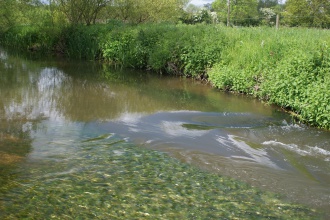
Case study:Salmonid, coarse fish and wetland bird habitat and flood plain linkage project, Hampshire Avon
This case study is pending approval by a RiverWiki administrator.
Project overview
| Status | Complete |
|---|---|
| Project web site | http://www.hampshireavoncatchmentpartnership.org.uk/ |
| Themes | Fisheries, Habitat and biodiversity |
| Country | England |
| Main contact forename | Leanne |
| Main contact surname | Sargeant |
| Main contact user ID | User:H |
| Contact organisation | Wessex Chalk Streams and Rivers Trust |
| Contact organisation web site | http://www.wcsrt.org.uk |
| Partner organisations | Barbel society, Avon Tyrell Estate, Wiltshire Fisheries Association, Wessex Chalk Streams Project, Game and Wildlife Conservation Trust |
| Parent multi-site project | |
| This is a parent project encompassing the following projects |
No |
Project summary
The project improved habitat for:
• water meadow and wetland botanical and invertebrate communities
• wading birds by improving the wetted area in adjoining fields
• nesting song birds in new, very low-growing, bankside willow cover
• helped trap sediment and nutrients on water meadows and within enhanced ditch systems
• better wetting of water meadow systems will help buffer flood peaks on the lower Avon
• Eels: improved connectivity with the floodplain and enhanced ditch systems
By cleaning spawning riffles the abundance of benthic macro-invertebrates and associated fly life will increase within project areas.
This will have a knock-on benefit of better food provision for fish, riparian birds and bats.
The Lower Avon Project at Avon Tyrell was completed using funding from CPAF. A total of 29 large woody debris and live hinged willows were added to the channel to encourage diversified flows and cover for Salmonids and other fish species. The 100m2 of gravel cleaning and 50m2 of cover habitat for fry and Parr were carried out. The project has created 3 backwaters at least 0.5m deep with shallow profiled margins, creating a total of 500m2 of new habitat.
The Salmonid Riffle improvements on the Nadder and Wylye involved 6 sites which were improved by the Partnership as part of this CPAF funding, with a further 3 riffles improved as part of other schemes going ahead in 2015/16. The project enhanced 300m2 of riffle gravel salmonid spawning habitat at 9 sites and created 150m2 of cover habitat for parr and fry downstream of the works.
Monitoring surveys and results
Fish using new woody habitat at Avon Tyrell. Salmon redds on new riffles and cleaned gravels. Monitoring of juvenile fish using fry bays. Presence of coarse fish fry in fry bays. Presence of waders. Fixed point photography to show the changes made by the project. This monitoring will all help with future delivery of projects and give us demonstration sites we can show to angling clubs and landowners.
The only monitoring that was not able to take place were the red counts as the weather was too severe, making the water too muddy and clouded to be able to undertake surveys.
Lessons learnt
The collaborative working went very well, especially with building in a monitoring plan through collaboration with other Catchment Partners.
The project gave some good case studies that can be used in conjunction with other angling clubs to get them delivering some of the same types of projects on other reaches in the catchment.
Image gallery
|
Catchment and subcatchmentSelect a catchment/subcatchment
Catchment
Subcatchment
Other case studies in this subcatchment: River Avon Stream project, Salisbury Avon Restoration Project, Strategic Framework for Restoration of the River Avon (SFfRRA)
Site
Project background
Cost for project phases
Reasons for river restoration
Measures
MonitoringHydromorphological quality elements
Biological quality elements
Physico-chemical quality elements
Any other monitoring, e.g. social, economic
Monitoring documents
Additional documents and videos
Additional links and references
Supplementary InformationEdit Supplementary Information
| ||||||||||||||||||||||||||||||||||||||||||||||||||||||||||||||||||||||||||||||||||||||||||||||||||||||||||||||||||||||||||||||||||||||||||||||||||||||||||||||||||||||||||||||||||||||||||||||||||||||||

