Case study:River Idle Restoration Project

From RESTORE
Revision as of 15:19, 6 June 2016 by Digbytaylor (talk | contribs)
Jump to navigation Jump to search

This case study is pending approval by a RiverWiki administrator.

Approve case study


0.00
(0 votes)


To discuss or comment on this case study, please use the discussion page.


Location: 53° 23' 11.69" N, 0° 55' 52.52" W
Loading map...
Left click to look around in the map, and use the wheel of your mouse to zoom in and out.


Project overview

Edit project overview
Status Complete
Project web site
Themes Environmental flows and water resources, Fisheries, Flood risk management, Habitat and biodiversity, Land use management - agriculture, Water quality
Country England
Main contact forename David
Main contact surname Newborough
Main contact user ID
Contact organisation Environment Agency
Contact organisation web site http://https://www.gov.uk/government/organisations/environment-agency
Partner organisations Nottinghamshire Wildlife Trust
Parent multi-site project
This is a parent project
encompassing the following
projects
No
Project picture

Project summary

Edit project overview to modify the project summary.


The project was in collaboration with the Nottinghamshire Wildlife Trust to establish a partnership that will enable joint working and delivery of high quality habitat restoration along the River Idle and its tributaries.

The River Idle was identified as having significant potential for high quality habitat restoration and for the substantial improvement of its water quality to meet WFD objectives. There were several strategies in existence for the Idle and many partners interested in the catchment. We were also finalising the Isle of Axholme Flood Risk Management Strategy. With so many organisations keen to be involved in the enhancement of the river, the project established an overarching Management Group, which brought together partners to ensure efficient and complementary working towards a shared vision. Such a "joined-up" approach offered better opportunities for innovation and access to funding than working in isolation.

A connection with the River Idle has been installed SK6956684463 to allow fish and eels to escape from the River Idle in high flows. The reed fringed pond connected to the river will also provide spawning opportunities. As the river level rises a valve will close to prevent water washing away habitat in the pond. Fish will be able to return to the river as its level falls.

The River Idle has been heavily modified over the years and typically lacks in-channel habitat. An existing berm was lowered and planted with common reed to create habitat for nesting birds and invertebrates. In order to enhance the newly created berm for fish a backwater was created to allow fish to move from the main channel into the backwater during high flows.

Following its establishment, the River Idle Management Partnership has been well attended. The Management Partnership comprises stakeholders with a diverse range of agendas and priorities, reflecting the national tensions and conflicts between water quality, flood risk management and the environment. This initially disparate group has worked through some significant areas of potential conflict to arrive at a good degree of mutual understanding. It is significant that several local farmers and landowners have become regular attendees. Several members of the partnership also attended the Rural Stakeholders Workshop for the wider Idle Catchment event that NWT organised through their catchment hosting role. It was reported back to us that it had been very useful to make the connections with upstream activities in the Maun and Meden and how this affects them on the Idle, and so how we need to think in a catchment-scale manner.

The partnership agreed that before any maintenance work is undertaken along the River Idle; a survey was required to ascertain how much silt is present and location of priority areas. At the October 2014 meeting it was confirmed that funding has been made available to undertake the silt assessment. While it was widely agreed by the Catchment Partnership that siltation was an issue, for flood defence and environmental reasons including SSSI condition, the extent of the silt burden was then unknown. Subsequent work by the Isle of Axholme and North Nottinghamshire Water Level Management Board using Environment Agency data from 1994 & 2001 estimated the volume of silt at c146,000m3, the cost of de-silting this volume was estimated at £4,000,000. The volume and extent of this task is beyond the ability of single landowners to undertake.

The catchment partnership will continue to take forward actions to improve the river and realise multiple benefits.

Monitoring surveys and results

Edit project overview to modify the Monitoring survey and results.


Working with landowners to create species-rich grassland buffer strips to reduce diffuse agricultural pollution from adjacent arable land through absorption of agricultural run-off. We installed hinged large woody debris to improve channel conditions for benefits for fish spawning and aerate flows. These will hopefully start to show an improvement from a WFD perspective through the habitat improvements.

The projects main success has been the establishment of the Idle Management Partnership Group. Although the group has taken time to develop and have a clear purpose, it has been beneficial to have landowners as well as partner organisations meeting together to discuss what's best for the river.

Lessons learnt

Edit project overview to modify the lessons learnt.


This has been a 3-year project. The partnership has taken that time to become established with clear objectives for the future. Partnerships of this size do take time.


Image gallery


Aerial photo of erosion at Scaftworth
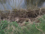
The River Idle has been heavily modified over the years and typically lacks in-channel habitat. An existing berm was lowered and planted with common reed to create habitat for nesting birds and invertebrates.
Reedbed construction.jpg
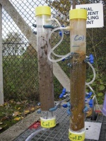
Phosphate stripping trials
Fencing to prevent cattle poaching the banks of the River Idle and mobilising silt and introducing faeces
Hinged woody debris structures along the River Idle between SK70437 84406 and SK71482 86530. This narrows the river channel slightly, increasing flow to reveal gravels and provide habitat diversity for water invertebrates and fish. Silt deposits build up behind the debris which become vegetated, further enhancing habitats within the river channel.
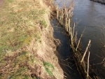
Erosion of bank undermining tree and lack of in-channel vegetation for fish and invertebrates
Installed Coir rolls increasing flow
The landscape adjacent to the River Ryton at Priorswell lacks natural features. Twenty alder trees were planted along the river bank in order to create dappled shade to enhance habitat for fish. Alder is a native species to the UK that typically colonises riparian habitat. The trees will also enhance the aesthetics of the area for local residents who overlook and walk through the site. In time the trees will provide excellent wildlife habitat for a range of wildlife.
The River Idle was causing severe bank erosion adjacent to a public footpath between SK69449 83331and SK69412 83400. The erosion was also introducing silt into the river that would affect water quality and smother gravels used by fish for spawning.
Willow stakes were installed into the base of the river bank and then willow was woven around the stakes to create a fence that would protect the river bank from further erosion. The area between the fence and the river bank was back-filled with brash. In time silt will accumulate allowing vegetation to colonise, effectively reinstating the integrity of the bank. A willow tree was removed from the opposite bank to allow the river to function naturally and erode the opposite bank.
This ‘living’ revetment creates bankside habitat. Each winter the willow is cut to ensure that tit does not become an obstacle within the river and the resultant ‘rods’ are used to make rustic garden furniture and willow baskets.
A wetland was created at Blaco Hill Farm (SK70727 87619) to remove phosphate from effluent discharged from Lound Sewage Treatment Works. Despite effluent from Lound STW meeting the required standard it does contain significant levels of phosphate and nitrate which is entering the River Idle at is entering the River Idle reducing water quality and encouraging algal blooms. Nottinghamshire Wildlife Trust, AECOM, Severn Trent Water and Lee Farms have been working in partnership during the last 3 years to try and improve this issue. Harworth Estates kindly provide reed / rhizomes for the wetland.
A connection between the River Idle and the Idle Valley Nature Reserve has been created to provide shelter to fish and eels during high flows in the river. The reed fringed water body will also provide spawning habitat. The connection will mimic natural processes by reconnecting the river with its flood plain.
Headwall Connection to the River Idle
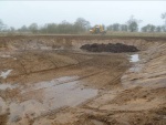
In order to enhance the newly created berm for fish a backwater was created to allow fish to move from the main channel into the backwater during high flows.
Backwater behind berm
ShowHideAdditionalImage.png


Catchment and subcatchment

Catchment

River basin district Humber
River basin Idle and Torne

Subcatchment

River name River Idle from Tiln to River Ryton
Area category 100 - 1000 km²
Area (km2)
Maximum altitude category Less than 100 m
Maximum altitude (m) 9090 m <br />0.09 km <br />9,000 cm <br />
Dominant geology Calcareous
Ecoregion Great Britain
Dominant land cover Arable and Horticulture
Waterbody ID GB104028058092


Site

Name
WFD water body codes GB104028058092
WFD (national) typology
WFD water body name River Idle from Tiln to River Ryton
Pre-project morphology
Reference morphology
Desired post project morphology
Heavily modified water body No
National/international site designation
Local/regional site designations
Protected species present No
Invasive species present No
Species of interest
Dominant hydrology
Dominant substrate
River corridor land use
Average bankfull channel width category
Average bankfull channel width (m)
Average bankfull channel depth category
Average bankfull channel depth (m)
Mean discharge category
Mean annual discharge (m3/s)
Average channel gradient category
Average channel gradient
Average unit stream power (W/m2)


Project background

Reach length directly affected (m)
Project started 2012/06/01
Works started
Works completed
Project completed 2015/05/01
Total cost category
Total cost (k€)
Benefit to cost ratio
Funding sources

Cost for project phases

Phase cost category cost exact (k€) Lead organisation Contact forename Contact surname
Investigation and design
Stakeholder engagement and communication
Works and works supervision
Post-project management and maintenance
Monitoring


Reasons for river restoration

Mitigation of a pressure
Hydromorphology Connection to groundwaters
Biology Fish, Macrophytes and/or phytobenthos: Average abundance
Physico-chemical Water quality below WFD objectives
Other reasons for the project Further partnership working


Measures

Structural measures
Bank/bed modifications Bank modification
Floodplain / River corridor Buffer strips
Planform / Channel pattern Introducing woody debris
Other Tree planting
Non-structural measures
Management interventions
Social measures (incl. engagement) Engagement with a wide range of stakeholders - more planned.
Other Survey work


Monitoring

Hydromorphological quality elements

Element When monitored Type of monitoring Control site used Result
Before measures After measures Qualitative Quantitative

Biological quality elements

Element When monitored Type of monitoring Control site used Result
Before measures After measures Qualitative Quantitative

Physico-chemical quality elements

Element When monitored Type of monitoring Control site used Result
Before measures After measures Qualitative Quantitative

Any other monitoring, e.g. social, economic

Element When monitored Type of monitoring Control site used Result
Before measures After measures Qualitative Quantitative


Monitoring documents


Additional documents and videos


Additional links and references

Link Description

Supplementary Information

Edit Supplementary Information