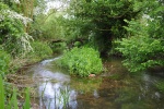
Case study:River Darent at Hawley Manor
Project overview
| Status | Complete |
|---|---|
| Project web site | |
| Themes | Habitat and biodiversity, Hydromorphology |
| Country | England |
| Main contact forename | Tom |
| Main contact surname | Cook |
| Main contact user ID | |
| Contact organisation | Environment Agency |
| Contact organisation web site | http://www.environment-agency.gov.uk/ |
| Partner organisations | |
| Parent multi-site project | |
| This is a parent project encompassing the following projects |
No |
Project summary
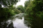
The River Darent in the Dartford area has been heavily modified over many years,including changes to channel planform, the implementation of land drainage schemes and abstraction,leading to an over widened channel. Prior to restoration this
section of river, two miles upstream of Dartford, was very uniform with a shallow gradient and uniform cross section. The natural substrate is dominated by pebbles and gravel but had become overlain by silt. Flow and habitat diversity was limited with
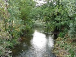
negative impacts on fish and macroinvertebrate communities. The aim of the project was to demonstrate that the processes that sustain a healthy chalk stream could be restored and the habitat protected during drought periods. This was to be achieved in a cost-effective way by re-working the in-channel gravels to form a low flow channel. The restoration work contributed to Chalk Rivers Biodiversity Action Plan (BAP) targets and complemented the implementation of the Darent Action Plan (1992).
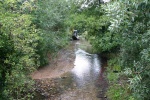
All of the bed modifications were carried out from within the channel, so the banks and trees were left untouched. The channel was re-profiled using a long reach excavator creating a sinuous channel, with pool and riffle sequences, still within the confines of the original channel. The excavator accessed the river where there were suitable gaps between trees and the creation of gravel berms at these points enabled the excavator to exit the river without damaging the banks.
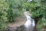
A low flow channel was created by moving small amounts of gravel in a meandering path within the confines of the wider channel. Part of the bed was kept at a higher elevation to create a sequence of riffles. In other areas more significant quantities of gravel were redistributed enabling pools to be created. Pools, spaced at approximately 20m intervals, were designed to be self-cleaning. Gravels were placed upstream of each to narrow the flow and increase velocity to induce scour in the pools.
The whole of the construction phase was supervised by the designer who was on site throughout the work and provided instructions to the excavator driver. Existing bankside trees with large root systems acted as natural deflectors and provided a variety of marginal habitat. A small amount of planting was carried out, including water crowfoot which was sourced locally from the Darent.
Monitoring surveys and results
Lessons learnt
Image gallery
|
Catchment and subcatchmentSelect a catchment/subcatchment
Catchment
Subcatchment
Other case studies in this subcatchment: Darent Valley Path, Lullingstone Castle, Lullingstone Castle phase 2
Site
Project background
Cost for project phases
Reasons for river restoration
Measures
MonitoringHydromorphological quality elements
Biological quality elements
Physico-chemical quality elements
Any other monitoring, e.g. social, economic
Monitoring documents
Additional documents and videos
Additional links and references
Supplementary InformationEdit Supplementary Information
| |||||||||||||||||||||||||||||||||||||||||||||||||||||||||||||||||||||||||||||||||||||||||||||||||||||||||||||||||||||||||||||||||||||||||||||||||||||||||||||||||||||||||||||||||||||||||||||||||||||||||||||||||||


