Case study:River Roding at Ray Lodge Park
Jump to navigation
Jump to search
Location: 51° 36' 59.43" N, 0° 3' 11.60" E
Left click to look around in the map, and use the wheel of your mouse to zoom in and out.
Project overview
| Status | Complete |
|---|---|
| Project web site | |
| Themes | Habitat and biodiversity, Hydromorphology, Social benefits |
| Country | England |
| Main contact forename | Nick |
| Main contact surname | Elbourne |
| Main contact user ID | User:NickRRC |
| Contact organisation | River Restoration Centre |
| Contact organisation web site | http://www.therrc.co.uk |
| Partner organisations | Environment Agency |
| Parent multi-site project | |
| This is a parent project encompassing the following projects |
No |
Project summary
Edit project overview to modify the project summary.
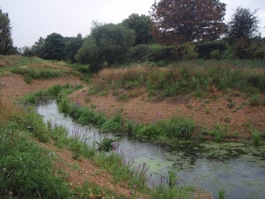
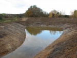
After works on a nearby motorway (the M11) in the 1970's ans 1980's, the River Roding was artificially diverted and straightened, resulting in poor quality wildlife habitat. The restoration project looked to address this by creating new habitats for a range of species including water voles, dragonflies and numerous fish species, without a reduction in flood protection. This was achieved through bank re-profiling, backwater creation and planting of the rivers banks.
Monitoring surveys and results
This case study hasn’t got any Monitoring survey and results, you can add some by editing the project overview.
Lessons learnt
This case study hasn’t got any lessons learnt, you can add some by editing the project overview.
Image gallery
|
Catchment and subcatchmentSelect a catchment/subcatchment
Site
Project background
Cost for project phases
Reasons for river restoration
Measures
MonitoringHydromorphological quality elements
Biological quality elements
Physico-chemical quality elements
Any other monitoring, e.g. social, economic
Monitoring documents
Additional documents and videos
Additional links and references
Supplementary InformationEdit Supplementary Information
| |||||||||||||||||||||||||||||||||||||||||||||||||||||||||||||||||||||||||||||||||||||||||||||||||||||||||||||||||||||||||||||||||||||||||||||||||||||||||||||||||||||||||||||||||


