Case study:Wandsworth Riverside Quarter: Difference between revisions
No edit summary |
No edit summary |
||
| Line 1: | Line 1: | ||
{{Project overview | {{Project overview | ||
|Status=Complete | |Status=Complete | ||
|Project web site url=www.restorerivers.eu/Portals/27/Wandsworth%20Riverside%20Quarter%20Intertidal%20Terraces.pdf | |Project web site url=www.restorerivers.eu/Portals/27/Wandsworth%20Riverside%20Quarter%20Intertidal%20Terraces.pdf | ||
|Themes=Habitat and biodiversity, Hydromorphology, Spatial planning, Urban | |Themes=Estuary, Habitat and biodiversity, Hydromorphology, Spatial planning, Urban | ||
|Country=England | |Country=England | ||
|Main contact forename=Toni | |Main contact forename=Toni | ||
| Line 14: | Line 8: | ||
|Main contact id=Ascarr | |Main contact id=Ascarr | ||
|Contact organisation=Environment Agency | |Contact organisation=Environment Agency | ||
|Partner organisations=Fraser Property, J.T Mackley & Co Ltd; Salix Wetlands | |Partner organisations=Beckett Rankine, Biodiversity By Design, Capita Lovejoy, Fraser Property, J.T Mackley & Co Ltd; Salix Wetlands | ||
|Multi-site=No | |Multi-site=No | ||
|Project picture=Wandsworth Riverside.jpg | |Project picture=Wandsworth Riverside.jpg | ||
| Line 58: | Line 52: | ||
* The site links in within green roofs and other green infrastructure designed as part of the redevelopment master plan creating an extended green network. | * The site links in within green roofs and other green infrastructure designed as part of the redevelopment master plan creating an extended green network. | ||
* The site acts as a showcase to demonstrate what can be achieved on tidal rivers. | * The site acts as a showcase to demonstrate what can be achieved on tidal rivers. | ||
|Lessons learn= | |Lessons learn=* Proactive discussion between the Environment Agency and the developers led to beneficial outcomes for both parties, and the creation of a multifunctional, more natural riverside environment. | ||
* Use of coir rolls to stabilise the sediment accretion and bank reprofiling was insufficient and required rock roll installation. | |||
* Success of sediment accretion between the terraces demonstrates good geomorphological understanding of processes and modelling. | |||
}} | }} | ||
{{Case study status | |||
|Approval status=Approved | |||
}} | |||
{{Location | |||
|Location=51.46273746270802, -0.1957261562347412 | |||
}} | |||
{{Image gallery}} | {{Image gallery}} | ||
{{Case study image | {{Case study image | ||
Latest revision as of 13:43, 16 September 2024
Project overview
| Status | Complete |
|---|---|
| Project web site | http://www.restorerivers.eu/Portals/27/Wandsworth%20Riverside%20Quarter%20Intertidal%20Terraces.pdf |
| Themes | Estuary, Habitat and biodiversity, Hydromorphology, Spatial planning, Urban |
| Country | England |
| Main contact forename | Toni |
| Main contact surname | Scarr |
| Main contact user ID | User:Ascarr |
| Contact organisation | Environment Agency |
| Contact organisation web site | |
| Partner organisations | Beckett Rankine, Biodiversity By Design, Capita Lovejoy, Fraser Property, J.T Mackley & Co Ltd; Salix Wetlands |
| Parent multi-site project | |
| This is a parent project encompassing the following projects |
No |
Project summary
The area of the London Borough Wandsworth on the west bank of the confluence of the River Wandle and the tidal River Thames was previously a 4 hectare Shell Oil terminal, and subsequently a brownfield industrial site. The area had been protected over time from tidal flooding through a combination of concrete quays and timber and metal tidal defences. The history of the site led to issues of contaminated land and a disconnection of the area from the rivers it borders.
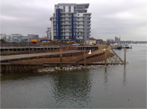
The former industrial site was redeveloped through a number of phased developments, which together comprised a complex of residential and commercial properties on the Thames waterfront under the name Wandsworth Riverside Quarter.
The redevelopment was identified by the Environment Agency as having the potential to provide an improved riverside environment, and an opportunity to reconnect the rivers with the people now using the previouslyderelict site. The suggested solution was to replace the existing tidal defences with a series of tidal terraces, creating a new intertidal zone and facilitating a range of associated transitional habitats.
Formation works (January 2009) • Preparation of site (coffer dams, excavation and soil removal, bank re-profiling, and set up site compound). Hard landscape works (February 2009):
- Laying contamination textile to reduce risk of contaminated soils entering the Thames during the works.
- Constructing timber terraces.
- Placing backfill materials.
- Laying root barrier.
- Laying silt accretion geotextiles to encourage silt to accumulate between the terraces.
- Fixing coir rolls at channel margins.
- Installing dead wood habitat staked at the margins between the slope and the channel to encourage more diverse plant establishment and flow conditions.
Monitoring period (March-May 2009)
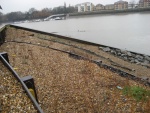
- After installation silt was allowed to naturally accrete in the lower terraces to allow for the growth of tidal flora. Silt accumulation was monitored during this period and a significant increase in sediment accretion between the terraces was
recorded.
Rock roll installation (May 2009)
- Rock rolls (wave energy reduction structures installed by long reach plant) installed along with coir matting to encourage plant growth. Planting (June 2009)
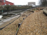
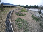
- Intertidal vegetation was planted and dead wood installed along the terraces.
techniques used
- Preserve and improve water’s edge and bank side habitats
- Retain and improve existing water’s edge and bankside habitats in modified watercourses
- Realign flood defences to increase coastal and intertidal habitat
- Restore aquatic habitats in modified watercourses
- Use green engineering techniques instead of hard bank protection
https://www.therrc.co.uk/sites/default/files/projects/51_wandsworth.pdf
Monitoring surveys and results
- Creation of a range of intertidal habitats in an otherwise biodiversity-poor area of the constrained Rivers Wandle and Thames.
- Improved access to the River Thames and River Wandle, bringing residents and members of the public closer the watercourse.
- Provides access to the watercourse for local wildlife.
- The site links in within green roofs and other green infrastructure designed as part of the redevelopment master plan creating an extended green network.
- The site acts as a showcase to demonstrate what can be achieved on tidal rivers.
Lessons learnt
- Proactive discussion between the Environment Agency and the developers led to beneficial outcomes for both parties, and the creation of a multifunctional, more natural riverside environment.
- Use of coir rolls to stabilise the sediment accretion and bank reprofiling was insufficient and required rock roll installation.
- Success of sediment accretion between the terraces demonstrates good geomorphological understanding of processes and modelling.
Image gallery
|
Catchment and subcatchmentSelect a catchment/subcatchment
Catchment
Subcatchment
Other case studies in this subcatchment: Barking Creek near A13, Barking Creekmouth, Chambers Wharf, Cuckolds Haven Nature Area, Greenwich Peninsula, Lower River Roding Regeneration Project, Mill Pool, Saving Chiswick Eyot
Site
Project background
Cost for project phases
Supplementary funding informationthe whole scheme including the development cost between £100k-£500k
Reasons for river restoration
Measures
MonitoringHydromorphological quality elements
Biological quality elements
Physico-chemical quality elements
Any other monitoring, e.g. social, economic
Monitoring documents
Additional documents and videos
Additional links and references
Supplementary InformationEdit Supplementary Information
| ||||||||||||||||||||||||||||||||||||||||||||||||||||||||||||||||||||||||||||||||||||||||||||||||||||||||||||||||||||||||||||||||||||||||||||||||||||||||||||||||||||||||||||||||||||||||||||||||||||||||||


