Case study:Riverlands Porlock Vale Streams: Difference between revisions
No edit summary |
No edit summary |
||
| Line 1: | Line 1: | ||
{{Case study status | {{Case study status | ||
|Approval status= | |Approval status=Approved | ||
}} | }} | ||
{{Location | {{Location | ||
Latest revision as of 11:57, 14 March 2024
Project overview
| Status | In progress |
|---|---|
| Project web site | http://www.nationaltrust.org.uk/our-cause/nature-climate/nature-conservation/riverlands-how-we-keep-our-rivers-flowing#rt-our-work-at-porlock |
| Themes | Environmental flows and water resources, Flood risk management, Habitat and biodiversity, Hydromorphology, Land use management - agriculture, Monitoring, Social benefits, Water quality |
| Country | England |
| Main contact forename | Ben |
| Main contact surname | Eardley |
| Main contact user ID | User:eardles |
| Contact organisation | The National Trust for Places of Historic Interest or Natural Beauty |
| Contact organisation web site | http://www.nationaltrust.org.uk/ |
| Partner organisations | Environment Agency, Somerset Rivers Authority, Interreg 2 Seas Co-adapt |
| This is a parent project encompassing the following projects |
Project summary
A catchment scale programme focusing on restoring natural process in the river systems and landscape to deliver benefits for people and wildlife. The programme encompasses a broad range of work from large river restoration scheme, changes in land management, small scale nature based solutions and innovative engagement activities and tools.
A virtual tour of the estate is being developed which covers some of the work undertaken as well as two immersive audio experiences that allow the listener to learn more about the landscape and its rivers.
http://storage.viewit360.co.uk/national-trust/holnicote-estate
Monitoring surveys and results
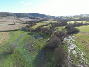
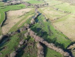
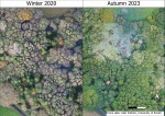
The National Trust owns two complete river systems at Holnicote and has been involved in comprehensive hydrological monitoring for around 15 years. The Riverlands project has built on this legacy and has completed flow and water quality monitoring at key project locations within the catchment. The project will continue to monitor water quality and quantity to determine the effect of nature based solutions deployed at scale. Additional hydromorphological monitoring includes high resolution drone monitoring and remote sensing to provide a baseline of river form, groundwater, water and soil temperature, soil chemistry and organic matter and fluvial transport assessment.
Additionally the project is also monitoring key indicators including (but not limited to) fish, fish habitat, aquatic invertebrates, bats, nesting birds, grass snakes, water vole and butterfly.
Lessons learnt
Applying nature based solutions in the current consenting and permitting environment is not easy. Water and wildlife need space and the current land management payment systems and permitting and consenting process needs to be changed and/or adapted to reflect more dynamic river systems that are given space to evolve. In certain places within our river systems we need to move from drainage to habitat and the regulatory and funding environment needs to be changed to enable this to happen.
Image gallery
|
Catchment and subcatchment
Site
Project background
Cost for project phases
Reasons for river restoration
Measures
MonitoringHydromorphological quality elements
Biological quality elements
Physico-chemical quality elements
Any other monitoring, e.g. social, economic
Monitoring documents
Additional documents and videos
Additional links and references
Supplementary InformationEdit Supplementary Information
| ||||||||||||||||||||||||||||||||||||||||||||||||||||||||||||||||||||||||||||||||||||||||||||||||||||||||||||||||||||||||||||||||||||||||||||||||||||||||||||||||||||||||||||||||||||


