Case study:Little Ponton: Difference between revisions
Dhutchinson (talk | contribs) No edit summary |
Dhutchinson (talk | contribs) No edit summary |
||
| Line 35: | Line 35: | ||
}} | }} | ||
{{Image gallery}} | {{Image gallery}} | ||
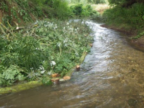
{{Case study image | |||
|File name=Little Ponton 1.png | |||
|Caption=Post restoration | |||
}} | |||
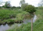
{{Case study image | |||
|File name=Little Ponton 2.png | |||
|Caption=Post restoration | |||
}} | |||
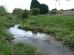
{{Case study image | |||
|File name=Little Ponton 3.png | |||
|Caption=Post Restoration | |||
}} | |||
{{Image gallery end}} | {{Image gallery end}} | ||
{{Toggle button}} | {{Toggle button}} | ||
Revision as of 14:30, 19 February 2024
This case study is pending approval by a RiverWiki administrator.
Project overview
| Status | Complete |
|---|---|
| Project web site | |
| Themes | Fisheries, Habitat and biodiversity |
| Country | England |
| Main contact forename | Matt |
| Main contact surname | Parr |
| Main contact user ID | |
| Contact organisation | Environment Agency |
| Contact organisation web site | http://www.gov.uk/government/organisations/environment-agency |
| Partner organisations | Grantham Angling Association Fly Fishing Section |
| Parent multi-site project | |
| This is a parent project encompassing the following projects |
No |
Project summary
Project Objectives
• To reduce fine sediment inputs caused by bank erosion. • Trap mobile fine sediments already in the river. • To improve conveyance during higher flows and reduce flood risk. • To improve in-stream habitats and the bed structure to benefit fish and invertebrates, including white-clawed crayfish.
The Enhancement Scheme The enhancement scheme was completed in two phases. A short section downstream of Great Ponton Mill was completed in February 2013 and the second, the continuation downstream to Whalebone Lane, Little Ponton, was completed in mid-August 2014. Prior to the enhancement work the in-river habitat was in generally good condition, however opportunities were identified to provide additional cover and food supply for a range of aquatic organisms together with measures to modify the flow to improve the structure of the riverbed and reduce the deposition of fine sediment.
The works consisted of brushwood mattress installation, Hinged Trees, Log Flow Deflectors and Vanes, improved stock fencing and ford refurbishment were all undertaken.
Monitoring surveys and results
A fixed point photographic record has been set up and this, together with visual inspections, will be used to monitor the integrity and performance of the in-stream structures. A programme of fine sediment sampling and Wolman Pebble Counts to monitor the coarser riverbed material has also been established. In combination they will determine and record changes to river morphology as the result of the works. The established crayfish monitoring site at the bottom of the reach is already surveyed every 2 years and this will give an indication of the impact of the scheme on crayfish numbers. Finally additional ongoing invertebrate sampling will identify any ecological and water quality changes that occur.
Lessons learnt
Learning lessons from the earlier GAAFFS work, willow logs were was not used in the subsequent phase of enhancement work. Instead logs, branches and brushwood generated by the management of other riverside tree
and shrub species were used to create a variety of structures to protect vulnerable banks from erosion, narrow the channel and trap suspended fine sediment.
Image gallery
|
Catchment and subcatchment
Site
Project background
Cost for project phases
Reasons for river restoration
Measures
MonitoringHydromorphological quality elements
Biological quality elements
Physico-chemical quality elements
Any other monitoring, e.g. social, economic
Monitoring documents
Additional documents and videos
Additional links and references
Supplementary InformationEdit Supplementary Information
| ||||||||||||||||||||||||||||||||||||||||||||||||||||||||||||||||||||||||||||||||||||||||||||||||||||||||||||||||||||||||||||||||||||||||||||||||||||||||||||||||||||||||||||||||||


