Case study:Forest Halt, Saltburn Valley Gardens: Difference between revisions
Peter.batty (talk | contribs) No edit summary |
Peter.batty (talk | contribs) No edit summary |
||
| Line 46: | Line 46: | ||
{{Case study image | {{Case study image | ||
|File name=WP 20190131 11 05 415 Pro.jpg | |File name=WP 20190131 11 05 415 Pro.jpg | ||
}} | |||
{{Case study image | |||
|File name=147.jpg | |||
}} | |||
{{Case study image | |||
|File name=20170621 113005.jpg | |||
}} | }} | ||
{{Image gallery end}} | {{Image gallery end}} | ||
Latest revision as of 16:25, 20 February 2019
This case study is pending approval by a RiverWiki administrator.
Project overview
| Status | Complete |
|---|---|
| Project web site | |
| Themes | Economic aspects, Flood risk management, Social benefits |
| Country | England |
| Main contact forename | Peter |
| Main contact surname | Batty |
| Main contact user ID | |
| Contact organisation | RAB Consultants |
| Contact organisation web site | http://www.rabconsultants.co.uk/ |
| Partner organisations | |
| Parent multi-site project | |
| This is a parent project encompassing the following projects |
No |
Project summary
The initial scope of the project was to assess the overall structural and hydromorphological condition of the watercourse running through Saltburn Valley Gardens to identify areas on potential improvement.
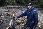
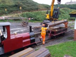
Three areas were identified as requiring intervention within the gardens where the part of the watercourse was beginning to effect infrastructure, namely the miniature railway line and the public car park or deposition is severely reducing the capacity of the channel. Given the lack of infrastructure surrounding the remainder of the watercourse this will be left to its natural processes. The first of the areas is located at the downstream end of the watercourse, at the confluence of Skelton Beck, Millholme Beck and the sea. At this location rapid erosion is taking place of the right-hand bank due to frequent inundation and the diversion of flows caused by silt deposition upstream, the second area of interest. The third area of interest and focus of this entry, is an area at the upstream end of the gardens adjacent to the final platform of the Saltburn Miniature Railway. This rapid response watercourse was regularly inundating the miniature railway and washing away both river bank and the sub base the tracks are laid on. The erosion was taking place on the outside of a sharp bend in the watercourse and various methods had pervious been tried to halt the erosion. All of these has subsequently failed leaving an area of bare earth with embedded pieces of gabion basket and other failed erosion protection measures.
A feasibility study was then undertaken considering the following options:
Do nothing
Use of local tree root balls to be imbedded in the bank with willow revetment
Use of vegetated bags with large stone revetment
Inclined gabion stone baskets.
Sheet piles with coir matting, willow faggots and rock rolls
A matrix scoring each option against environmental, economic and technical criteria was created and option 5 was selected offering erosion protection, flood protection and environmental benefits.
Detailed design, specification, construction drawings, method statement and environmental risk assessment were produced to allow the flood risk activity permit to be granted and the contractor to undertake the work. The works were undertaken in line with the methods statement approved by the Environment Agency which included a number of silt curtains and use of biodiesel.
Monitoring surveys and results
Lessons learnt
Image gallery
|
Catchment and subcatchmentSelect a catchment/subcatchment
Catchment
Subcatchment
Site
Project background
Cost for project phases
Reasons for river restoration
Measures
MonitoringHydromorphological quality elements
Biological quality elements
Physico-chemical quality elements
Any other monitoring, e.g. social, economic
Monitoring documents
Additional documents and videos
Additional links and references
Supplementary InformationEdit Supplementary Information
| ||||||||||||||||||||||||||||||||||||||||||||||||||||||||||||||||||||||||||||||||||||||||||||||||||||||||||||||||||||||||||||||||||||||||||||||||||||||||||||||||||||||||||||||||||||||||||||||||||||||||


