Case study:Saving Chiswick Eyot: Difference between revisions
No edit summary |
No edit summary |
||
| Line 64: | Line 64: | ||
}} | }} | ||
{{Image gallery}} | {{Image gallery}} | ||
{{Case study image | {{Case study image | ||
|File name=West bank point cloud pic.JPG | |File name=West bank point cloud pic.JPG | ||
| Line 87: | Line 79: | ||
|File name=Bathymetry and scans.JPG | |File name=Bathymetry and scans.JPG | ||
|Caption=Bathymetry and scans | |Caption=Bathymetry and scans | ||
}} | |||
{{Case study image | |||
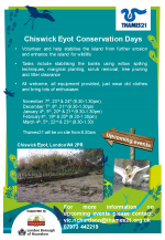
|File name=Thames21 Chiswick Eyot days.png | |||
}} | |||
{{Case study image | |||
|File name=Old Chiswick Conservation Area.JPG | |||
}} | |||
{{Case study image | |||
|File name=Records of burrowing species in the Thames tideway.jpg | |||
}} | |||
{{Case study image | |||
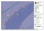
|File name=EA flood risk level.JPG | |||
}} | |||
{{Case study image | |||
|File name=East bank with new posts.JPG | |||
}} | |||
{{Case study image | |||
|File name=3D model of west bank.jpg | |||
}} | |||
{{Case study image | |||
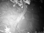
|File name=Animal photo capture.JPG | |||
}} | }} | ||
{{Image gallery end}} | {{Image gallery end}} | ||
Revision as of 11:55, 15 March 2018
Project overview
| Status | In progress |
|---|---|
| Project web site | http://www.savingchiswickeyot.com |
| Themes | Economic aspects, Environmental flows and water resources, Fisheries, Flood risk management, Habitat and biodiversity, Hydromorphology, Land use management - forestry, Monitoring, Social benefits, Water quality, Urban |
| Country | England |
| Main contact forename | Martin |
| Main contact surname | Richardson |
| Main contact user ID | User:Mobilitydream |
| Contact organisation | Natural History Museum |
| Contact organisation web site | http://www.nhm.ac.uk |
| Partner organisations | Royal Holloway University of London, MoLA, Fullers Brewery, University of Leicester, Thames21, Port of London Authority, DHI, Thames Tideway, The British Geological Survey |
| This is a parent project encompassing the following projects |
Project summary
Project team
Dr. Dave Morritt, Royal Holloway University of London. Dr. Paul Clark, Natural History Museum, London. Martin Richardson, PhD student RHUL & NHM. Therese Tobin, Old Chiswick Preservation Society, OCPS Thames21
Site Designations
Old Chiswick Conservation Area, London Borough of Hounslow, 1969; Metropolitan Green Belt; Site of Metropolitan Importance for Nature Conservation, Greater London Authority (GLA),1990; Local Nature Reserve, London Borough of Hounslow, 1993; London Basin Natural Area, English nature, 1997; Strategic Nature Conservation Site, London Borough of Hounslow,1999;
Selection of Reports
1990 Chiswick Eyot, The London Ecology Unit; 1996 The Chinese mitten crab in the Thames Catchment, Environment Agency, Thomas and Yeomans; 1998 Effects of burrowing Chinese mitten Crabs (Eriocheir sinensis) on the Thames Tideway Dutton & Conroy, Environment Agency; 1999 Erosion assessment using flags, BSc. Dissertation, University of Westminster; 1999 MSc. Thesis: Burrow distribution of the Chinese mitten crab (Eriocheir sinensis) at Syon park flood meadow (SSSI), Zucco, UCL; Chiswick Eyot Local Nature Reserve report, Carillion integrated Services; 2000 Chiswick Eyot, River Thames, London Borough of Hounslow. A foreshore earthwork survey, Museum of London Archaeology; 2000 Chiswick Eyot Management plan 2001-2005, London Borough of Hounslow; 2002 Survey of Chiswick Eyot,Thames explorer trust; 2011 Chiswick Eyot habitat management Plan,Thames21;
Description
Island habitat in the Thames is rare and several of them, as with the lost rivers of the Thames catchment, have disappeared over time. Chiswick Eyot is a small, historically important island close by Chiswick Mall. An economically important willow holt of several hundred salix spp. trees has been maintained since the middle ages however, husbandry has lapsed at times with the island showing periods of low growth when the area was heavily industrialised with gravel pits at Barnes and the Thonycroft shipyard at Chiswick. A survey by Dr Oliver Natelson conducted in 2002 found 554 living and 319 dead trees.
Erosion first became a concern in the mid-1940's when it was realised that the surface area had declined by nearly 40%. Both ends of the island had receded and overall length decreased by nearly '100 yds.' Restoration work has continued since that time and several ecological studies have been conducted by the Environment Agency, Hounslow Council, and Thames Explorer Trust. We are working with an ‘ecosystem’ of partners to address the problem of maintaining the island employing best practice techniques. An initial 3D scan of almost the entire island was conducted in 2016 in association with the University of Leicester and Leica Geosystems. The scan was repeated in 2017. Analysis of the data will provide greater understanding of the processes at work and enable visualisation of any changes occurring as well as determination of rate of erosion. In addition, several hundred digital photographs were taken of areas of particular interest over a 3-year period to provide a visual record, these will also be used to develop point clouds as supplementary data.
Bi-monthly conventional topographic surveys of part of one bank were undertaken by MoLA in 1999 and 2000 allowing for decadal scale assessment of the erosion rate. High resolution aerial photographs and digitized historical Ordnance Survey maps are available dating back to at least the 1930s and these will be used to assess changes in surface area and any migration of the banks generally. We have engaged with the local community and formed partnerships with other organisations including Thames 21, the River Restoration Centre, Leica Geosystems, DHI, MoLA, and Royal Holloway University of London.
Monitoring surveys and results
Very accurate baseline surveys have been completed.Preliminary assessment indicates a current rate of retreat of the banks at around 1m per decade, or approximately 10cm annually.A large amount of material has accumulated behind the spiling and facines which are being well maintained. Additional work, installation of supporting posts and fascines, has commenced on the east side of the island.
Lessons learnt
Restoration work using traditional willow withes has resulted in improved overall appearance and accretion to some areas of the bank. Vegetation is not growing in the silt perhaps because of a lack of oxygen. Seepage from the bank toe area is keeping the silt mobile in some areas. The current approach employed by Thames21 of incremental maintenance appears to be successful and demonstrates good cost vs. benefit ratio, especially since partners have started to make contributions towards costs. Withies planted on the flat surface of the island by the Old Chiswick Preservation Society are growing well and the willow holt, which is pollared annually, appears to be in good condition. The withies produced by the pollarding are then bundled by the OCPS and volunteers and used to provide structure behind the fascines.
It might be useful at this point to consider additional techniques such as rolls of rocks (rocks bundled into mesh 'socks') at the areas of the bank toe with seepage. Thames21 has also mentioned using different species of aquatic plants.
Image gallery
|
Catchment and subcatchmentSelect a catchment/subcatchment
Catchment
Subcatchment
Other case studies in this subcatchment: Barking Creek near A13, Barking Creekmouth, Chambers Wharf, Cuckolds Haven Nature Area, Greenwich Peninsula, Lower River Roding Regeneration Project, Mill Pool, Wandsworth Riverside Quarter
Site
Project background
Cost for project phases
Reasons for river restoration
Measures
MonitoringHydromorphological quality elements
Biological quality elements
Physico-chemical quality elements
Any other monitoring, e.g. social, economic
Monitoring documents
Additional documents and videos
Additional links and references
Supplementary InformationEdit Supplementary Information
| ||||||||||||||||||||||||||||||||||||||||||||||||||||||||||||||||||||||||||||||||||||||||||||||||||||||||||||||||||||||||||||||||||||||||||||||||||||||||||||||||||||||||||||||||||||||||||||||


