Case study:The River Deerness Project: Difference between revisions
No edit summary |
Hazel Wilson (talk | contribs) No edit summary |
||
| Line 6: | Line 6: | ||
}} | }} | ||
{{Project overview | {{Project overview | ||
|Status= | |Status=Complete | ||
|Project web site url=www.wear-rivers-trust.org.uk/content/deernessrestoration | |Project web site url=www.wear-rivers-trust.org.uk/content/deernessrestoration | ||
|Themes=Habitat and biodiversity, Hydromorphology, Water quality | |Themes=Habitat and biodiversity, Hydromorphology, Water quality | ||
Revision as of 15:58, 15 March 2016
Project overview
| Status | Complete |
|---|---|
| Project web site | http://www.wear-rivers-trust.org.uk/content/deernessrestoration |
| Themes | Habitat and biodiversity, Hydromorphology, Water quality |
| Country | England |
| Main contact forename | Steve |
| Main contact surname | Hudson |
| Main contact user ID | |
| Contact organisation | Wear Rivers Trust |
| Contact organisation web site | http://www.wear-rivers-trust.org.uk/ |
| Partner organisations | Durham County Council, Durham University |
| This is a parent project encompassing the following projects |
Hedleyhope Burn, The River Deerness Project 2 |
Project summary
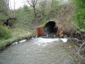
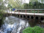
The Deerness catchment, located west of Durham City, covers 53 km2 and includes the small colliery towns of Ushaw Moor, Esh Winning and Cornsay. Land use is largely agricultural, with woodland cover and several reclaimed open cast and landfill sites. A significant part of the catchment fails the Water Framework Directive for fish, due to the cumulative effects of barriers to the upstream and downstream movement of all fish spe-cies and also because of water quality issues (principally phosphate) reflected in altered phytobenthos.
The outcomes of the project are the following: enhanced habitat connectivity throughout both catchments allowing all fish species, migratory and non-migratory, maximum scope to spawn and feed; improved knowledge of fish populations and behaviours through baseline and postimplementation monitoring and evaluation; progress toward/achievement of Good Ecological Status and focus on any residual water quality issues required to achieve good status; establishment of partnership working and joint delivery to be ex-tended under the auspices of the Wear Catchment Management Plan.
Monitoring surveys and results
The Wear Rivers Trust operates fish and invertebrate surveys to assess fish populations and water health in both catchments. Under CRF a Durham University PhD student, with WRT and volunteer support, will survey below and above each obstruction both before and after restoration activities to measure impacts on those animal groups. Changes in invertebrate communities are not expected as a direct result of the restoration activities but they can inform on the wider food web for fish feeding opportunities, and provide biotic indices of water quality, giving wider insight into local environmental quality. Waste water management is significant across the Lower Wear system, including these two catchments. Supplementary projects, based on a separate volunteer walkover programme, will be developed under the auspices of the Wear River Catchment Management Plan to identify and address point and diffuse sources of pollution, in order to augment CRF actions for improvement to fish movement within these catchments
Lessons learnt
Image gallery
|
Catchment and subcatchmentSelect a catchment/subcatchment
Catchment
Subcatchment
Other case studies in this subcatchment: The River Deerness Project 2
Site
Project background
Cost for project phases
Reasons for river restoration
Measures
MonitoringHydromorphological quality elements
Biological quality elements
Physico-chemical quality elements
Any other monitoring, e.g. social, economic
Monitoring documents
Additional documents and videos
Additional links and references
Supplementary InformationEdit Supplementary Information
| |||||||||||||||||||||||||||||||||||||||||||||||||||||||||||||||||||||||||||||||||||||||||||||||||||||||||||||||||||||||||||||||||||||||||||||||||||||||||||||||||||||||||||||||||||||||||||||||||||||||||||||||


