Case study:Adams Mill enhancements: Difference between revisions
Robclapham (talk | contribs) No edit summary |
Robclapham (talk | contribs) No edit summary |
||
| Line 55: | Line 55: | ||
|Average bankfull channel depth category=2 - 5 m | |Average bankfull channel depth category=2 - 5 m | ||
}} | }} | ||
{{Project background}} | {{Project background | ||
|Reach length directly affected=575 | |||
|Project started=2014/09/01 | |||
|Works started=2014/10/03 | |||
|Total cost category=Less than 1 k€ | |||
|Funding sources=WFD GiA | |||
|Investigation and design cost category=Less than 1 k€ | |||
|Investigation and design Lead organisation=Environment Agency | |||
|Investigation and design Other contact forename=Rob | |||
|Investigation and design Other contact surname=Clapham | |||
|Stakeholder1 engagement cost category=Less than 1 k€ | |||
|Stakeholder engagement Lead organisation=Environment Agency | |||
|Works and supervision Lead organisation=Environment Agency | |||
|Works and supervision Other contact forename=Rob | |||
|Works and supervision Other contact surname=Clapham | |||
|Monitoring1 cost category=Less than 1 k€ | |||
|Monitoring Lead organisation=Environment Agency | |||
|Monitoring Other contact forename=Rob | |||
|Monitoring Other contact surname=Clapham | |||
}} | |||
{{Motivations}} | {{Motivations}} | ||
{{Measures}} | {{Measures}} | ||
Revision as of 09:58, 17 October 2014
This case study is pending approval by a RiverWiki administrator.
Project overview
| Status | In progress |
|---|---|
| Project web site | |
| Themes | Fisheries, Hydromorphology |
| Country | England |
| Main contact forename | Rob |
| Main contact surname | Clapham |
| Main contact user ID | |
| Contact organisation | Environment Agency |
| Contact organisation web site | |
| Partner organisations | |
| Parent multi-site project | |
| This is a parent project encompassing the following projects |
No |
Project summary
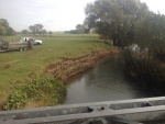
Site is location of a historically successful Barbel fishery. Recent deterioration has been noted by EA and Anglers at this location. Surveys have shown that the decline is likely to be a result of increased sediment load from collapse banks undermined by signal crayfish activity, along with historic modification that have reduced the natural resilience of the river.
Measures undertaken and planned at this site include:
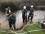
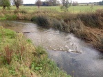
- Tree planting (started April 2014) - Bank stabilization(started October 2014) - Riffle enhancement(started October 2014) - Channel narrowing (expected 2015)
Monitoring surveys and results
Location of riffle enhancement is at location of existing WFD monitoring site for fish. Pre- and post-enhancement survey data will be available.
Lessons learnt
Image gallery
|
Catchment and subcatchment
Site
Project background
Cost for project phases
Reasons for river restoration
Measures
MonitoringHydromorphological quality elements
Biological quality elements
Physico-chemical quality elements
Any other monitoring, e.g. social, economic
Monitoring documents
Additional documents and videos
Additional links and references
Supplementary InformationEdit Supplementary Information
| ||||||||||||||||||||||||||||||||||||||||||||||||||||||||||||||||||||||||||||||||||||||||||||||||||||||||||||||||||||||||||||||||||||||||||||||||||||||||||||||||||||||||||||||||||


