Case study:Mayesbrook Climate Change Park restoration project: Difference between revisions
No edit summary |
No edit summary |
||
| Line 48: | Line 48: | ||
<i>Results</i><br> | <i>Results</i><br> | ||
Geomorphology and channel adjustment:<br> | Geomorphology and channel adjustment:<br> | ||
• In summer 2012/ spring 2013, the majority of restored sections showed an increase in the abundance and diversity of habitat and flow types.<br> | • In summer 2012/ spring 2013, the majority of restored sections showed an increase in the abundance and diversity of habitat and flow types (compared to baseline River Habitat Survey data from 2008 and 2009).<br> | ||
• Low rainfall and below average flows (drought-like conditions) in 2011/12 undoubtedly limited the regrowth of macrophytes (after physical works). The backwater and SUDs in the middle reach were planted up in places by volunteers.<br> | • Low rainfall and below average flows (drought-like conditions) in 2011/12 undoubtedly limited the regrowth of macrophytes (after physical works). The backwater and SUDs in the middle reach were planted up in places by volunteers.<br> | ||
• A scoring method was trialed to score all fixed point photos (before, during and after restoration) on the observed naturalness of habitat and vegetation within the river corridor. The majority of fixed points peaked in summer 2012 or spring 2013 after restoration (note: photos were taken on a quarterly basis between spring 2011 and spring 2013).<br> | • A scoring method was trialed to score all fixed point photos (before, during and after restoration) on the observed naturalness of habitat and vegetation within the river corridor. The majority of fixed points peaked in summer 2012 or spring 2013 after restoration (note: photos were taken on a quarterly basis between spring 2011 and spring 2013).<br> | ||
• There was relatively insignificant change in the topography and chainage of cross-section surveys collected bi-annually at 12 transects in the middle and lower reaches between autumn 2011 (immediately after new channel excavated) and spring 2012 (eighteen months post works). However there was evidence of an evolution of in-channel features in parts of the middle reach (see Image Gallery) and natural gravel movements in the upper reach. | • There was relatively insignificant change in the topography and chainage of cross-section surveys collected bi-annually at 12 transects in the middle and lower reaches between autumn 2011 (immediately after new channel excavated) and spring 2012 (eighteen months post works). However there was evidence of an evolution of in-channel features in parts of the middle reach (see Image Gallery) and natural gravel movements in the upper reach. | ||
}} | }} | ||
{{Image gallery}} | {{Image gallery}} | ||
Revision as of 15:33, 13 March 2014
Project overview
| Status | Complete |
|---|---|
| Project web site | http://www.lbbd.gov.uk/LeisureArtsAndLibraries/Parksandcountryside/Pages/MayesbrookPark.aspx |
| Themes | Economic aspects, Flood risk management, Habitat and biodiversity, Hydromorphology, Monitoring, Social benefits, Water quality, Urban |
| Country | England |
| Main contact forename | Nick |
| Main contact surname | Elbourne |
| Main contact user ID | User:NickRRC |
| Contact organisation | River Restoration Centre |
| Contact organisation web site | http://www.therrc.co.uk |
| Partner organisations | Thames Rivers Trust, Environment Agency, London Borough of Barking and Dagenham, Environment Agency, Queen Mary University of London, Natural England, Design for London, Greater London Authority, London Wildlife Trust, RSA (Insurance), SITA Trust, Mayesbrook Park Friends group |
| Parent multi-site project | |
| This is a parent project encompassing the following projects |
No |
Project summary
Introduction
The river restoration project is part of the UK’s first ‘Climate Change Park’ at Mayesbrook in Barking, east London. The project aimed to transform a rundown 45 hectare park into a showcase of how public greenspace can help a community to cope with the risks from climate change; such as increased flooding and higher summer temperatures.
The Mayesbrook Climate Change Park was delivered by an innovative partnership of public, private and voluntary organisations. By combining staff, funding and technical resources the partners were able to deliver a project that no one partner could have done alone. Funding received a major boost in 2009 when RSA donated £300,000 to the project through Thames Rivers Trust as a research contribution into natural flood management and reducing flood risk through a low carbon approach. The RSA donation also helped lever in a further £400,000 of funding from the Mayor of London’s ‘Help a London Park’ campaign.
At the launch of the works in March 2011, Richard Benyon the Minister for the Natural Environment at DEFRA said: “The Mayesbrook Climate Change Park is a shining example of the public and private sectors working in partnership. This project will be a great boost for the local communities and the environment. By bringing the Mayes Brook back into the park, planting trees and creating a wetland, this park will provide not only a great space for local people, but also the perfect habitat for wildlife. I look forward to coming back and seeing the progress of this fantastic project in the years to come.” In his speech the Minister also said that the project was showing “how to achieve more for less, which is important in today’s economic climate” and that the project was “good value for money by anybody’s standards”.
What did the project involve?
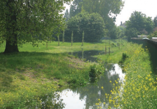
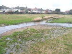
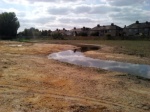
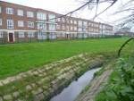
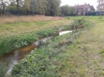
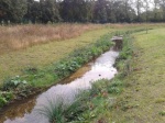
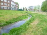
The first phase of the works has resulted in a significantly improved park in a borough which is one of the twenty most deprived in the UK. The Mayes Brook which formerly lay in a concrete channel has been brought out into the park along its 1.6 km length. The uploaded .KML file overlaid on the Google map (above) shows the course of the restored sinuous river channel in three sections (blue lines), available floodplain storage after restoration (opaque polygons) and numerous sustainable urban drainage areas (SUDs) and a backwater in the middle part of the park (green-blue polygons). These have contributed to an improvement in the wildlife and recreational value of the park. The landscaping in the middle part of the park increase flood storage by one-hectare to naturally and safely store the anticipated increase in floodwaters expected in future. In addition, separate Thames Water work to remedy misconnected drains has dramatically improved the quality of the water in the brook. New trees now cover the equivalent of three football pitches, to give shade, help cool the area and provide a home for more wildlife. New footpaths, entrance ways and signage allow the public to better use the park.
Next steps
The Mayesbrook partnership, led by Barking and Dagenham Council, have plans to implement a second phase of the project. This would include a café surrounded by a climate change garden of drought resistant plants. A display board in a new cafe will explain how all of the improvements to the park help adaptation to climate change. The display will also help people change their own lives to better cope with climate change impacts. Two polluted lakes in the park will be cleaned up, to better cool the area and to increase wildlife. One lake will have boating restored, with angling reintroduced on the other. As of March 2014, the project was still seeking funding to deliver these improvements.
Howard Davidson, Director of the Environment Agency South East, said: “Mayesbrook is already providing valuable lessons about how to plan for climate change, how to do it in partnership and how to spread the cost to make it affordable.”
Monitoring surveys and results
Multi-partner monitoring strategy
Coordinated by the River Restoration Centre and the London Borough of Barking and Dagenham, a monitoring strategy was set-up during the conception stage of the project with a range of targets across four thematic areas to assess the success of the project in a clear, scientific and transparent way. The four themes were:
• Climate change
• Natural environment (aquatic)
• Natural environment (terrestrial)
• People
The 'SMART' framework was used to set targets that were Specific, Measurable, Achievable, Relevant and Time based. These targets were agreed by the project Steering Group and were designed to incorporate the River Restoration Centre's monitoring guidance document (PRAGMO) http://therrc.co.uk/rrc_pragmo.php where appropriate. The strategy reflected monitoring activities related primarily to Phase 1 works (2011/2012) which included river restoration, habitat creation and general landscape improvements. It also included targets for the community engagement project, ‘Wild at Heart’ which was delivered in the park concurrently. The monitoring document was identified the overall aims for each theme and a list of individual targets were specified and prioritised in terms of cost, achievability and relevance. Information including what should be measured and existing data was recorded. The programme of monitoring actions for each partner was identified using a Gantt chart and this was updated throughout the monitoring programme to reflect data collected. Delivery of the strategy was overseen by the River Restoration Centre to ensure that all responsible monitoring partners collected their data in a timely and consistent manner. Data was held in one central inventory which was made accessible to all project partners.
Data collected
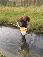
The monitoring strategy were delivered by different individuals and organisations of the Mayesbrook partnership. The 'climate change', 'people' and 'natural environment (terrestrial)' components of the strategy were led by the London Borough of Barking and Dagenham. With grant funding from Natural England (the Wild at Heart project), the Council employed a full-time ranger, between 2011 and 2013, to organise events for local people, coordinate volunteers and collect monitoring data. Data was collected to indicate the resilience of restored park features and flora to climate change. The change in area, condition and habitat suitablity of acid grassland, meadow grassland and woodland habitat was collected as well as number of birds and bats observed. From a social science perspective, the diversity and abundance of park users; an increase in outdoor learning and engagement; participation in volunteering; and public satisfaction was gathered to capture the project's impact on local communities and park visitors. The 'natural environment (aquatic)' component was delivered by the Environment Agency with Nick Elbourne, a part-time M.Sc. student at Cranfield University. Geomorphology, river habitat, water quality, macro-invertebrate, macrophyte and fixed point photography data was collected between 2011 and 2013. Some comparative baseline data was available from 2008/2009.
Results
Geomorphology and channel adjustment:
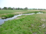
• In summer 2012/ spring 2013, the majority of restored sections showed an increase in the abundance and diversity of habitat and flow types (compared to baseline River Habitat Survey data from 2008 and 2009).
• Low rainfall and below average flows (drought-like conditions) in 2011/12 undoubtedly limited the regrowth of macrophytes (after physical works). The backwater and SUDs in the middle reach were planted up in places by volunteers.
• A scoring method was trialed to score all fixed point photos (before, during and after restoration) on the observed naturalness of habitat and vegetation within the river corridor. The majority of fixed points peaked in summer 2012 or spring 2013 after restoration (note: photos were taken on a quarterly basis between spring 2011 and spring 2013).
• There was relatively insignificant change in the topography and chainage of cross-section surveys collected bi-annually at 12 transects in the middle and lower reaches between autumn 2011 (immediately after new channel excavated) and spring 2012 (eighteen months post works). However there was evidence of an evolution of in-channel features in parts of the middle reach (see Image Gallery) and natural gravel movements in the upper reach.
Lessons learnt
Image gallery
|
Catchment and subcatchmentSelect a catchment/subcatchment
Catchment
Subcatchment
Other case studies in this subcatchment: Blake Avenue, Mayes Brook, County Gardens, Mayes Brook, Fairlop Plain and Fairlop Water, Goodmayes Park, Mayes Brook, Loxford Water, Seven Kings Water
Site
Project background
Cost for project phases
Reasons for river restoration
Measures
MonitoringHydromorphological quality elements
Biological quality elements
Physico-chemical quality elements
Any other monitoring, e.g. social, economic
Monitoring documents
Additional documents and videos
Additional links and references
Supplementary InformationEdit Supplementary Information
| ||||||||||||||||||||||||||||||||||||||||||||||||||||||||||||||||||||||||||||||||||||||||||||||||||||||||||||||||||||||||||||||||||||||||||||||||||||||||||||||||||||||||||||||||||||||||||||||||||||||||||||||||||||||||||||||||||||||||||||||||||||||||||||||||||||||||||||||||||||||||||||

