Case study:HLS New Forest: Difference between revisions
No edit summary |
No edit summary |
||
| Line 122: | Line 122: | ||
{{Monitoring documents end}} | {{Monitoring documents end}} | ||
{{Additional Documents}} | {{Additional Documents}} | ||
{{Case study documents | |||
|File name=9. Wootton photos combined.pdf | |||
}} | |||
{{Case study documents | |||
|File name=15. Press articles.pdf | |||
}} | |||
{{Additional Documents end}} | {{Additional Documents end}} | ||
{{Additional links and references header}} | {{Additional links and references header}} | ||
Revision as of 14:21, 15 February 2019
This case study is pending approval by a RiverWiki administrator.
Project overview
| Status | In progress |
|---|---|
| Project web site | |
| Themes | Habitat and biodiversity, Monitoring |
| Country | England |
| Main contact forename | Nick |
| Main contact surname | Wardlaw |
| Main contact user ID | User:nwardlaw |
| Contact organisation | Forestry Commission |
| Contact organisation web site | |
| Partner organisations | |
| This is a parent project encompassing the following projects |
Project summary
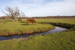
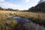
The NF HLS is a wetland restoration scheme of huge scale and ambition with a fundamental aim to improve the condition of unfavourable SSSI units affected by historic drainage.
The restoration work is perhaps unusual when compared to standard “river restorations” as the focus is on the floodplain habitat connection more than in stream habitat. The New Forest is recognised as being of outstanding importance for nature conservation in both the UK and Europe due to the size, quality and complex mosaic of habitats. The project area covers a large proportion of the New Forest SAC, SPA, SSSI and Ramsar designated land.
Over a period of approximately 150 years the mires and streams have been subjected to significant modification through drainage for varying land uses such as forestry and to enhance the potential for grazing animals. This drainage has meant that the floodplain connections are impoverished and are continuing to decline, as well as undermining the natural processes and resilience of the wetland habitats.
Due to the extensive range of drainage operations throughout the New Forest catchments, the project has delivered varying scales of restorations. At the upper end of the scale, restoration has included the re-meandering of a 3.5km stretch of straightened river on the Avon Water down to the smaller scale infilling of ~10m2 of knickpoint erosion in heathland. Approximately sixty sites have been restored since 2010.
Options for restoration on a number of the sites were drawn up based on eco-hydrological surveys and restoration plans were formed to incorporate the requirements of the unique features of the forest such as the steep stream gradients and sensitive mire ecology. The FC has led on the restoration design and implementation with input from Natural England, the Environment Agency, members of the New Forest Association, the National Park Authority and a number of consultants who have specialised in planning, ecological surveys and hydrology.
A range of restoration techniques have been used to restore the natural processes. These techniques have included: Re-meandering the watercourses into remnant meanders at the lowest point in the floodplain; re-meandering the channel within its existing planform; narrowing the channel and raising the bed level to a more natural width and depth to encourage out-of-bank flooding in high flows; infilling erosion knickpoints to prevent further headward erosion; replacing bridges with fords on forest tracks to prevent the energy being focused around the structure.
Monitoring surveys and results
In recent years there has been extensive monitoring and evaluation of wetland sites. An independent review by the River Restoration Centre and Jonathan Cox Associates was commissioned in 2015 which evaluated eight sites that had previously been restored. The findings of this review recommended an expanded monitoring programme. In 2016 we developed a Monitoring Strategy and Delivery Plan. This details what evidence should be collected at future wetland restoration sites in the NF.
Since 2014 monitoring and surveys have been undertaken including: • pre and post work fish population surveys • invertebrate surveys and fish spawning surveys • river habitat surveys and modular river physical surveys • time-lapse photography • botanical surveys • fixed point photography • Riverfly monitoring by volunteers • water level and quality monitoring.
Alongside the restoration monitoring, species surveys have been undertaken. Whilst it is important to monitor direct impacts of the work using the methods described above, the real aim of the restoration is to increase the resilience of the habitats that are unique in the New Forest long into the future. Therefore, these species surveys are an important indicator of the health of these habitats.
Lessons learnt
Monitoring
The New Forest has a long history of wetland restoration, with a number of studies completed prior to the HLS. As a result of this, and the nature of delivery focused agri-environment funding, it was felt that there was enough current evidence to deliver the restoration schemes in the forest. However, the previous evidence became more outdated as time progressed. Alongside this, there was an increased need for consultation with stakeholders due to needing planning permission for larger projects.
So in 2013 we developed an extensive and pioneering monitoring programme to aid with evidence for the future. In 2016 we appointed our first full time HLS monitoring officer whose sole focus is on gathering evidence to demonstrate the effects of this work.
Weather
Our in-channel restoration work takes place in a limited construction window to take account of Salmonid spawning restrictions from May until October and bird nesting season March through July.
Inclement weather has delayed a number of projects when work is suspended as a result of unsuitable ground conditions. Careful planning of work and use of resources has allowed us to undertake a large number of restorations simultaneously in the short window of opportunity.
Image gallery
|
Catchment and subcatchment
Site
Project background
Cost for project phases
Reasons for river restoration
Measures
MonitoringHydromorphological quality elements
Biological quality elements
Physico-chemical quality elements
Any other monitoring, e.g. social, economic
Monitoring documents
Additional documents and videos
Additional links and references
Supplementary InformationEdit Supplementary Information
| |||||||||||||||||||||||||||||||||||||||||||||||||||||||||||||||||||||||||||||||||||||||||||||||||||||||||||||||||||||||||||||||||||||||||||||||||||||||||||||||||||||||||||||||||||||||||||||||||||||||


