Case study:Norman Park Bromley.: Difference between revisions
Hazel Wilson (talk | contribs) No edit summary |
Hazel Wilson (talk | contribs) No edit summary |
||
| Line 39: | Line 39: | ||
|Subcatchment=Ravensbourne (Keston to Catford) | |Subcatchment=Ravensbourne (Keston to Catford) | ||
}} | }} | ||
{{Site}} | {{Site | ||
|WFD water body code=GB106039023260 | |||
|WFD water body name=Ravensbourne (Keston to Catford) | |||
|Heavily modified water body=No | |||
|Protected species present=No | |||
|Invasive species present=No | |||
}} | |||
{{Project background | {{Project background | ||
|Project started=2000/03/01 | |Project started=2000/03/01 | ||
Revision as of 12:59, 2 November 2015
Project overview
| Status | Complete |
|---|---|
| Project web site | |
| Themes | Flood risk management, Habitat and biodiversity, Social benefits, Urban |
| Country | England |
| Main contact forename | Dave |
| Main contact surname | Webb |
| Main contact user ID | User:Djwebb |
| Contact organisation | Environment Agency |
| Contact organisation web site | |
| Partner organisations | London Borough of Bromley |
| Parent multi-site project | |
| This is a parent project encompassing the following projects |
No |
Project summary
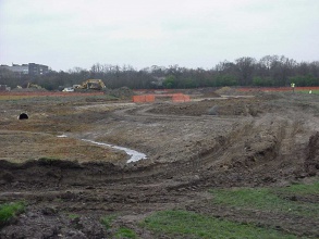
The Ravensbourne is a spring-fed stream flowing from its source near Keston, on the north slope of the North Downs, northwards through Bromley, Catford and Lewisham to join the Thames at Deptford Creek. In many areas such as Norman Park the stream is
confined within a culvert. Culverting of small watercourses in urban and parkland areas has been common in the recent past.
Burying the river was felt to reduce the flooding potential, minimise safety issues associated with open water and maximise land available for development or use as open space/playing fields. Little consideration was given to habitat loss, aesthetic and landscape appeal of rivers or the potential benefits of surface water storage. The Ravensbourne flows for 300m through a 1m
diameter concrete-lined steel culvert. Smaller land drains, which had been ditches before the area was levelled to form the park, flow into the culvert at intervals along its length. The culvert is crossed close to both its northern and southern ends by park access tracks and major services, with a gas pipeline and electric supply cables crossing the culvert at the north end and a water pipe and local electrical supply cables at the southern end. Deculverting (daylighting) the Ravensbourne would
help to restore the corridor by recreating an open channel (in replacement of the culverted section) with diverse in-channel and bankside habitats linking to Scrogginhall Woods just upstream of the park.
Monitoring surveys and results
River Corridor Survey.
Lessons learnt
The park users, particularly dog walkers, now see the open Ravensbourne as a focal point, circling the area and making use of the crossing points. Children and dogs play along the banks even though the site has still to mature.
The marginal planting is suffering disturbance from dogs and children and may take longer than expected to establish a good cover, though this may eventually produce a good diversity of edge habitats. The wildflower plugs have been decimated by crows in search of worms. About a third were removed from the ground and became desiccated.
The planting scheme was designed as a balance between creating an instance impact for the local users and allowing natural processes of colonisation to occur. Even so the local users have stated that they would have expected more immediate impact from the planting. The success of the project can be attributed to the multi-disciplinary project team and the Partnership between the Borough Council and the Environment Agency.
Image gallery
|
Catchment and subcatchmentSelect a catchment/subcatchment
Catchment
Subcatchment
Other case studies in this subcatchment: Downham Playing Fields, Fordmill weir, Ravensbourne at Queensmead
Site
Project background
Cost for project phases
Reasons for river restoration
Measures
MonitoringHydromorphological quality elements
Biological quality elements
Physico-chemical quality elements
Any other monitoring, e.g. social, economic
Monitoring documents
Additional documents and videos
Additional links and references
Supplementary InformationEdit Supplementary Information
| ||||||||||||||||||||||||||||||||||||||||||||||||||||||||||||||||||||||||||||||||||||||||||||||||||||||||||||||||||||||||||||||||||||||||||||||||||||||||||||||||||||||||||||||||||||||||||||||||||||||||

