Case study:Restoration of Wandle Park: Difference between revisions
No edit summary |
No edit summary |
||
| Line 57: | Line 57: | ||
|Invasive species present=No | |Invasive species present=No | ||
}} | }} | ||
{{Project background}} | {{Project background | ||
|Project started=2009/01/01 | |||
}} | |||
{{Motivations}} | {{Motivations}} | ||
{{Measures}} | {{Measures}} | ||
Revision as of 14:27, 16 July 2015
Project overview
| Status | Complete |
|---|---|
| Project web site | |
| Themes | Flood risk management, Habitat and biodiversity, Social benefits, Water quality |
| Country | England |
| Main contact forename | Tom |
| Main contact surname | Sweeney |
| Main contact user ID | |
| Contact organisation | Croydon Council |
| Contact organisation web site | http://www.croydon.gov.uk/ |
| Partner organisations | Royal HaskoningDHV |
| Parent multi-site project | |
| This is a parent project encompassing the following projects |
No |
Project summary
The River Wandle is located in the southeast of England. It is approximately 14km long with two sources, one at Waddon Ponds (Croydon) and the other at Carshalton Ponds (Sutton). It flowsnorth-eastthrough Croydon, Sutton, Lambeth, Merton and Wandsworth to then join the Tidal Thames.
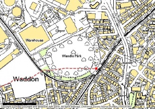
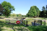
The River Wandle runs under the Wandle Park, in the London Borough of Croydon, for approximately 350mand is only evident by the presence of two man-hole access chambers located within the park’s playing fields. The parkis located at OSgrid reference TQ31681,65563 and covers anarea of 8.5 hectares.
Wandle Park is owned and managed by Croydon Council. It is surrounded byamultitude of land-use types including residential, industrial and commercial.
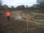
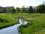
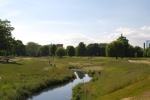
The London Borough of Croydon in partnership with the Environment Agency is developing a scheme to restore the River Wandle at Wandle Park, Croydon. The London Borough of Croydon believes that the park is presently an underused asset and wishes to restore the park to reflect is original Victorian lay out.
The main objectives of the project are as follows: Restore the river corridor through Wandle Park improving the habitat for local wildlife; Provide flood risk benefit for properties downstream to approximately 1 in 50 return period; Providethe local community with an opportunity to enjoy a high-quality environment and encourage people to care for, use, appreciate and enjoy the environment; Improve the water quality in the channel in support of the Water Framework Directive, helping to meet Good Ecological Potential (GEP) in the catchmentand; Provideflood storagethat will contribute to the London Rivers Action Plan.
Monitoring surveys and results
Lessons learnt
Image gallery
|
Catchment and subcatchmentSelect a catchment/subcatchment
Catchment
Subcatchment
Other case studies in this subcatchment: Beddington Park, Beddington Park Enhancements, Boulder Pool and Plough Lane, Durand Close, EDF Weir removal, Eel Pass over tilting weir at Ravensbury Park, Garratt Park, Hackbridge Restoration, Hackbridge weir notch, King Georges Park... further results
Site
Project background
Cost for project phases
Reasons for river restoration
Measures
MonitoringHydromorphological quality elements
Biological quality elements
Physico-chemical quality elements
Any other monitoring, e.g. social, economic
Monitoring documents
Additional documents and videos
Additional links and references
Supplementary InformationEdit Supplementary Information
| ||||||||||||||||||||||||||||||||||||||||||||||||||||||||||||||||||||||||||||||||||||||||||||||||||||||||||||||||||||||||||||||||||||||||||||||||||||||||||||||||||||||||||||||||||||||||||||||||||||||||

