Case study:Heybarnes Recreation Ground Cole Restoration: Difference between revisions
No edit summary |
No edit summary |
||
| (7 intermediate revisions by 3 users not shown) | |||
| Line 2: | Line 2: | ||
|Approval status=Approved | |Approval status=Approved | ||
}} | }} | ||
{{Location | {{Location | ||
|Location=52.46797, -1.83142 | |Location=52.46797, -1.83142 | ||
| Line 55: | Line 34: | ||
{{Toggle button}} | {{Toggle button}} | ||
{{Toggle content start}} | {{Toggle content start}} | ||
{{Case study subcatchment}} | {{Case study subcatchment | ||
|Subcatchment=R Cole from Springfield to Hatchford-Kingshurst Brook | |||
}} | |||
{{Site | |||
|Name=Heybarnes Recreation Ground | |||
|WFD water body code=GB104028042502 | |||
|WFD water body name=Cole from Springfield to Hatchford-Kingshurst Brook Water Body | |||
|Pre-project morphology=Straightened | |||
|Desired post project morphology=Low gradient passively meandering | |||
|Heavily modified water body=No | |||
|Protected species present=Yes | |||
|Invasive species present=Yes | |||
|Species=Brown trout (Salmo trutta), bullhead (Cottus gobio) | |||
|Dominant hydrology=Quick run-off | |||
|Dominant substrate=Gravel | |||
|River corridor land use=Parklands garden | |||
}} | |||
{{Project background | |||
|Reach length directly affected=970 | |||
|Works started=2024-06-24 | |||
|Works completed=2024-08-09 | |||
|Total cost category=100 - 500 k€ | |||
|Funding sources=EA WEIF, WMCA Community Green Grant, University of Birmingham | |||
}} | |||
{{Motivations | |||
|Specific mitigation=Urbanisation, Invasive species | |||
|Hydromorphological quality elements=Quantity & dynamics of flow, Substrate conditions | |||
|Biological quality elements=Fish, Invertebrates, Macrophytes | |||
|Other motivation=Landscape enhancement, Community demand | |||
}} | |||
{{Measures}} | {{Measures}} | ||
{{Hydromorphological quality elements header}} | {{Hydromorphological quality elements header}} | ||
Latest revision as of 12:27, 21 November 2024
Project overview
| Status | Complete |
|---|---|
| Project web site | |
| Themes | Flood risk management, Habitat and biodiversity, Hydromorphology, Land use management - agriculture, Water quality |
| Country | England |
| Main contact forename | Emily |
| Main contact surname | Farrell |
| Main contact user ID | |
| Contact organisation | Ebsford Environmental Ltd |
| Contact organisation web site | http://https://ebsford.co.uk/ |
| Partner organisations | Enviornment Agency, University of Birmingham |
| Parent multi-site project | |
| This is a parent project encompassing the following projects |
No |
Project summary
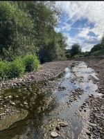
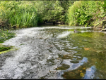
The River Cole is 34km in length, rising in northeast Worcestershire then flowing in a north easterly direction through Birmingham before joining the River Blythe in North Warwickshire. During the late Victorian era a section of the river in east Birmingham was diverted into a gun-barrel straight, engineered millstream and the original river was lost. During the summer of 2024 we undertook a project to transform a 1km section of this featureless millstream to allow it to behave more like a naturally functioning river. By re-profiling the banks and introducing a range of features including mid-channel bars, inset berms, large woody material and gravels we have kick started natural process. By making space for the river the forces of erosion and deposition, previously shackled, have now been freed. These introduced features will transform the uniform flow of this subreach with the development of pool-riffle sequences and flow variability. With time this engineered Victorian millstream will begin to resemble the original sinuous river that it replaced over 100 years ago.
Monitoring surveys and results
Baseline MoRPh10 survey undertaken in June 2022. Data available on Cartographer website
Post-project MoRPh10 survey to be undertaken in summer 2025
Lessons learnt
Image gallery
|
Catchment and subcatchmentSelect a catchment/subcatchment
Catchment
Subcatchment
Other case studies in this subcatchment: Babbs Mill reed bed
Site
Project background
Cost for project phases
Reasons for river restoration
Measures
MonitoringHydromorphological quality elements
Biological quality elements
Physico-chemical quality elements
Any other monitoring, e.g. social, economic
Monitoring documents
Additional documents and videos
Additional links and references
Supplementary InformationEdit Supplementary Information
| ||||||||||||||||||||||||||||||||||||||||||||||||||||||||||||||||||||||||||||||||||||||||||||||||||||||||||||||||||||||||||||||||||||||||||||||||||||||||||||||||||||||||||||||||||||||||||||||


