Case study:Source to Sea Programme: Difference between revisions
No edit summary |
No edit summary |
||
| (3 intermediate revisions by the same user not shown) | |||
| Line 1: | Line 1: | ||
{{Project overview | {{Project overview | ||
|Status=In progress | |Status=In progress | ||
|Project web site url=www.rspb.org.uk/ourwork/projects/details/324123-source-to-sea | |Project web site url=www.rspb.org.uk/ourwork/projects/details/324123-source-to-sea | ||
|Themes=Economic aspects, Habitat and biodiversity, Land use management - agriculture, Social benefits, Water quality | |Themes=Economic aspects, Estuary, Habitat and biodiversity, Land use management - agriculture, Peat, Social benefits, Water quality | ||
|Country=England | |Country=England | ||
|Main contact forename=Richard | |Main contact forename=Richard | ||
| Line 15: | Line 8: | ||
|Main contact id=S2S-PO | |Main contact id=S2S-PO | ||
|Contact organisation=RSPB | |Contact organisation=RSPB | ||
|Contact organisation url= | |Contact organisation url=www.rspb.org.uk/ | ||
|Partner organisations=Cumbria Wildlife Trust, Cumbria Woodlands, Lune Rivers Trust, Morecambe Bay Partnership, | |Partner organisations=Arnside & Silverdale AONB Partnership, Cumbria Wildlife Trust, Cumbria Woodlands, Lune Rivers Trust, Morecambe Bay Partnership, RSPB, South Cumbria Rivers Trust | ||
|Multi-site=Yes | |Multi-site=Yes | ||
|Project picture=Lune and Howgills (from Nettlepott on B6257).jpg | |Project picture=Lune and Howgills (from Nettlepott on B6257).jpg | ||
|Picture description=River Lune - Source to Sea area | |Picture description=River Lune - Source to Sea area | ||
|Project summary=Morecambe Bay and its river catchments should be considered as one interacting entity. Therefore, the Source to Sea Programme is a pan-Morecambe Bay Catchment Restoration Fund initiative that encompasses restoration projects for a range of waterbodies, protected sites, and associated priority habitats and species. | |Project summary=Morecambe Bay and its river catchments should be considered as one interacting entity. Therefore, the Source to Sea Programme is a pan-Morecambe Bay Catchment Restoration Fund initiative that encompasses restoration projects for a range of waterbodies, protected sites, and associated priority habitats and species. | ||
Community Involvement - Engagement activities will include public consultations, practical volunteering activities like beach cleans, and tree planting, and awareness-raising through media and face-to-face contact. | The project will restore the natural connections along watercourses (removing barriers) and between water-courses and their floodplains and headwaters (restoring habitats). The project works in partnership with landowners and managers to bring about land management change to benefit water quality and raises awareness amongst Morecambe Bay coastal communities. Diffuse pollution, a lack of riparian habitat, unnatural flow regimes attributable to upland drainage and obstructions to fish passage are causing certain watercourses in the project area to fail to meet the required standards under the Water Framework Directive (WFD). Fish populations, particularly salmonids, have been found to be greatly diminished. To ensure that the failing waterbodies achieve Good Ecological Status under the WFD, the project aims to improve the habitat and connectivity in order to generate sustainable fish populations. The creation of wetland habitats and riparian buffer zones will reduce diffuse pollution from farmland and roads, and some upland drainage grips are to be blocked to encourage a sustainable return to natural flow regimes. | ||
|Monitoring surveys and results=Community Involvement - Engagement activities will include public consultations, practical volunteering activities like beach cleans, and tree planting, and awareness-raising through media and face-to-face contact. | |||
}} | }} | ||
{{Case study status | |||
|Approval status=Approved | |||
}} | |||
{{Location | |||
|Location=54.027196465482, -2.8039813041687 | |||
|Kml file=C2C catchmentb.kml | |||
}} | |||
{{Image gallery}} | {{Image gallery}} | ||
{{Case study image | {{Case study image | ||
| Line 82: | Line 80: | ||
{{Site | {{Site | ||
|WFD water body code=GB 31 229 647, GB 53 120 721 2100, GB 11 207 206 5840, GB 11 207 206 5880, GB 11 207 307 1260, GB 11 207 307 1220, GB 11 207 307 1300, GB 11 207 307 1050, GB 11 207 307 1240, GB 11 207 306 4450, GB 11 207 206 5860, GB 11 207 206 5850, GB 11 207 206 5990, GB 11 207 307 1430, GB 11 207 307 4640, GB 11 207 307 1370, GB 11 207 307 1430, GB 11 207 207 1770, GB 11 207 206 6020, GB 11 207 207 1700, GB 11 207 306 4430, GB 11 207 307 1420, GB 11 207 307 1350, GB 11 207 307 1290, GB 11 207 307 1030, GB 11 207 207 1710 | |WFD water body code=GB 31 229 647, GB 53 120 721 2100, GB 11 207 206 5840, GB 11 207 206 5880, GB 11 207 307 1260, GB 11 207 307 1220, GB 11 207 307 1300, GB 11 207 307 1050, GB 11 207 307 1240, GB 11 207 306 4450, GB 11 207 206 5860, GB 11 207 206 5850, GB 11 207 206 5990, GB 11 207 307 1430, GB 11 207 307 4640, GB 11 207 307 1370, GB 11 207 307 1430, GB 11 207 207 1770, GB 11 207 206 6020, GB 11 207 207 1700, GB 11 207 306 4430, GB 11 207 307 1420, GB 11 207 307 1350, GB 11 207 307 1290, GB 11 207 307 1030, GB 11 207 207 1710 | ||
|WFD (national) typology=Estuarine, freshwater | |||
|Heavily modified water body=No | |Heavily modified water body=No | ||
|Protected species present=No | |Protected species present=No | ||
Latest revision as of 12:29, 19 September 2024
Project overview
Project summary
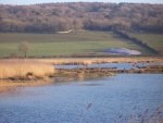
Morecambe Bay and its river catchments should be considered as one interacting entity. Therefore, the Source to Sea Programme is a pan-Morecambe Bay Catchment Restoration Fund initiative that encompasses restoration projects for a range of waterbodies, protected sites, and associated priority habitats and species.
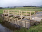
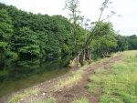
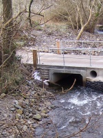
The project will restore the natural connections along watercourses (removing barriers) and between water-courses and their floodplains and headwaters (restoring habitats). The project works in partnership with landowners and managers to bring about land management change to benefit water quality and raises awareness amongst Morecambe Bay coastal communities. Diffuse pollution, a lack of riparian habitat, unnatural flow regimes attributable to upland drainage and obstructions to fish passage are causing certain watercourses in the project area to fail to meet the required standards under the Water Framework Directive (WFD). Fish populations, particularly salmonids, have been found to be greatly diminished. To ensure that the failing waterbodies achieve Good Ecological Status under the WFD, the project aims to improve the habitat and connectivity in order to generate sustainable fish populations. The creation of wetland habitats and riparian buffer zones will reduce diffuse pollution from farmland and roads, and some upland drainage grips are to be blocked to encourage a sustainable return to natural flow regimes.
Monitoring surveys and results
Community Involvement - Engagement activities will include public consultations, practical volunteering activities like beach cleans, and tree planting, and awareness-raising through media and face-to-face contact.
Lessons learnt
Image gallery
|
Catchment and subcatchmentSelect a catchment/subcatchment
Catchment
Subcatchment
Other case studies in this subcatchment: Source to Sea Programme – 9. Kent, Leven and Duddon Estuaries beach cleans and volunteer ambassadors
Site
Project background
Cost for project phases
Reasons for river restoration
Measures
MonitoringHydromorphological quality elements
Biological quality elements
Physico-chemical quality elements
Any other monitoring, e.g. social, economic
Monitoring documents
Additional documents and videos
Additional links and references
Supplementary InformationEdit Supplementary Information
| ||||||||||||||||||||||||||||||||||||||||||||||||||||||||||||||||||||||||||||||||||||||||||||||||||||||||||||||||||||||||||||||||||||||||||||||||||||||||||||||||||||||||||||||||||||||||||||||


