Case study:Bowston Weir Removal: Difference between revisions
(Created page with "{{Case study status |Approval status=Draft }} {{Location |Location=54.364365107071194, -2.775409655440164 }} {{Project overview |Project title=Bowston Weir Removal |Status=Com...") |
No edit summary |
||
| (24 intermediate revisions by one other user not shown) | |||
| Line 1: | Line 1: | ||
{{Case study status | {{Case study status | ||
|Approval status= | |Approval status=Approved | ||
}} | }} | ||
{{Location | {{Location | ||
| Line 6: | Line 6: | ||
}} | }} | ||
{{Project overview | {{Project overview | ||
|Status=Complete | |Status=Complete | ||
|Project web site url=scrt.co.uk/what-we-do/current-projects/bowston/ | |||
|Themes=Flood risk management, Habitat and biodiversity, Hydromorphology, Social benefits | |Themes=Flood risk management, Habitat and biodiversity, Hydromorphology, Social benefits | ||
|Country=England | |Country=England | ||
| Line 15: | Line 15: | ||
|Contact organisation=South Cumbria Rivers Trust | |Contact organisation=South Cumbria Rivers Trust | ||
|Contact organisation url=scrt.co.uk | |Contact organisation url=scrt.co.uk | ||
|Name of parent multi-site project=Case_study:Cumbria River Restoration Strategy | |||
|Multi-site=No | |Multi-site=No | ||
| | |Project picture=20220630 115303.jpg | ||
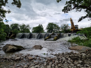
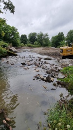
|Picture description=Bowston weir removal | |||
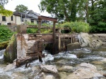
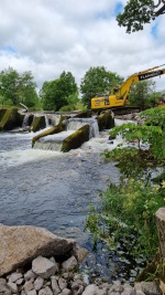
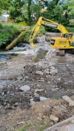
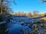
|Project summary=Bowston weir is the first weir to be removed on the River Kent Site of Special Scientific Interest and Special Area of Conservation (SSSI/SAC). Bowston weir removal forms part of the Cumbria River Restoration Strategy (CRRS) which aims to restore the three Cumbrian SSSI/SAC rivers to their natural form and function and help them achieve Favourable Condition. Additional benefits include improved migration, biodiversity net gain, improved navigation and a reduced flood risk to local residents. | |||
|Monitoring surveys and results=1. Baseline data includes fish surveys and other ecological parameters, topographical and bathymetrical surveys, drone surveys and walk over fluvial audits. | |||
2. Post-removal data collection continued immediately after the weir removal to track the immediate change in river processes and hydrological conditions. | |||
3. Continued collection and analysis following geomorphologically effective flow events has provided valuable monitoring data to identify positive changes in the river dynamics, improved sediment flux through the system, enhancement to the now varied ecosystem. | |||
|Lessons learn=SCRT created a Local Community Engagement Plan with local representatives which explained how, what and when we would communicate with local stakeholders and the public. This was extremely effective in setting out our engagement responsibilities and ensured a standardised approached to our communications. | |||
|Project title=Bowston Weir Removal | |||
}} | }} | ||
{{Image gallery}} | {{Image gallery}} | ||
{{Case study image | |||
|File name=Bowston pic.png | |||
|Caption=Picture by cbec | |||
}} | |||
{{Case study image | |||
|File name=20220704 123811.jpg | |||
}} | |||
{{Case study image | |||
|File name=20220706-WA0009.jpg | |||
}} | |||
{{Case study image | |||
|File name=Half removal.jpg | |||
}} | |||
{{Case study image | |||
|File name=20220707-WA0000.jpg | |||
}} | |||
{{Case study image | |||
|File name=20220712-WA0001.jpg | |||
}} | |||
{{Case study image | |||
|File name=20221215 140306.jpg | |||
}} | |||
{{Case study image | |||
|File name=Post flood (1).mp4 | |||
}} | |||
{{Image gallery end}} | {{Image gallery end}} | ||
{{Toggle button}} | {{Toggle button}} | ||
{{Toggle content start}} | {{Toggle content start}} | ||
{{Case study subcatchment}} | {{Case study subcatchment | ||
{{Site}} | |Subcatchment=River Kent | ||
{{Project background}} | }} | ||
{{Motivations}} | {{Site | ||
{{Measures}} | |Name=Bowston weir | ||
|WFD water body code=GB531207312000 | |||
|WFD (national) typology=Estuarine | |||
|WFD water body name=River Kent | |||
|Heavily modified water body=Yes | |||
|Site designation=EU - Special Area of Conservation | |||
|Local site designation=SSSI (Site of Special Scientific Interest), | |||
|Protected species present=Yes | |||
|Invasive species present=No | |||
|Species=white-clawed crayfish (Austropotamobius pallipes), Freshwater pearl mussel (Margaritifera margaritifera), bullhead (Cottus gobio), water crowfoot (Ranunculus aquatilis), water-milfoil (Myriophyllum alterniflorum), reed canary-grass (Phalaris arundinacea) | |||
}} | |||
{{Project background | |||
|Reach length directly affected=1000 | |||
|Project started=2016/06/16 | |||
|Works started=2022/06/20 | |||
|Works completed=2022/07/19 | |||
|Project completed=2020/09/30 | |||
|Total cost category=1000 - 5000 k€ | |||
|Funding sources=Cumbria River Restoration/European Regional Development Fund | |||
|Investigation and design cost category=5000 - 10000 k€ | |||
|Stakeholder1 engagement cost category=1000 - 5000 k€ | |||
|Works1 and supervision cost category=more than 10000 k€ | |||
|Post-project1 management and maintenance cost category=more than 10000 k€ | |||
|Monitoring1 cost category=5000 - 10000 k€ | |||
}} | |||
{{Motivations | |||
|Specific mitigation=Barriers to fish migration, Flood risk management, Navigation | |||
|Hydromorphological quality elements=Continuity of sediment transport, Continuity for organisms, Freshwater flow regime, Channel pattern/planform, Quantity & dynamics of flow, | |||
|Biological quality elements=Fish, Invertebrates: Diversity, | |||
}} | |||
{{Measures | |||
|Bank and bed modifications measure=removal of dams, Rock ramp construction, | |||
|Planform / Channel pattern=Channel naturalisation, | |||
|Social measures=Engagement with a wide range of stakeholders, | |||
}} | |||
{{Hydromorphological quality elements header}} | {{Hydromorphological quality elements header}} | ||
{{Hydromorphological quality element table row | |||
|Element=Channel pattern/planform | |||
|Monitored before=Yes | |||
|Monitored after=Yes | |||
|Qualitative monitoring=Yes | |||
|Quantitative monitoring=Yes | |||
|Control site used=No | |||
|Result=Improvement | |||
}} | |||
{{Hydromorphological quality element table row | |||
|Element=Continuity of sediment transport | |||
|Monitored before=Yes | |||
|Monitored after=Yes | |||
|Qualitative monitoring=Yes | |||
|Quantitative monitoring=Yes | |||
|Control site used=No | |||
|Result=Improvement | |||
}} | |||
{{Hydromorphological quality element table row | |||
|Element=Quantity & dynamics of flow | |||
|Monitored before=Yes | |||
|Monitored after=Yes | |||
|Qualitative monitoring=Yes | |||
|Quantitative monitoring=Yes | |||
|Control site used=No | |||
|Result=Improvement | |||
}} | |||
{{Hydromorphological quality element table row | |||
|Element=Continuity for organisms | |||
|Monitored before=No | |||
|Monitored after=Yes | |||
|Qualitative monitoring=No | |||
|Quantitative monitoring=Yes | |||
|Control site used=No | |||
|Result=Awaiting results | |||
}} | |||
{{End table}} | {{End table}} | ||
{{Biological quality elements header}} | {{Biological quality elements header}} | ||
{{Biological quality element table row | |||
|Monitored before=No | |||
|Monitored after=No | |||
|Qualitative monitoring=No | |||
|Quantitative monitoring=No | |||
|Control site used=No | |||
}} | |||
{{End table}} | {{End table}} | ||
{{Physico-chemical quality elements header}} | {{Physico-chemical quality elements header}} | ||
{{End table}} | {{End table}} | ||
{{Other responses header}} | {{Other responses header}} | ||
{{Other response table row | |||
|Element=Flood risk management | |||
|Monitored before=Yes | |||
|Monitored after=Yes | |||
|Qualitative monitoring=Yes | |||
|Quantitative monitoring=Yes | |||
|Control site used=No | |||
|Result=Improvement | |||
}} | |||
{{Other response table row | |||
|Element=Bat Survey | |||
|Monitored before=Yes | |||
|Monitored after=No | |||
|Qualitative monitoring=No | |||
|Quantitative monitoring=No | |||
|Control site used=No | |||
|Result=Awaiting results | |||
}} | |||
{{Other response table row | |||
|Element=Bathymetric Survey | |||
|Monitored before=Yes | |||
|Monitored after=Yes | |||
|Qualitative monitoring=Yes | |||
|Quantitative monitoring=Yes | |||
|Control site used=No | |||
|Result=Improvement | |||
}} | |||
{{Other response table row | |||
|Element=general assessment of habitat quality and diversity (repeat photography) | |||
|Monitored before=Yes | |||
|Monitored after=No | |||
|Qualitative monitoring=No | |||
|Quantitative monitoring=No | |||
|Control site used=No | |||
|Result=Awaiting results | |||
}} | |||
{{End table}} | {{End table}} | ||
{{Monitoring documents}} | {{Monitoring documents}} | ||
Latest revision as of 10:29, 6 July 2023
Project overview
| Status | Complete |
|---|---|
| Project web site | http://scrt.co.uk/what-we-do/current-projects/bowston/ |
| Themes | Flood risk management, Habitat and biodiversity, Hydromorphology, Social benefits |
| Country | England |
| Main contact forename | Peter |
| Main contact surname | Evoy |
| Main contact user ID | User:South Cumbria Rivers Trust |
| Contact organisation | South Cumbria Rivers Trust |
| Contact organisation web site | http://scrt.co.uk |
| Partner organisations | |
| Parent multi-site project | |
| This is a parent project encompassing the following projects |
No |
Project summary
Bowston weir is the first weir to be removed on the River Kent Site of Special Scientific Interest and Special Area of Conservation (SSSI/SAC). Bowston weir removal forms part of the Cumbria River Restoration Strategy (CRRS) which aims to restore the three Cumbrian SSSI/SAC rivers to their natural form and function and help them achieve Favourable Condition. Additional benefits include improved migration, biodiversity net gain, improved navigation and a reduced flood risk to local residents.
Monitoring surveys and results
1. Baseline data includes fish surveys and other ecological parameters, topographical and bathymetrical surveys, drone surveys and walk over fluvial audits.
2. Post-removal data collection continued immediately after the weir removal to track the immediate change in river processes and hydrological conditions.
3. Continued collection and analysis following geomorphologically effective flow events has provided valuable monitoring data to identify positive changes in the river dynamics, improved sediment flux through the system, enhancement to the now varied ecosystem.
Lessons learnt
SCRT created a Local Community Engagement Plan with local representatives which explained how, what and when we would communicate with local stakeholders and the public. This was extremely effective in setting out our engagement responsibilities and ensured a standardised approached to our communications.
Image gallery
|
Catchment and subcatchmentSelect a catchment/subcatchment
Catchment
Subcatchment
Other case studies in this subcatchment: Lake District Foundation - Building future environmental investment
Site
Project background
Cost for project phases
Reasons for river restoration
Measures
MonitoringHydromorphological quality elements
Biological quality elements
Physico-chemical quality elements
Any other monitoring, e.g. social, economic
Monitoring documents
Additional documents and videos
Additional links and references
Supplementary InformationEdit Supplementary Information
| |||||||||||||||||||||||||||||||||||||||||||||||||||||||||||||||||||||||||||||||||||||||||||||||||||||||||||||||||||||||||||||||||||||||||||||||||||||||||||||||||||||||||||||||||||||||||||||||||||||||||||||||||||||||||||||||||||||||||||||||||||||||||||||

