Case study:Broadwater Brook: Difference between revisions
(Created page with "{{Case study status |Approval status=Draft }} {{Location |Location=50.82556231600717, -0.3510360890591824 }} {{Project overview |Project title=Broadwater Brook |Status=Complet...") |
m (Ascarr moved page Case study:Broadwater Brook 2 to Case study:Broadwater Brook) |
||
| (20 intermediate revisions by 2 users not shown) | |||
| Line 1: | Line 1: | ||
{{Case study status | {{Case study status | ||
|Approval status= | |Approval status=Approved | ||
}} | }} | ||
{{Location | {{Location | ||
| Line 6: | Line 6: | ||
}} | }} | ||
{{Project overview | {{Project overview | ||
|Status=Complete | |Status=Complete | ||
|Themes=Habitat and biodiversity, Land use management - agriculture, Social benefits, Water quality, Urban | |Themes=Habitat and biodiversity, Land use management - agriculture, Social benefits, Water quality, Urban | ||
| Line 15: | Line 14: | ||
|Contact organisation=Ouse & Adur Rivers Trust | |Contact organisation=Ouse & Adur Rivers Trust | ||
|Contact organisation url=www.oart.org.uk | |Contact organisation url=www.oart.org.uk | ||
|Partner organisations=Sompting Estate Trust, Environment Agency SSD, Heritage Lottery Fund, | |||
|Multi-site=No | |Multi-site=No | ||
|Project picture=New River Channel1.jpg | |||
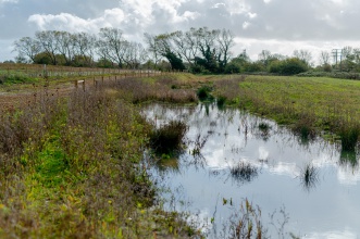
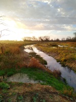
|Picture description=New River Channel | |||
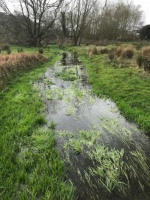
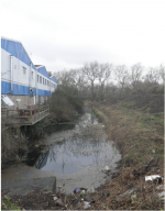
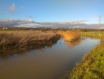
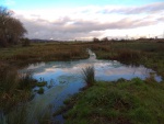
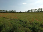
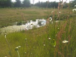
|Project summary=This urban chalk stream project has realigned the course of the Broadwater Brook, removing it from underground pipes and setting a new route through agricultural fields. Previously degraded from pollution entering from industrial areas and the main road network we have installed sediment traps at the upstream extent and have ensured vegetation establishment in the channel to further filter pollutants. Allowing for low flows (as a ephemeral stream) the stream is narrow with marginal shelves to provide wetland habitat whilst being flooded during heavy rainfall. The surrounding land has been transformed from arable maize fields into 6.9ha of wildflower meadow with 2.2km of new hedgerow and 500 trees forming a shaw woodland. Additional habitat in the form of three ponds, a re-wilding zone and scrapes have been formed along the riparian zone. The project tackled land contamination from neighbouring landfill along with accumulations of arsenic from previous land use. A mains sewer was realigned and mitigation for a chemical effluent pipe and mains power cable were also needed to complete the project which also had to content with a 1:3000 gradient and artificially raised ground through the centre of the site. | |||
The project has been co-designed and delivered with the local community with numerous activities and events inspiring and raising awareness of chalk streams and the impact of urban living which has inspired behavioural change. Over 1000 members of the local community have been involved in the project whether through volunteering on practical tasks, attending educational events or being involved in one of the citizen science monitoring programmes. The site is now open to the public for the first time along a newly created Sompting Brooks River Trail which includes interpretation and artworks depicting the areas historical association with water. | |||
|Monitoring surveys and results=We have been monitoring the effectiveness of silt traps within the system along with taking water sample for chemical analysis. In addition we have undertaken BMWP sampling for freshwater invertebrates as well as ecological surveys for reptiles and amphibians, fish, birds, dragonflies, bats, harvest mice and macrophytes. All of these were also undertaken for 2 years before the project started to generate a baseline status for the site. Results show that, across all parameters, water quality is significantly improved and that the sediment traps are working in all but the most extreme flow conditions. Species diversity across the site has grown from a recorded 100 species in 2017/18 to 535 species in 2021. Five fish species have been recorded within the new channel (from none within the old channel). The site has also recorded the first Scarce Blue Tailed Damselfly in Sussex for 125 years, one of 18 species of Odonata now recorded on the Brooks. Water quality sampling has revealed significant amounts of nitrate being released from the aquifer over winter which has highlighted a need for further investigation of land management practices to the north of the project area. | |||
We have also been monitoring impacts on the local community and results show a better appreciation and understanding of the water environment, that co-design and delivery has ensured guardianship of the site into the future and that providing outdoor opportunities in heavily urbanised areas is of great value to wellbeing and community cohesion. All results of the project will be available on the website from January 2022 - www.oart.org.uk/epic | |||
|Lessons learn=*We used local contractors to provide ECI assistance during the development of designs, this resulted in large costs increases (even from the ECI) at tender and we would ensure that more consideration is given to the right contractor providing this advice from the beginning of the project. | |||
*Relied on existing relationships and partnerships to provide solutions to constraints on site which meant no legal framework was in place for agreed actions and organizations changed their approach to elements of the project at the last minute. In future we would ensure that legal agreements are in place around service mitigation prior to appointing a contractor. | |||
*We did not appreciate or appropriately consider the ground contamination constraints at an early enough stage. A lack of prior experience of these issues and relying on previous reports led to misunderstanding the costs and constraints this would cause. For future projects we would ensure, where potential land contamination is present, that early involvement of experts is obtained, and budgets reflect possible additional costs. | |||
*We have also learnt that, through perseverance, projects which many believe to be unachievable due to costs and constraints can be delivered in a manner which is cost beneficial and provide multiple benefits to people and wildlife. | |||
|Project title=Broadwater Brook | |||
}} | }} | ||
{{Image gallery}} | {{Image gallery}} | ||
{{Case study image | |||
|File name=Upstream of Industrial Estate.jpg | |||
}} | |||
{{Case study image | |||
|File name=Downstream Industrial Estate.png | |||
}} | |||
{{Case study image | |||
|File name=Downstream.jpg | |||
}} | |||
{{Case study image | |||
|File name=Silt traps.jpg | |||
}} | |||
{{Case study image | |||
|File name=Wildflower Meadow.jpg | |||
}} | |||
{{Case study image | |||
|File name=River Banks.jpg | |||
}} | |||
{{Case study image | |||
|File name=009.jpeg | |||
}} | |||
{{Image gallery end}} | {{Image gallery end}} | ||
{{Toggle button}} | {{Toggle button}} | ||
{{Toggle content start}} | {{Toggle content start}} | ||
{{Case study subcatchment}} | {{Case study subcatchment | ||
{{Site}} | |Subcatchment=Teville Stream | ||
{{Project background}} | }} | ||
{{Motivations}} | {{Site | ||
{{Measures}} | |Name=Broadwater Brooks | ||
|WFD water body code=GB107041011940 | |||
|WFD water body name=Teville Stream | |||
|Heavily modified water body=Yes | |||
|Protected species present=Yes | |||
|Invasive species present=Yes | |||
|Dominant substrate=Clay, Sand, | |||
|River corridor land use=Intensive agriculture (arable), | |||
|Avrg bankfull channel width=5.0 | |||
|Avrg1 bankfull channel depth=0.4 | |||
|Average channel gradient category=Less than 0.001 | |||
}} | |||
{{Project background | |||
|Reach length directly affected=1000 | |||
|Project started=01/01/2017 | |||
|Works started=2019/06/10 | |||
|Works completed=2019/08/16 | |||
|Project completed=2021/12/31 | |||
|Total cost category=100 - 500 k€ | |||
|Funding sources=National Lottery Heritage Fund, Environment Agency, Rampion Offshore Wind Ltd, | |||
|Investigation and design cost category=10 - 50 k€ | |||
|Investigation and design Lead organisation=Ouse & Adur Rivers Trust | |||
|Investigation and design Other contact forename=Peter | |||
|Investigation and design Other contact surname=King | |||
|Stakeholder1 engagement cost category=1 - 10 k€ | |||
|Stakeholder engagement Lead organisation=Ouse & Adur Rivers Trust | |||
|Stakeholder engagement Other contact forename=Peter | |||
|Stakeholder engagement Other contact surname=King | |||
|Works1 and supervision cost category=100 - 500 k€ | |||
|Works and supervision Lead organisation=Ouse & Adur Rivers Trust | |||
|Works and supervision Other contact forename=Peter | |||
|Works and supervision Other contact surname=King | |||
|Post-project1 management and maintenance cost category=10 - 50 k€ | |||
|Post-project management and maintenance Lead organisation=Ouse & Adur Rivers Trust | |||
|Post-project management and maintenance Other contact forename=Peter | |||
|Post-project management and maintenance Other contact surname=King | |||
|Monitoring1 cost category=10 - 50 k€ | |||
|Monitoring Lead organisation=Ouse & Adur Rivers Trust | |||
|Monitoring Other contact forename=Peter | |||
|Monitoring Other contact surname=King | |||
}} | |||
{{Motivations | |||
|Hydromorphological quality elements=Continuity of sediment transport, | |||
|Biological quality elements=Fish, Invertebrates, | |||
|Physico-chemical quality elements=Nutrient concentrations, Oxygen balance, | |||
|Other motivation=Recreation, | |||
}} | |||
{{Measures | |||
|Bank and bed modifications measure=Channel realignment, | |||
|Floodplain / River corridor=Channel realignment, Conservation measures and environmental improvement, Creation of multi stage channel, Habitat creation, | |||
|Planform / Channel pattern=Channel realignment, Creation of new channel, Habitat creation, Habitat restoration, Improvement of channel morphology, | |||
|Management interventions=Agricultural business changed its way of working, Arable reversion to wildflower meadow, Clean-up days, Diffuse pollution mitigation, Easier management, Ensuring biodiversity, Monitoring strategy, | |||
|Social measures=Active involvement of local interests groups and land owners, Agreement with the owners, Awareness raising, Awareness raising by a sign, Citizen participation in the restoration project, Community Education, Community Events, Community Litter-picking work, Community based management, Community consultation, Community education (talks and workshops, Community involvement, Creation of a path alongside the river, Decreased flood risk, Engagement with a wide range of stakeholders, Engagement with schools, Improved public access, Information panels for people, | |||
}} | |||
{{Hydromorphological quality elements header}} | {{Hydromorphological quality elements header}} | ||
{{Hydromorphological quality element table row | |||
|Element=Continuity of sediment transport | |||
|Monitored before=Yes | |||
|Monitored after=Yes | |||
|Qualitative monitoring=No | |||
|Quantitative monitoring=Yes | |||
|Control site used=No | |||
|Result=Improvement | |||
}} | |||
{{End table}} | {{End table}} | ||
{{Biological quality elements header}} | {{Biological quality elements header}} | ||
{{Biological quality element table row | |||
|Element=Fish: Species composition | |||
|Monitored before=Yes | |||
|Monitored after=Yes | |||
|Qualitative monitoring=No | |||
|Quantitative monitoring=Yes | |||
|Control site used=No | |||
|Result=Improvement | |||
}} | |||
{{Biological quality element table row | |||
|Element=Invertebrates: Taxonomic composition | |||
|Monitored before=Yes | |||
|Monitored after=Yes | |||
|Qualitative monitoring=No | |||
|Quantitative monitoring=Yes | |||
|Control site used=Yes | |||
|Result=Improvement | |||
}} | |||
{{End table}} | {{End table}} | ||
{{Physico-chemical quality elements header}} | {{Physico-chemical quality elements header}} | ||
{{Physico-chemical quality element table row | |||
|Element=Nutrient concentrations | |||
|Monitored before=Yes | |||
|Monitored after=Yes | |||
|Qualitative monitoring=No | |||
|Quantitative monitoring=Yes | |||
|Control site used=Yes | |||
|Result=Improvement | |||
}} | |||
{{Physico-chemical quality element table row | |||
|Element=Oxygen balance | |||
|Monitored before=Yes | |||
|Monitored after=Yes | |||
|Qualitative monitoring=No | |||
|Quantitative monitoring=Yes | |||
|Control site used=Yes | |||
|Result=Improvement | |||
}} | |||
{{End table}} | {{End table}} | ||
{{Other responses header}} | {{Other responses header}} | ||
{{Other response table row | |||
|Element=Bat Survey | |||
|Monitored before=Yes | |||
|Monitored after=Yes | |||
|Qualitative monitoring=No | |||
|Quantitative monitoring=Yes | |||
|Control site used=No | |||
|Result=Improvement | |||
}} | |||
{{Other response table row | |||
|Element=Birds | |||
|Monitored before=Yes | |||
|Monitored after=Yes | |||
|Qualitative monitoring=No | |||
|Quantitative monitoring=Yes | |||
|Control site used=No | |||
|Result=Improvement | |||
}} | |||
{{Other response table row | |||
|Element=Concentration phosphate, Chloride and Nitrogen | |||
|Monitored before=Yes | |||
|Monitored after=Yes | |||
|Qualitative monitoring=No | |||
|Quantitative monitoring=Yes | |||
|Control site used=Yes | |||
|Result=Improvement | |||
}} | |||
{{Other response table row | |||
|Element=Macroinvertebrates (IBMWP) | |||
|Monitored before=Yes | |||
|Monitored after=Yes | |||
|Qualitative monitoring=No | |||
|Quantitative monitoring=Yes | |||
|Control site used=Yes | |||
|Result=Improvement | |||
}} | |||
{{End table}} | {{End table}} | ||
{{Monitoring documents}} | {{Monitoring documents}} | ||
Latest revision as of 15:35, 24 August 2021
Project overview
| Status | Complete |
|---|---|
| Project web site | |
| Themes | Habitat and biodiversity, Land use management - agriculture, Social benefits, Water quality, Urban |
| Country | England |
| Main contact forename | Peter |
| Main contact surname | King |
| Main contact user ID | User:Oartpk |
| Contact organisation | Ouse & Adur Rivers Trust |
| Contact organisation web site | http://www.oart.org.uk |
| Partner organisations | Sompting Estate Trust, Environment Agency SSD, Heritage Lottery Fund |
| Parent multi-site project | |
| This is a parent project encompassing the following projects |
No |
Project summary
This urban chalk stream project has realigned the course of the Broadwater Brook, removing it from underground pipes and setting a new route through agricultural fields. Previously degraded from pollution entering from industrial areas and the main road network we have installed sediment traps at the upstream extent and have ensured vegetation establishment in the channel to further filter pollutants. Allowing for low flows (as a ephemeral stream) the stream is narrow with marginal shelves to provide wetland habitat whilst being flooded during heavy rainfall. The surrounding land has been transformed from arable maize fields into 6.9ha of wildflower meadow with 2.2km of new hedgerow and 500 trees forming a shaw woodland. Additional habitat in the form of three ponds, a re-wilding zone and scrapes have been formed along the riparian zone. The project tackled land contamination from neighbouring landfill along with accumulations of arsenic from previous land use. A mains sewer was realigned and mitigation for a chemical effluent pipe and mains power cable were also needed to complete the project which also had to content with a 1:3000 gradient and artificially raised ground through the centre of the site.
The project has been co-designed and delivered with the local community with numerous activities and events inspiring and raising awareness of chalk streams and the impact of urban living which has inspired behavioural change. Over 1000 members of the local community have been involved in the project whether through volunteering on practical tasks, attending educational events or being involved in one of the citizen science monitoring programmes. The site is now open to the public for the first time along a newly created Sompting Brooks River Trail which includes interpretation and artworks depicting the areas historical association with water.
Monitoring surveys and results
We have been monitoring the effectiveness of silt traps within the system along with taking water sample for chemical analysis. In addition we have undertaken BMWP sampling for freshwater invertebrates as well as ecological surveys for reptiles and amphibians, fish, birds, dragonflies, bats, harvest mice and macrophytes. All of these were also undertaken for 2 years before the project started to generate a baseline status for the site. Results show that, across all parameters, water quality is significantly improved and that the sediment traps are working in all but the most extreme flow conditions. Species diversity across the site has grown from a recorded 100 species in 2017/18 to 535 species in 2021. Five fish species have been recorded within the new channel (from none within the old channel). The site has also recorded the first Scarce Blue Tailed Damselfly in Sussex for 125 years, one of 18 species of Odonata now recorded on the Brooks. Water quality sampling has revealed significant amounts of nitrate being released from the aquifer over winter which has highlighted a need for further investigation of land management practices to the north of the project area.
We have also been monitoring impacts on the local community and results show a better appreciation and understanding of the water environment, that co-design and delivery has ensured guardianship of the site into the future and that providing outdoor opportunities in heavily urbanised areas is of great value to wellbeing and community cohesion. All results of the project will be available on the website from January 2022 - www.oart.org.uk/epic
Lessons learnt
- We used local contractors to provide ECI assistance during the development of designs, this resulted in large costs increases (even from the ECI) at tender and we would ensure that more consideration is given to the right contractor providing this advice from the beginning of the project.
- Relied on existing relationships and partnerships to provide solutions to constraints on site which meant no legal framework was in place for agreed actions and organizations changed their approach to elements of the project at the last minute. In future we would ensure that legal agreements are in place around service mitigation prior to appointing a contractor.
- We did not appreciate or appropriately consider the ground contamination constraints at an early enough stage. A lack of prior experience of these issues and relying on previous reports led to misunderstanding the costs and constraints this would cause. For future projects we would ensure, where potential land contamination is present, that early involvement of experts is obtained, and budgets reflect possible additional costs.
- We have also learnt that, through perseverance, projects which many believe to be unachievable due to costs and constraints can be delivered in a manner which is cost beneficial and provide multiple benefits to people and wildlife.
Image gallery
|
Catchment and subcatchmentSelect a catchment/subcatchment
Catchment
Subcatchment
Site
Project background
Cost for project phases
Reasons for river restoration
Measures
MonitoringHydromorphological quality elements
Biological quality elements
Physico-chemical quality elements
Any other monitoring, e.g. social, economic
Monitoring documents
Additional documents and videos
Additional links and references
Supplementary InformationEdit Supplementary Information
| |||||||||||||||||||||||||||||||||||||||||||||||||||||||||||||||||||||||||||||||||||||||||||||||||||||||||||||||||||||||||||||||||||||||||||||||||||||||||||||||||||||||||||||||||||||||||||||||||||||||||||||||||||||||||||||||||||||||||||||||||||||||||||||||||||||||


