Case study:Manor Road Park: Difference between revisions
Jump to navigation
Jump to search
No edit summary |
No edit summary |
||
| (3 intermediate revisions by the same user not shown) | |||
| Line 1: | Line 1: | ||
{{Case study status}} | {{Case study status | ||
|Approval status=Approved | |||
}} | |||
{{Location | {{Location | ||
|Location=51.877071, -0.4046286999999893 | |Location=51.877071, -0.4046286999999893 | ||
| Line 31: | Line 33: | ||
|Invasive species present=No | |Invasive species present=No | ||
}} | }} | ||
{{Project background}} | {{Project background | ||
{{Motivations}} | |Reach length directly affected=140 | ||
{{Measures}} | |Project started=2018/06/01 | ||
}} | |||
{{Motivations | |||
|Specific mitigation=Urbanisation, | |||
|Hydromorphological quality elements=Channel pattern/planform, | |||
|Other motivation=Landscape enhancement, Recreation, | |||
}} | |||
{{Measures | |||
|Bank and bed modifications measure=Creation of pools and riffles, Introduction of gravel, | |||
|Floodplain / River corridor=Remeandering, | |||
}} | |||
{{Hydromorphological quality elements header}} | {{Hydromorphological quality elements header}} | ||
{{Hydromorphological quality element table row | {{Hydromorphological quality element table row | ||
Latest revision as of 15:02, 7 June 2019
Location: 51° 52' 37.46" N, 0° 24' 16.66" W
Left click to look around in the map, and use the wheel of your mouse to zoom in and out.
Project overview
| Status | Complete |
|---|---|
| Project web site | http://stakeholder.affinitywater.co.uk/manor-park-improvements.aspx |
| Themes | Environmental flows and water resources, Habitat and biodiversity, Hydromorphology, Social benefits, Water quality, Urban |
| Country | England |
| Main contact forename | Jane |
| Main contact surname | Everett |
| Main contact user ID | |
| Contact organisation | Affinity Water |
| Contact organisation web site | http://www.affinitywater.co.uk/index.aspx |
| Partner organisations | Luton Borough Council, Environment Agency, Luton Lea Catchment Partnership |
| Parent multi-site project | |
| This is a parent project encompassing the following projects |
No |
Project summary
Edit project overview to modify the project summary.
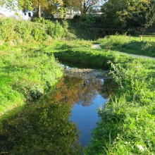
The River Lea flows along the eastern edge of Manor Road Park in a deep, restricted channel. The riverbed is concrete and the river runs between concrete walls or steps with metal railings.
The way the river flows means that silt covers the natural gravels, making it harder for fish and other creatures to thrive. The high walls separate the river from the floodplain which can put other areas of the town at risk of flooding. Above all, the river is unwelcoming and hidden from the local communities who could be enjoying a rich natural environment.
Monitoring surveys and results
This case study hasn’t got any Monitoring survey and results, you can add some by editing the project overview.
Lessons learnt
This case study hasn’t got any lessons learnt, you can add some by editing the project overview.
Image gallery
|
Catchment and subcatchment
Site
Project background
Cost for project phases
Reasons for river restoration
Measures
MonitoringHydromorphological quality elements
Biological quality elements
Physico-chemical quality elements
Any other monitoring, e.g. social, economic
Monitoring documents
Additional documents and videos
Additional links and references
Supplementary InformationEdit Supplementary Information
| ||||||||||||||||||||||||||||||||||||||||||||||||||||||||||||||||||||||||||||||||||||||||||||||||||||||||||||||||||||||||||||||||||||||||||||||||||||||||||||||||||||||||||||||||||||||||||||||||||||||||||||||

