Case study:Mill Brook, Tattenhall, Cheshire: Difference between revisions
No edit summary |
No edit summary |
||
| (3 intermediate revisions by the same user not shown) | |||
| Line 1: | Line 1: | ||
{{Case study status | {{Case study status | ||
|Approval status= | |Approval status=Approved | ||
}} | }} | ||
{{Location | {{Location | ||
| Line 31: | Line 31: | ||
|Invasive species present=No | |Invasive species present=No | ||
}} | }} | ||
{{Project background}} | {{Project background | ||
{{Motivations}} | |Total1 cost=£13.5k | ||
{{Measures}} | |Funding sources=North West RFCC, Local levy council tax funding | ||
}} | |||
{{Motivations | |||
|Specific mitigation=Flood risk management, | |||
}} | |||
{{Measures | |||
|Bank and bed modifications measure=habitat creation, Riparian planting, | |||
|Floodplain / River corridor=Reedbed creation, Floodplain creation, Riparian habitat restoration, | |||
}} | |||
{{Hydromorphological quality elements header}} | {{Hydromorphological quality elements header}} | ||
{{End table}} | {{End table}} | ||
Latest revision as of 11:55, 1 November 2018
Project overview
| Status | Complete |
|---|---|
| Project web site | http://www.therrc.co.uk/sites/default/files/projects/7_millbrook.pdf |
| Themes | Flood risk management, Habitat and biodiversity, Hydromorphology, Social benefits |
| Country | England |
| Main contact forename | Duncan |
| Main contact surname | Revell |
| Main contact user ID | |
| Contact organisation | Environment Agency |
| Contact organisation web site | http://www.gov.uk/government/organisations/environment-agency |
| Partner organisations | Bolesworth Estate, Tattenhall Wildlife Group |
| Parent multi-site project | |
| This is a parent project encompassing the following projects |
No |
Project summary
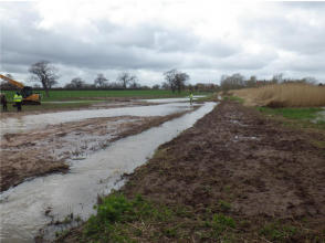
This was a habitat creation scheme (Photo 1) which incorporated innovative, Natural Flood Management (NFM) techniques along 230m of Mill Brook, upstream of Tattenhall near Chester (Map 1). This partnership project with the Bolesworth Estate and Tattenhall Wildlife Group created 1.5ha of priority reedbed and wet grassland habitats within a new excavated floodplain area. The project helps attenuate flood peaks and reduces risk downstream in Tattenhall. The North West Regional Flood and Coastal Committee allocated £13,500 of funding to this scheme from the North West 'Slowing the Flow' project. Key facts: 1.5ha of priority habitats created, wider and improved riparian zone and wildlife corridor: reduced diffuse agricultural pollution leading to reduced sediment input and improved water quality: helping to meet Water Framework Directive objectives; increased floodwater storage upstream and flood peak attenuation, which slows the flow of the brook, leading to some flood risk reduction benefits to the downstream village of Tattenhall
Monitoring surveys and results
Lessons learnt
Image gallery
|
Catchment and subcatchment
Site
Project background
Cost for project phases
Reasons for river restoration
Measures
MonitoringHydromorphological quality elements
Biological quality elements
Physico-chemical quality elements
Any other monitoring, e.g. social, economic
Monitoring documents
Additional documents and videos
Additional links and references
Supplementary InformationEdit Supplementary Information
| ||||||||||||||||||||||||||||||||||||||||||||||||||||||||||||||||||||||||||||||||||||||||||||||||||||||||||||||||||||||||||||||||||||||||||||||||||||||||||||||||||||||||||||||||||

