Case study:Hull and East Riding Catchment Partnership: Difference between revisions
(Created page with "{{Case study status |Approval status=Draft }} {{Location |Location=TA073478 |Kml file=Hull and East Riding Catchment Plan 2017 (Final).pdf |Kml path=https://www.catchmentbased...") |
No edit summary |
||
| (10 intermediate revisions by 3 users not shown) | |||
| Line 1: | Line 1: | ||
{{Case study status | {{Case study status | ||
|Approval status= | |Approval status=Approved | ||
}} | }} | ||
{{Location | {{Location | ||
|Location= | |Location=53.71819855270821, -0.30933380126953125 | ||
|Kml file=Hull and East Riding Catchment Plan 2017 (Final).pdf | |Kml file=Hull and East Riding Catchment Plan 2017 (Final).pdf | ||
|Kml path=https://www.catchmentbasedapproach.org/index.php?option=com_k2&view=item&layout=item&id=25&Itemid=240 | |Kml path=https://www.catchmentbasedapproach.org/index.php?option=com_k2&view=item&layout=item&id=25&Itemid=240 | ||
}} | }} | ||
{{Project overview | {{Project overview | ||
|Status=In progress | |Status=In progress | ||
|Project web site url=www.catchmentbasedapproach.org/index.php?option=com_k2&view=item&layout=item&id=25&Itemid=240 | |||
|Themes=Economic aspects, Environmental flows and water resources, Fisheries, Flood risk management, Hydromorphology, Land use management - agriculture, Monitoring, Social benefits, Water quality, Urban | |Themes=Economic aspects, Environmental flows and water resources, Fisheries, Flood risk management, Hydromorphology, Land use management - agriculture, Monitoring, Social benefits, Water quality, Urban | ||
|Country=England | |Country=England | ||
| Line 16: | Line 16: | ||
|Main contact id=Ahanson | |Main contact id=Ahanson | ||
|Contact organisation=Hull and East Riding Catchment Partnership | |Contact organisation=Hull and East Riding Catchment Partnership | ||
|Contact organisation url= | |Contact organisation url=www.catchmentbasedapproach.org/index.php?option=com_k2&view=item&layout=item&id=25&Itemid=240 | ||
|Partner organisations=Yorkshire Wildlife Trust, East Yorkshire Rivers Trust, Beverley and North Holderness Internal Drainage Board, East and North Yorkshire Waterways Partnership, East Riding of Yorkshire Council, Environment Agency, Hull City Council, Natural England, Ouse and Humber Drainage Board, South Holderness Internal Drainage Board and Yorkshire Water | |||
|Multi-site=Yes | |Multi-site=Yes | ||
|Project picture=17-03-15 HER Operational Catchments v4.jpg | |||
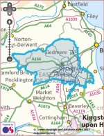
|Picture description=Map of the Hull and East Riding Catchment Area | |||
|Project summary=In 2012, Defra introduced the catchment based approach (CaBA) - a community-led approach that engages people and groups from across society to help improve our water environments. Defra drives CaBA through a national network of catchment partnerships. These partnerships are expected to identify local priorities and tackle cross-cutting issues; ensure that the work of partners is coordinated; and deliver improvements across their catchments. | |||
Established in 2014, the Hull and East Riding Catchment Partnership is hosted by the Yorkshire Wildlife Trust with support from the East Yorkshire Rivers Trust as Joint Host. They are joined on the partnership by the Beverley and North Holderness Internal Drainage Board, East and North Yorkshire Waterways Partnership, East Riding of Yorkshire Council, Environment Agency, Hull City Council, Natural England, Ouse and Humber Drainage Board, South Holderness Internal Drainage Board and Yorkshire Water. | |||
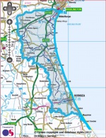
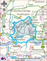
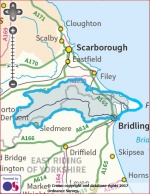
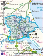
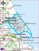
Unlike most other catchments, the Hull and East Riding catchment area comprises a series of distinct and often discrete watercourses / water bodies, known locally as: Barmston Sea Cut; Gypsey Race; Hornsea Mere; Market Weighton Canal and River Foulness; River Hull; and the South Holderness Drains (Burstwick, Keyingham, Ottringham, Thorngumbald and Winestead). | |||
Most of these water bodies are separate from the main inland waterway network. Together, though, they are crucial to the drainage of the Yorkshire Wolds and the East Riding and to the unique landscape character of the region. | |||
In March 2017, the Hull and East Riding Catchment Partnership published its first catchment plan, which explains how partners are using the CaBA to make a difference in the water environment, in local communities and to the local economy – now and in the long term. The document also demonstrates the partnership's strong track record of collaborative working and includes case studies which illustrate the partnership's capacity for effective catchment management. | |||
|Project title=Hull and East Riding Catchment Partnership | |||
}} | }} | ||
{{Image gallery}} | {{Image gallery}} | ||
{{Case study image | |||
|File name=Barmston Sea Drain.JPG | |||
|Caption=Barmston Sea Drain (map) | |||
}} | |||
{{Case study image | |||
|File name=Foulness.JPG | |||
|Caption=River Foulness (map) | |||
}} | |||
{{Case study image | |||
|File name=Gypsey Race.JPG | |||
|Caption=Gypsey Race (map) | |||
}} | |||
{{Case study image | |||
|File name=Lower Hull.JPG | |||
|Caption=Lower Hull (map) | |||
}} | |||
{{Case study image | |||
|File name=Upper Hull.JPG | |||
|Caption=Upper Hull (map) | |||
}} | |||
{{Case study image | |||
|File name=South Holderness Drains.JPG | |||
|Caption=South Holderness Drains (map) | |||
}} | |||
{{Case study image | |||
|File name=17-12-05 AquaGreen Image.jpg | |||
|Caption=Hull AquaGreens Programme (urban SuDS) | |||
}} | |||
{{Case study image | |||
|File name=17-12-05 Lowthorpe Diversion Project.jpg | |||
|Caption=Lowthorpe Diversion Project | |||
}} | |||
{{Case study image | |||
|File name=Barmston Drain Photo.jpg | |||
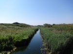
|Caption=Barmston Drain | |||
}} | |||
{{Case study image | |||
|File name=Boynton Bridge Gypsey Race.jpg | |||
|Caption=Gypsey Race at Boynton Bridge (D Croft) | |||
}} | |||
{{Case study image | |||
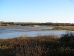
|File name=Hornsea Mere & Hide - Jess Charlton (42).JPG | |||
|Caption=Hornsea Mere and bird hide (Jess Charlton) | |||
}} | |||
{{Case study image | |||
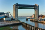
|File name=River Hull Tidal Barrier.jpg | |||
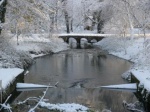
|Caption=River Hull Tidal Barrier (Hull City Council) | |||
}} | |||
{{Case study image | |||
|File name=Wansford Bridge.jpg | |||
|Caption=River Hull at Wansford Bridge (Yorkshire Wildlife Trust) | |||
}} | |||
{{Case study image | |||
|File name=Skerne wet woodland creation site credit J Traill.JPG | |||
|Caption=Skerne Wetlands, River Hull Headwaters (Yorkshire Wildlife Trust) | |||
}} | |||
{{Case study image | |||
|File name=Tophill Low South Lagoon.jpg | |||
|Caption=South Lagoon, Tophill Low Nature Reserve (Yorkshire Water) | |||
}} | |||
{{Case study image | |||
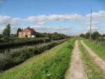
|File name=MW Canal.jpg | |||
|Caption=Market Weighton Canal | |||
}} | |||
{{Image gallery end}} | {{Image gallery end}} | ||
{{Toggle button}} | {{Toggle button}} | ||
{{Toggle content start}} | {{Toggle content start}} | ||
{{Case study subcatchment}} | {{Case study subcatchment | ||
|Subcatchment=HUMBER MIDDLE | |||
}} | |||
{{Site}} | {{Site}} | ||
{{Project background}} | {{Project background}} | ||
{{Motivations}} | {{Motivations | ||
{{Measures}} | |Other motivation=Landscape enhancement, | ||
}} | |||
{{Measures | |||
|Social measures=Volunteer engagement, | |||
}} | |||
{{Hydromorphological quality elements header}} | {{Hydromorphological quality elements header}} | ||
{{End table}} | {{End table}} | ||
Latest revision as of 09:04, 10 July 2018
Project overview
| Status | In progress |
|---|---|
| Project web site | http://www.catchmentbasedapproach.org/index.php?option=com_k2&view=item&layout=item&id=25&Itemid=240 |
| Themes | Economic aspects, Environmental flows and water resources, Fisheries, Flood risk management, Hydromorphology, Land use management - agriculture, Monitoring, Social benefits, Water quality, Urban |
| Country | England |
| Main contact forename | Annabel |
| Main contact surname | Hanson |
| Main contact user ID | User:Ahanson |
| Contact organisation | Hull and East Riding Catchment Partnership |
| Contact organisation web site | http://www.catchmentbasedapproach.org/index.php?option=com k2&view=item&layout=item&id=25&Itemid=240 |
| Partner organisations | Yorkshire Wildlife Trust, East Yorkshire Rivers Trust, Beverley and North Holderness Internal Drainage Board, East and North Yorkshire Waterways Partnership, East Riding of Yorkshire Council, Environment Agency, Hull City Council, Natural England, Ouse and Humber Drainage Board, South Holderness Internal Drainage Board and Yorkshire Water |
| This is a parent project encompassing the following projects |
Project summary
In 2012, Defra introduced the catchment based approach (CaBA) - a community-led approach that engages people and groups from across society to help improve our water environments. Defra drives CaBA through a national network of catchment partnerships. These partnerships are expected to identify local priorities and tackle cross-cutting issues; ensure that the work of partners is coordinated; and deliver improvements across their catchments.
Established in 2014, the Hull and East Riding Catchment Partnership is hosted by the Yorkshire Wildlife Trust with support from the East Yorkshire Rivers Trust as Joint Host. They are joined on the partnership by the Beverley and North Holderness Internal Drainage Board, East and North Yorkshire Waterways Partnership, East Riding of Yorkshire Council, Environment Agency, Hull City Council, Natural England, Ouse and Humber Drainage Board, South Holderness Internal Drainage Board and Yorkshire Water.
Unlike most other catchments, the Hull and East Riding catchment area comprises a series of distinct and often discrete watercourses / water bodies, known locally as: Barmston Sea Cut; Gypsey Race; Hornsea Mere; Market Weighton Canal and River Foulness; River Hull; and the South Holderness Drains (Burstwick, Keyingham, Ottringham, Thorngumbald and Winestead).
Most of these water bodies are separate from the main inland waterway network. Together, though, they are crucial to the drainage of the Yorkshire Wolds and the East Riding and to the unique landscape character of the region.
In March 2017, the Hull and East Riding Catchment Partnership published its first catchment plan, which explains how partners are using the CaBA to make a difference in the water environment, in local communities and to the local economy – now and in the long term. The document also demonstrates the partnership's strong track record of collaborative working and includes case studies which illustrate the partnership's capacity for effective catchment management.
Monitoring surveys and results
Lessons learnt
Image gallery
|
Catchment and subcatchmentSelect a catchment/subcatchment
Catchment
Subcatchment
Site
Project background
Cost for project phases
Reasons for river restoration
Measures
MonitoringHydromorphological quality elements
Biological quality elements
Physico-chemical quality elements
Any other monitoring, e.g. social, economic
Monitoring documents
Additional documents and videos
Additional links and references
Supplementary InformationEdit Supplementary Information
| ||||||||||||||||||||||||||||||||||||||||||||||||||||||||||||||||||||||||||||||||||||||||||||||||||||||||||||||||||||||||||||||||||||||||||||||||||||||||||||||||||||||||||||||||||||||||||||||||||||||||


