Case study:Knepp Rewilding Project: Difference between revisions
No edit summary |
No edit summary |
||
| (2 intermediate revisions by the same user not shown) | |||
| Line 83: | Line 83: | ||
}} | }} | ||
{{Measures | {{Measures | ||
|Bank and bed modifications measure= | |Bank and bed modifications measure=Bank modification, Re-profiling, Creation of low flow channel, Habitat restoration, Creation of low flow channel, Barrier removal, Creation of backwaters, Introducing large woody debris, Riverbed restoration, | ||
|Floodplain / River corridor=Floodplain reconnection, Scrapes, Increase water retention area, Wetland habitat, | |Floodplain / River corridor=Floodplain reconnection, Scrapes, Increase water retention area, Wetland habitat, | ||
|Planform / Channel pattern=Channel realignment, Re-meandering, Enhancing flow diversity, Habitat restoration, | |Planform / Channel pattern=Channel realignment, Re-meandering, Enhancing flow diversity, Habitat restoration, Meandering channel, | ||
|Other technical measure=Selective removal of organic muds and sludge contaminated with toxic, Create more natural flow regime, Improvement of natural flows, Improving fish migration, | |Other technical measure=Selective removal of organic muds and sludge contaminated with toxic, Create more natural flow regime, Improvement of natural flows, Improving fish migration, | ||
|Management interventions=Flow management, | |Management interventions=Flow management, | ||
Latest revision as of 16:32, 2 January 2019
Project overview
| Status | Complete |
|---|---|
| Project web site | http://knepp.co.uk |
| Themes | Environmental flows and water resources, Flood risk management, Habitat and biodiversity, Hydromorphology, Land use management - agriculture, Social benefits, Water quality |
| Country | England |
| Main contact forename | Penny |
| Main contact surname | Green |
| Main contact user ID | User:Penny Green |
| Contact organisation | Knepp Castle Estate |
| Contact organisation web site | http://knepp.co.uk |
| Partner organisations | Environment Agency, Sussex Wildlife Trust, Royal HaskoningDHV, West Sussex County Council and Natural England |
| Parent multi-site project | |
| This is a parent project encompassing the following projects |
No |
Project summary
Jointly funded by Natural England and the Knepp Estate, the restoration of the upper reaches of the River Adur lies at the heart of the largest rewilding project in lowland UK.
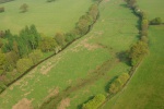
The work, carried out by the Environment Agency, has involved removing 4 weirs, returning 2.4km of canalised river to its original meanders and linking it to 5.5kms of restored floodplain upstream.
It is part of a landscape-scale conservation enterprise aimed at restoring the full range of hydrological processes from the moment raindrops fall on the land, filtering through vegetation and the soil, to their passage into watercourses towards the sea.
This reach of the River Adur was enlarged and diverted to the edge of the floodplain at least two hundred years ago, in an attempt to improve land drainage and allow the land to be farmed more productively. This extensive modification created a deep, uniform trapezoidal channel that supported very little flow or habitat diversity and was largely cut off from its floodplain in all but the largest floods. The extent of channel enlargement meant that flows became very low during dry summer periods, with parts of the river resembling a series of connected ponds rather than a flowing channel. A sluice and two stepped weirs were installed in an attempt to maintain depths of flow, but these impounded flows, encouraged sedimentation and limited fish passage. As a result of these modifications, natural river processes were limited and the river did not support the range of habitats that would be expected, resulting in a failure to reach Good Ecological Status under the Water Framework Directive.
The main aim of the restoration project was therefore to physically modify the existing channel to restore natural river processes, reconnect the river to its floodplain, and create the conditions that are required to support a rich and varied range of habitats for plants, invertebrates and fish. The project formed part of the wider Knepp Castle Rewilding Project, which aims to produce a large scale minimal-intervention landscape.
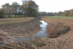
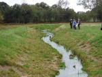
Creation of 1 km of new meandering river channel with naturally variable bed and bank profiles. Re-naturalisation of an additional 1.5 km of channel through bank re-profiling. The uniform, high banks were “pushed” into the channel to create a low flow channel with natural bank profiles that support a range of emergent and marginal habitats.
The new channel has a much smaller capacity than the modified channel that it replaced, concentrating low flows and improving floodplain connectivity during periods of higher flow. Blocking and diversion of floodplain drains and creation of scrapes to retain water on the floodplain.
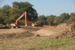
Works included: Realignment of 1km river channel to its former naturally meandering course. Removal of four obsolete in-channel structures to restore natural flow and sediment transport processes and allow the free passage of fish. Creation of two backwaters to provide valuable habitats for aquatic plants and invertebrates.
Monitoring surveys and results
Lessons learnt
Image gallery
|
Catchment and subcatchmentSelect a catchment/subcatchment
Catchment
Subcatchment
Site
Project background
Cost for project phases
Reasons for river restoration
Measures
MonitoringHydromorphological quality elements
Biological quality elements
Physico-chemical quality elements
Any other monitoring, e.g. social, economic
Monitoring documents
Additional documents and videos
Additional links and references
Supplementary InformationEdit Supplementary Information
| ||||||||||||||||||||||||||||||||||||||||||||||||||||||||||||||||||||||||||||||||||||||||||||||||||||||||||||||||||||||||||||||||||||||||||||||||||||||||||||||||||||||||||||||||||||||||||||||||


