Case study:Emmanuel’s Common Reconnection Project: Difference between revisions
No edit summary |
No edit summary |
||
| (7 intermediate revisions by the same user not shown) | |||
| Line 1: | Line 1: | ||
{{Case study status | {{Case study status | ||
|Approval status= | |Approval status=Approved | ||
}} | }} | ||
{{Location | {{Location | ||
| Line 20: | Line 20: | ||
The project within the common has now been completed. We have delivered the restoration scheme as planned where we wanted to reconnect 600m of old channel constructing one new length of channel to make the meander sequence link up. | The project within the common has now been completed. We have delivered the restoration scheme as planned where we wanted to reconnect 600m of old channel constructing one new length of channel to make the meander sequence link up. | ||
The project aims to reconnect the old meandering channel, open up some of the channel by removing scrub to allow light in, improve flow regime, improve fish & invertebrate habitat, and improve aquatic and riparian plant habitat. | |||
Reinstating the old channel by creating a short linking channel upstream and reconnecting the meanders downstream. | |||
The lower channel accounted for 80% of the project time. The available route passed through a slightly raised part of the flood-plain and in the middle reaches it was a challenge to peel away enough ground to make the correct, naturally shallow cross-section. There was little fall to play with too and the main river to which the new channel returned has been dredged and so tuning the gradient proved very tricky. It was worth the effort though. When the flows finally broke through the new channel worked perfectly, with good velocity and no unintentional impoundments. | |||
|Monitoring surveys and results=Please use the link to find out about the Electrofishing surveys for the project http://www.norfolkriverstrust.org/wp-content/uploads/2016/02/Electrofishing-doc.pdf | |Monitoring surveys and results=Please use the link to find out about the Electrofishing surveys for the project http://www.norfolkriverstrust.org/wp-content/uploads/2016/02/Electrofishing-doc.pdf | ||
}} | }} | ||
| Line 46: | Line 45: | ||
|Project completed=2014/11/14 | |Project completed=2014/11/14 | ||
}} | }} | ||
{{Motivations}} | {{Motivations | ||
{{Measures}} | |Hydromorphological quality elements=Reconnect old channel, improve flow regime, | ||
|Biological quality elements=Improve fish habitat and biodiversity | |||
}} | |||
{{Measures | |||
|Floodplain / River corridor=Reinstating old channel, Remeandering, | |||
}} | |||
{{Hydromorphological quality elements header}} | {{Hydromorphological quality elements header}} | ||
{{End table}} | {{End table}} | ||
Latest revision as of 14:32, 1 June 2017
Project overview
| Status | Complete |
|---|---|
| Project web site | |
| Themes | Fisheries, Habitat and biodiversity, Hydromorphology |
| Country | England |
| Main contact forename | Helen |
| Main contact surname | Mandley |
| Main contact user ID | User:JoshRRC |
| Contact organisation | Norfolk Rivers Trust |
| Contact organisation web site | http://www.norfolkriverstrust.org/ |
| Partner organisations | |
| Parent multi-site project | |
| This is a parent project encompassing the following projects |
No |
Project summary
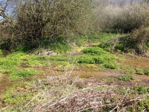
The River Nar has been historically modified for human use, changing its channel size and shape, and in places the river’s course. These changes have negatively impacted on the wildlife of the river. The River Nar through Emmanuel’s Common has historically been used for water meadows to graze animals. The river has been deepened and straightened to enable drainage of the site and to increase water flow to power Newton Mill. By looking at historic maps and investigating on the ground you can see the old meandering channel through the woodland.
The project within the common has now been completed. We have delivered the restoration scheme as planned where we wanted to reconnect 600m of old channel constructing one new length of channel to make the meander sequence link up.
The project aims to reconnect the old meandering channel, open up some of the channel by removing scrub to allow light in, improve flow regime, improve fish & invertebrate habitat, and improve aquatic and riparian plant habitat.
Reinstating the old channel by creating a short linking channel upstream and reconnecting the meanders downstream.
The lower channel accounted for 80% of the project time. The available route passed through a slightly raised part of the flood-plain and in the middle reaches it was a challenge to peel away enough ground to make the correct, naturally shallow cross-section. There was little fall to play with too and the main river to which the new channel returned has been dredged and so tuning the gradient proved very tricky. It was worth the effort though. When the flows finally broke through the new channel worked perfectly, with good velocity and no unintentional impoundments.
Monitoring surveys and results
Please use the link to find out about the Electrofishing surveys for the project http://www.norfolkriverstrust.org/wp-content/uploads/2016/02/Electrofishing-doc.pdf
Lessons learnt
Image gallery
|
Catchment and subcatchmentSelect a catchment/subcatchment
Catchment
Subcatchment
Other case studies in this subcatchment: The Pentney Restoration Project
Site
Project background
Cost for project phases
Reasons for river restoration
Measures
MonitoringHydromorphological quality elements
Biological quality elements
Physico-chemical quality elements
Any other monitoring, e.g. social, economic
Monitoring documents
Additional documents and videos
Additional links and references
Supplementary InformationEdit Supplementary Information
| ||||||||||||||||||||||||||||||||||||||||||||||||||||||||||||||||||||||||||||||||||||||||||||||||||||||||||||||||||||||||||||||||||||||||||||||||||||||||||||||||||||||||||||||||||||||||||||||||||||||||

