Case study:River Idle Restoration Project: Difference between revisions
Digbytaylor (talk | contribs) No edit summary |
No edit summary |
||
| (2 intermediate revisions by 2 users not shown) | |||
| Line 1: | Line 1: | ||
{{Case study status | {{Case study status | ||
|Approval status= | |Approval status=Approved | ||
}} | }} | ||
{{Location | {{Location | ||
| Line 127: | Line 127: | ||
{{Measures | {{Measures | ||
|Bank and bed modifications measure=Bank modification | |Bank and bed modifications measure=Bank modification | ||
|Floodplain / River corridor=Buffer strips, | |Floodplain / River corridor=Buffer strips, Tree planting, | ||
|Planform / Channel pattern=Introducing woody debris | |Planform / Channel pattern=Introducing large woody debris, | ||
|Social measures=Engagement with a wide range of stakeholders - more planned., | |||
|Social measures=Engagement with a wide range of stakeholders - more planned., | |||
|Wider stakeholder / citizen engagement=Survey work | |Wider stakeholder / citizen engagement=Survey work | ||
}} | }} | ||
Latest revision as of 11:37, 31 May 2017
Project overview
| Status | Complete |
|---|---|
| Project web site | |
| Themes | Environmental flows and water resources, Fisheries, Flood risk management, Habitat and biodiversity, Land use management - agriculture, Water quality |
| Country | England |
| Main contact forename | David |
| Main contact surname | Newborough |
| Main contact user ID | |
| Contact organisation | Environment Agency |
| Contact organisation web site | http://https://www.gov.uk/government/organisations/environment-agency |
| Partner organisations | Nottinghamshire Wildlife Trust |
| Parent multi-site project | |
| This is a parent project encompassing the following projects |
No |
Project summary
The project was in collaboration with the Nottinghamshire Wildlife Trust to establish a partnership that will enable joint working and delivery of high quality habitat restoration along the River Idle and its tributaries.
The River Idle was identified as having significant potential for high quality habitat restoration and for the substantial improvement of its water quality to meet WFD objectives. There were several strategies in existence for the Idle and many partners interested in the catchment. We were also finalising the Isle of Axholme Flood Risk Management Strategy. With so many organisations keen to be involved in the enhancement of the river, the project established an overarching Management Group, which brought together partners to ensure efficient and complementary working towards a shared vision. Such a "joined-up" approach offered better opportunities for innovation and access to funding than working in isolation.
A connection with the River Idle has been installed SK6956684463 to allow fish and eels to escape from the River Idle in high flows. The reed fringed pond connected to the river will also provide spawning opportunities. As the river level rises a valve will close to prevent water washing away habitat in the pond. Fish will be able to return to the river as its level falls.
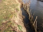
The River Idle has been heavily modified over the years and typically lacks in-channel habitat. An existing berm was lowered and planted with common reed to create habitat for nesting birds and invertebrates. In order to enhance the newly created berm for fish a backwater was created to allow fish to move from the main channel into the backwater during high flows.
Following its establishment, the River Idle Management Partnership has been well attended. The Management Partnership comprises stakeholders with a diverse range of agendas and priorities, reflecting the national tensions and conflicts between water quality, flood risk management and the environment. This initially disparate group has worked through some significant areas of potential conflict to arrive at a good degree of mutual understanding. It is significant that several local farmers and landowners have become regular attendees. Several members of the partnership also attended the Rural Stakeholders Workshop for the wider Idle Catchment event that NWT organised through their catchment hosting role. It was reported back to us that it had been very useful to make the connections with upstream activities in the Maun and Meden and how this affects them on the Idle, and so how we need to think in a catchment-scale manner.
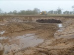
The partnership agreed that before any maintenance work is undertaken along the River Idle; a survey was required to ascertain how much silt is present and location of priority areas. At the October 2014 meeting it was confirmed that funding has been made available to undertake the silt assessment. While it was widely agreed by the Catchment Partnership that siltation was an issue, for flood defence and environmental reasons including SSSI condition, the extent of the silt burden was then unknown. Subsequent work by the Isle of Axholme and North Nottinghamshire Water Level Management Board using Environment Agency data from 1994 & 2001 estimated the volume of silt at c146,000m3, the cost of de-silting this volume was estimated at £4,000,000. The volume and extent of this task is beyond the ability of single landowners to undertake.
The catchment partnership will continue to take forward actions to improve the river and realise multiple benefits.
Monitoring surveys and results
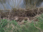
Working with landowners to create species-rich grassland buffer strips to reduce diffuse agricultural pollution from adjacent arable land through absorption of agricultural run-off. We installed hinged large woody debris to improve channel conditions for benefits for fish spawning and aerate flows. These will hopefully start to show an improvement from a WFD perspective through the habitat improvements.
The projects main success has been the establishment of the Idle Management Partnership Group. Although the group has taken time to develop and have a clear purpose, it has been beneficial to have landowners as well as partner organisations meeting together to discuss what's best for the river.
Lessons learnt
This has been a 3-year project. The partnership has taken that time to become established with clear objectives for the future. Partnerships of this size do take time.
Image gallery


|
Catchment and subcatchmentSelect a catchment/subcatchment
Catchment
Subcatchment
Site
Project background
Cost for project phases
Reasons for river restoration
Measures
MonitoringHydromorphological quality elements
Biological quality elements
Physico-chemical quality elements
Any other monitoring, e.g. social, economic
Monitoring documents
Additional documents and videos
Additional links and references
Supplementary InformationEdit Supplementary Information
| ||||||||||||||||||||||||||||||||||||||||||||||||||||||||||||||||||||||||||||||||||||||||||||||||||||||||||||||||||||||||||||||||||||||||||||||||||||||||||||||||||||||||||||||||||||||||||||||


