Case study:Millfield Plantation 2: Difference between revisions
No edit summary |
No edit summary |
||
| (7 intermediate revisions by 2 users not shown) | |||
| Line 1: | Line 1: | ||
{{Case study status | {{Case study status | ||
|Approval status= | |Approval status=Approved | ||
}} | }} | ||
{{Location | {{Location | ||
| Line 8: | Line 8: | ||
|Status=In progress | |Status=In progress | ||
|Project web site url=http://www.essexrivershub.org.uk/ | |Project web site url=http://www.essexrivershub.org.uk/ | ||
|Themes=Flood risk management, Habitat and biodiversity, Hydromorphology, Water quality | |||
|Country=England | |Country=England | ||
|Main contact forename=Kieren | |Main contact forename=Kieren | ||
| Line 28: | Line 29: | ||
In addition to the back channel connection there will also be installation of several bits of woody debris further downstream to kick start geomorphological processes in the river such as riffle creation, berms, flow dynamics and some bank erosion. It also has a part to play in diffuse pollution removal by pushing water through soil which removes nitrate via dentrification. | In addition to the back channel connection there will also be installation of several bits of woody debris further downstream to kick start geomorphological processes in the river such as riffle creation, berms, flow dynamics and some bank erosion. It also has a part to play in diffuse pollution removal by pushing water through soil which removes nitrate via dentrification. | ||
All the consents are now in place for this project and earthworks as due to commence in August 2015, completing soon after. Once complete, we should start to see the benefits in the following winter. | All the consents are now in place for this project and earthworks as due to commence in August 2015, completing soon after. Once complete, we should start to see the benefits in the following winter. | ||
|Monitoring surveys and results=There will be low key monitoring surrounding this project. Fixed point photography will be utilised to monitor any changes in vegetation and land forming. | |Monitoring surveys and results=There will be low key monitoring surrounding this project. Fixed point photography will be utilised to monitor any changes in vegetation and land forming. | ||
There will be regular monitoring of riverflies in these reach, an improvement in these may point to an improvement in the water quality in this reach. | There will be regular monitoring of riverflies in these reach, an improvement in these may point to an improvement in the water quality in this reach. | ||
|Lessons learn=The River Pant has low flow issues during the summer, and is also a conduit for the Ely-Ouse transfer system, these must be protected at all costs. Therefore any connection to the floodplain must take this into account. Also, due to the constraints of having to ensure that the landowner can keep access to the surrounding fields we have had to go for a formal connection, in an ideal world we would go for a more informal connection that would offer additional benefits to fish fry and avoid the need for an eel screen to prevent eels from being deposited in the new back channel. | |Lessons learn=The River Pant has low flow issues during the summer, and is also a conduit for the Ely-Ouse transfer system, these must be protected at all costs. Therefore any connection to the floodplain must take this into account. Also, due to the constraints of having to ensure that the landowner can keep access to the surrounding fields we have had to go for a formal connection, in an ideal world we would go for a more informal connection that would offer additional benefits to fish fry and avoid the need for an eel screen to prevent eels from being deposited in the new back channel. | ||
}} | }} | ||
{{Image gallery}} | {{Image gallery}} | ||
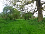
{{Case study image | |||
|File name=Old derelict channel.JPG | |||
}} | |||
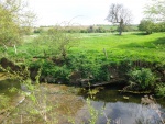
{{Case study image | |||
|File name=Mouth of derelict channel.JPG | |||
}} | |||
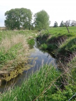
{{Case study image | |||
|File name=Heavily incised channel.JPG | |||
}} | |||
{{Image gallery end}} | {{Image gallery end}} | ||
{{Toggle button}} | {{Toggle button}} | ||
{{Toggle content start}} | {{Toggle content start}} | ||
{{Case study subcatchment | {{Case study subcatchment | ||
|Subcatchment= | |Subcatchment=Pant | ||
}} | }} | ||
{{Site | {{Site | ||
| Line 55: | Line 61: | ||
{{Project background | {{Project background | ||
|Project started=2012/04/01 | |Project started=2012/04/01 | ||
|Works started=2014/ | |Works started=2014/08/11 | ||
|Investigation and design Lead organisation=Ess | |||
|Investigation and design Other contact forename=Kieren | |||
|Investigation and design Other contact surname=Alexander | |||
|Stakeholder engagement Lead organisation=Essex Wildlife Trust | |||
|Stakeholder engagement Other contact forename=Kieren | |||
|Stakeholder engagement Other contact surname=Alexander | |||
|Works and supervision Lead organisation=Essex Wildlife Trust | |||
|Works and supervision Other contact forename=Kieren | |||
|Works and supervision Other contact surname=Alexander | |||
|Post-project management and maintenance Lead organisation=Essex Wildlife Trust | |||
|Post-project management and maintenance Other contact forename=Kieren | |||
|Post-project management and maintenance Other contact surname=Alexander | |||
|Monitoring Lead organisation=Essex Wildlife Trust | |||
|Monitoring Other contact forename=Kieren | |||
|Monitoring Other contact surname=Alexander | |||
}} | }} | ||
{{Motivations}} | {{Motivations}} | ||
{{Measures}} | {{Measures | ||
|Bank and bed modifications measure=Creation of wooden deflectors, | |||
|Floodplain / River corridor=Floodplain reconnection, | |||
|Planform / Channel pattern=Introducing large woody debris, silt depositon on the flood plain | |||
}} | |||
{{Hydromorphological quality elements header}} | {{Hydromorphological quality elements header}} | ||
{{End table}} | {{End table}} | ||
| Line 72: | Line 97: | ||
{{Additional Documents end}} | {{Additional Documents end}} | ||
{{Additional links and references header}} | {{Additional links and references header}} | ||
{{Additional links and references | |||
|Link=www.essexrivershub.org.uk | |||
|Description=For more information on this and other projects in Combined Essex catchment | |||
}} | |||
{{Additional links and references footer}} | {{Additional links and references footer}} | ||
{{Supplementary Information}} | {{Supplementary Information}} | ||
{{Toggle content end}} | {{Toggle content end}} | ||
Latest revision as of 14:34, 12 May 2015
Project overview
| Status | In progress |
|---|---|
| Project web site | http://http://www.essexrivershub.org.uk/ |
| Themes | Flood risk management, Habitat and biodiversity, Hydromorphology, Water quality |
| Country | England |
| Main contact forename | Kieren |
| Main contact surname | Alexander |
| Main contact user ID | User:KierenAlexander |
| Contact organisation | Essex Wildlife Trust |
| Contact organisation web site | http://http://www.essexwt.org.uk/ |
| Partner organisations | |
| Parent multi-site project | |
| This is a parent project encompassing the following projects |
No |
Project summary
The river restoration project at Millfield plantation builds on the work also being undertaken at Bocking Blackwater local nature reserve, Ironbridge Farm and Plough Hill farm. All the projects are linked both thematically and geographically and are focused on improving the status of the river under the water framework.
Currently the river Pant is failing under WFD, a number of issues have been identified including physical modification, fish passage and both point source and diffuse pollution. This manifests itself in a manner of ways, most notably with a heavily modified channel which has been deepened and in places straightened but most importantly disconnected from its floodplain by large artificial bunds. The land use is predominantly arable and this can lead to some pollution events both diffuse and one of such as oil and other contaminants. It should be noted that Essex and Suffolk water have done a huge amount to improve the status of this river by landowner interaction and education and this project aims to build on this.
After a period of consultation and a professional assessment looking at the feasibility of the project a plan was designed to start improving the water body. This will involve installing a pipe at the mouth of an old channel, we do not know exactly know what the original purpose of this channel was but it is likely to be an old mill race that due to historical management has been increasingly separated from the original channel. However, it now offers a unique chance to reconnect the floodplain and contribute to water quality via the installation of a new 300mm culvert and simple pipe.
This will allow the back channel to go from being inundated a handful of times a year to up to 15 or 16 times. This will only be transitory inundation, we are not planning on installing anything that will hold water back but it should be enough to kick start some changes in the vegetation structure promoting semi-aquatic and marginal vegetation. It will be this vegetation as it develops that allows the water to be filtered, silt will also be given the chance to settle out on the floodplain, further improving the condition of the river and its value to invertebrates and fish.
In addition to the back channel connection there will also be installation of several bits of woody debris further downstream to kick start geomorphological processes in the river such as riffle creation, berms, flow dynamics and some bank erosion. It also has a part to play in diffuse pollution removal by pushing water through soil which removes nitrate via dentrification.
All the consents are now in place for this project and earthworks as due to commence in August 2015, completing soon after. Once complete, we should start to see the benefits in the following winter.
Monitoring surveys and results
There will be low key monitoring surrounding this project. Fixed point photography will be utilised to monitor any changes in vegetation and land forming.
There will be regular monitoring of riverflies in these reach, an improvement in these may point to an improvement in the water quality in this reach.
Lessons learnt
The River Pant has low flow issues during the summer, and is also a conduit for the Ely-Ouse transfer system, these must be protected at all costs. Therefore any connection to the floodplain must take this into account. Also, due to the constraints of having to ensure that the landowner can keep access to the surrounding fields we have had to go for a formal connection, in an ideal world we would go for a more informal connection that would offer additional benefits to fish fry and avoid the need for an eel screen to prevent eels from being deposited in the new back channel.
Image gallery
|
Catchment and subcatchmentSelect a catchment/subcatchment
Catchment
Subcatchment
Other case studies in this subcatchment: Ironbridge Farm, Plough Hill Farm Meander and Wet meadow restoration
Site
Project background
Cost for project phases
Reasons for river restoration
Measures
MonitoringHydromorphological quality elements
Biological quality elements
Physico-chemical quality elements
Any other monitoring, e.g. social, economic
Monitoring documents
Additional documents and videos
Additional links and references
Supplementary InformationEdit Supplementary Information
| ||||||||||||||||||||||||||||||||||||||||||||||||||||||||||||||||||||||||||||||||||||||||||||||||||||||||||||||||||||||||||||||||||||||||||||||||||||||||||||||||||||||||||||||||||||||||||||||||||||||||||


