Case study:Little Waltham Meadows Back Channel creation: Difference between revisions
No edit summary |
No edit summary |
||
| (14 intermediate revisions by 3 users not shown) | |||
| Line 14: | Line 14: | ||
|Contact organisation=Essex Wildlife Trust | |Contact organisation=Essex Wildlife Trust | ||
|Contact organisation url=www.essexwt.org.uk | |Contact organisation url=www.essexwt.org.uk | ||
|Partner organisations=Essex and Suffolk Water (Northumbrian Water), Chelmer and Blackwater Catchment Partnership, Natural England, Environment Agency, Chelmer and Blackwater Navigation (Essex Waterways Ltd), Parish Councils and the Rural Communities Council for Essex, Landowners and farmers, Rivers Trust, Essex County Council, Essex Farming and Wildlife Advisory Group | |||
|Multi-site=No | |Multi-site=No | ||
|Project picture=Back channel at LW.jpg | |Project picture=Back channel at LW.jpg | ||
|Project summary=This | |Project summary=This is a multi-benefit project aimed at improving in channel morphological diversity, reducing the amount of diffuse pollution and sedimentation entering the main river Chelmer. It will also increase the amount of riparian habitat along the River Chelmer and enhance the resilience of the wet woodland. | ||
This project was funded by the Catchment restoration fund, as part of the Essex Healthy headwaters scheme. The earthworks were undertaken in late Summer, early Autumn 2014. | |||
The aims of this project were achieved in the first instance by the creation of a new 280 backwater channel with three settling ponds and a sluice structure. The back channel connects with the river and an existing culvert/drainage point off the nearby main road. The ponds and back channel in the first instance allow for any nitrate and phosphate heavy water coming through the culvert to be settled and filtered. The back channel is also excellent in times of high flows at providing fish refuges, especially for fish fry which are in danger of being washed downstream in flood events. It will also provide an interface between the river and the bank side which will allow some interesting and diverse flora to develop. Finally, by connecting the river with the floodplain it creates additional riparian habitat and has a small but meaningful impact on flooding by increasing storage in the floodplain, outside of Chelmsford. | |||
The | The other aim of the project, namely to increase the resilience of the wet woodland. Was created by installing a sluice at the far end of an existing ditch. Unlike the other sluice this captures rain water and holds it back on the landward side, this has been set at a level that is higher than previous levels and will effect a raise in water off approximately 50 centimeters. The increased water levels have also allowed for additional planting to be undertaken that will extend the water by over half a hectare, there has also been some limited earthworks to spread the water over a wider area. | ||
These works will keep the woodland wetter in the summer months, keeping Bramble under control and allowing a further establishment of the flora normally associated with wet woodlands. | |||
|Monitoring surveys and results= | |Monitoring surveys and results=There has been a full pre-works survey conducted by Essex Ecological Consultancy service which has established a baseline index of key invertebrates and flora. | ||
Post works it is hoped that this survey can repeated once the site has settled down to allow an accurate summary of the effect of the works. There will also be adhoc surveys of any flora development in time. | |||
|Lessons learn=The sluice at the Wet woodland presented some issues post project, with an unacceptable level of water loss through the frame. This was rectified and is now operating at a normal level. However, some thought must be given to the purpose of the sluice and this should inform the design of the sluice. Holding water back requires a strong but not particularly flexible structure. | |||
Any back channel is relies heavily on the correct levels being established, this relies on understanding the local conditions i.e. any local impoundments this may not be easily recognized so early and often discussions with the EA or the local Drainage board are necessary. | |||
}} | }} | ||
{{Image gallery}} | {{Image gallery}} | ||
| Line 34: | Line 37: | ||
|File name=IMG 20140925 114123.jpg | |File name=IMG 20140925 114123.jpg | ||
}} | }} | ||
{{Case study image | |||
|File name=IMG 20140723 122117.jpg | |||
}} | |||
{{Case study image | |||
|File name=Little Waltham After.jpg | |||
}} | |||
{{Case study image | |||
|File name=Work begins on the Back channel.jpg | |||
}} | |||
{{Case study image | |||
|File name=The back channel comes together.jpg | |||
}} | |||
{{Image gallery end}} | {{Image gallery end}} | ||
{{Toggle button}} | {{Toggle button}} | ||
| Line 41: | Line 55: | ||
|Subcatchment=Chelmer (Upper) | |Subcatchment=Chelmer (Upper) | ||
}} | }} | ||
{{Site}} | {{Site | ||
|WFD water body code=GB105037041200 | |||
|WFD water body name=Chelmer (Upper) | |||
|Heavily modified water body=No | |||
|Protected species present=No | |||
|Invasive species present=No | |||
}} | |||
{{Project background | {{Project background | ||
|Reach length directly affected=400 | |Reach length directly affected=400 | ||
| Line 48: | Line 68: | ||
|Works completed=2014/11/21 | |Works completed=2014/11/21 | ||
|Project completed=2015/03/31 | |Project completed=2015/03/31 | ||
|Funding sources=Catchment Restoration Fund, | |Total cost category=50 - 100 k€ | ||
|Total1 cost=90 | |||
|Funding sources=Defra Catchment Restoration Fund, | |||
|Investigation and design Lead organisation=Essex Wildlife Trust | |Investigation and design Lead organisation=Essex Wildlife Trust | ||
|Investigation and design Other contact forename=Kieren | |Investigation and design Other contact forename=Kieren | ||
|Investigation and design Other contact surname=Alexander | |Investigation and design Other contact surname=Alexander | ||
|Stakeholder engagement Lead organisation=Essex Wildlife Trust | |||
|Stakeholder engagement Other contact forename=Kieren | |||
|Stakeholder engagement Other contact surname=Alexander | |||
|Works and supervision Lead organisation=Essex Wildlife Trust | |||
|Works and supervision Other contact forename=Kieren | |||
|Works and supervision Other contact surname=Alexander | |||
|Post-project management and maintenance Lead organisation=Essex Wildlife Trust | |||
|Post-project management and maintenance Other contact forename=Kieren | |||
|Post-project management and maintenance Other contact surname=Alexander | |||
|Monitoring Lead organisation=Essex Wildlife Trust | |||
|Monitoring Other contact forename=Kieren | |||
|Monitoring Other contact surname=Alexander | |||
}} | }} | ||
{{Motivations | {{Motivations | ||
|Hydromorphological quality elements=Reduce diffuse pollution | |Hydromorphological quality elements=Channel pattern/planform, | ||
|Biological quality elements=Fish, Invertebrates, Macrophytes, | |||
|Physico-chemical quality elements=Reduce diffuse pollution, Specific synthetic pollutants, | |||
|Other motivation=Biodiversity, Landscape enhancement, flood alleviation | |Other motivation=Biodiversity, Landscape enhancement, flood alleviation | ||
}} | }} | ||
{{Measures | {{Measures | ||
|Bank and bed modifications measure=New sluice structures | |Bank and bed modifications measure=New sluice structures | ||
|Floodplain / River corridor=Creation of backwaters, Creation of wet woodland, | |Floodplain / River corridor=Creation of backwaters, Creation of wet woodland, Protect/restore riparian zone, | ||
|Social measures= | |Social measures=Volunteer engagement, | ||
}} | }} | ||
{{Hydromorphological quality elements header}} | {{Hydromorphological quality elements header}} | ||
| Line 75: | Line 111: | ||
{{Additional Documents end}} | {{Additional Documents end}} | ||
{{Additional links and references header}} | {{Additional links and references header}} | ||
{{Additional links and references | |||
|Link=http://www.essexrivershub.org.uk/ | |||
|Description=For more information on this and other projects in Combined Essex catchment | |||
}} | |||
{{Additional links and references footer}} | {{Additional links and references footer}} | ||
{{Supplementary Information}} | {{Supplementary Information}} | ||
{{Toggle content end}} | {{Toggle content end}} | ||
Latest revision as of 15:04, 6 June 2017
Project overview
| Status | Complete |
|---|---|
| Project web site | |
| Themes | Habitat and biodiversity, Hydromorphology |
| Country | England |
| Main contact forename | Kieren |
| Main contact surname | Alexander |
| Main contact user ID | User:KierenAlexander |
| Contact organisation | Essex Wildlife Trust |
| Contact organisation web site | http://www.essexwt.org.uk |
| Partner organisations | Essex and Suffolk Water (Northumbrian Water), Chelmer and Blackwater Catchment Partnership, Natural England, Environment Agency, Chelmer and Blackwater Navigation (Essex Waterways Ltd), Parish Councils and the Rural Communities Council for Essex, Landowners and farmers, Rivers Trust, Essex County Council, Essex Farming and Wildlife Advisory Group |
| Parent multi-site project | |
| This is a parent project encompassing the following projects |
No |
Project summary
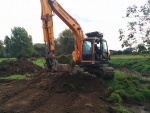
This is a multi-benefit project aimed at improving in channel morphological diversity, reducing the amount of diffuse pollution and sedimentation entering the main river Chelmer. It will also increase the amount of riparian habitat along the River Chelmer and enhance the resilience of the wet woodland.
This project was funded by the Catchment restoration fund, as part of the Essex Healthy headwaters scheme. The earthworks were undertaken in late Summer, early Autumn 2014.
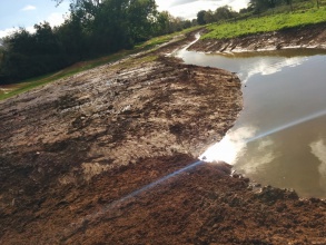
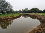
The aims of this project were achieved in the first instance by the creation of a new 280 backwater channel with three settling ponds and a sluice structure. The back channel connects with the river and an existing culvert/drainage point off the nearby main road. The ponds and back channel in the first instance allow for any nitrate and phosphate heavy water coming through the culvert to be settled and filtered. The back channel is also excellent in times of high flows at providing fish refuges, especially for fish fry which are in danger of being washed downstream in flood events. It will also provide an interface between the river and the bank side which will allow some interesting and diverse flora to develop. Finally, by connecting the river with the floodplain it creates additional riparian habitat and has a small but meaningful impact on flooding by increasing storage in the floodplain, outside of Chelmsford.
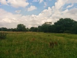
The other aim of the project, namely to increase the resilience of the wet woodland. Was created by installing a sluice at the far end of an existing ditch. Unlike the other sluice this captures rain water and holds it back on the landward side, this has been set at a level that is higher than previous levels and will effect a raise in water off approximately 50 centimeters. The increased water levels have also allowed for additional planting to be undertaken that will extend the water by over half a hectare, there has also been some limited earthworks to spread the water over a wider area.
These works will keep the woodland wetter in the summer months, keeping Bramble under control and allowing a further establishment of the flora normally associated with wet woodlands.
Monitoring surveys and results
There has been a full pre-works survey conducted by Essex Ecological Consultancy service which has established a baseline index of key invertebrates and flora.
Post works it is hoped that this survey can repeated once the site has settled down to allow an accurate summary of the effect of the works. There will also be adhoc surveys of any flora development in time.
Lessons learnt
The sluice at the Wet woodland presented some issues post project, with an unacceptable level of water loss through the frame. This was rectified and is now operating at a normal level. However, some thought must be given to the purpose of the sluice and this should inform the design of the sluice. Holding water back requires a strong but not particularly flexible structure.
Any back channel is relies heavily on the correct levels being established, this relies on understanding the local conditions i.e. any local impoundments this may not be easily recognized so early and often discussions with the EA or the local Drainage board are necessary.
Image gallery
|
Catchment and subcatchmentSelect a catchment/subcatchment
Catchment
Subcatchment
Site
Project background
Cost for project phases
Reasons for river restoration
Measures
MonitoringHydromorphological quality elements
Biological quality elements
Physico-chemical quality elements
Any other monitoring, e.g. social, economic
Monitoring documents
Additional documents and videos
Additional links and references
Supplementary InformationEdit Supplementary Information
| ||||||||||||||||||||||||||||||||||||||||||||||||||||||||||||||||||||||||||||||||||||||||||||||||||||||||||||||||||||||||||||||||||||||||||||||||||||||||||||||||||||||||||||||||||||||||||||||||


