Case study:Bow Brook Living Landscape: Difference between revisions
No edit summary |
No edit summary |
||
| (7 intermediate revisions by 3 users not shown) | |||
| Line 1: | Line 1: | ||
{{Case study status | {{Case study status | ||
|Approval status= | |Approval status=Approved | ||
}} | }} | ||
{{Location | {{Location | ||
| Line 7: | Line 7: | ||
}} | }} | ||
{{Project overview | {{Project overview | ||
|Status= | |Status=Complete | ||
|Themes=Fisheries, Habitat and biodiversity, Land use management - agriculture, Monitoring, Water quality | |Themes=Fisheries, Habitat and biodiversity, Land use management - agriculture, Monitoring, Water quality | ||
|Country=England | |Country=England | ||
| Line 15: | Line 15: | ||
|Contact organisation=Worcestershire Wildlife Trust | |Contact organisation=Worcestershire Wildlife Trust | ||
|Contact organisation url=www.worcswildlifetrust.co.uk/ | |Contact organisation url=www.worcswildlifetrust.co.uk/ | ||
|Partner organisations=Environment Agency | |||
|Multi-site=No | |Multi-site=No | ||
|Project picture=Bow Brook 100m backwater channel Sept 2013.JPG | |Project picture=Bow Brook 100m backwater channel Sept 2013.JPG | ||
| Line 63: | Line 64: | ||
}} | }} | ||
{{Project background}} | {{Project background}} | ||
{{Motivations}} | {{Motivations | ||
|Specific mitigation=Land drainage, Urbanisation, Invasive species, Pollution incident, | |||
|Hydromorphological quality elements=Channel pattern/planform, Quantity & dynamics of flow, Substrate conditions, Width & depth variation, | |||
|Biological quality elements=Fish, Macrophytes and/or phytobenthos: Taxonomic composition, | |||
}} | |||
{{Measures | {{Measures | ||
|Bank and bed modifications measure=Introducing large woody debris, Soft erosion solutions, Bank reprofiling, | |Bank and bed modifications measure=Introducing large woody debris, Soft erosion solutions, Bank reprofiling, Cattle drinkers, | ||
|Floodplain / River corridor=Creation of wetland, Fencing, Tree planting, Pollarding, Control of invasive species, | |Floodplain / River corridor=Creation of wetland, Fencing, Tree planting, Pollarding, Control of invasive species, | ||
|Management interventions=Arable reversion to wildflower meadow, Soil Health Plan | |Management interventions=Arable reversion to wildflower meadow, Soil Health Plan | ||
|Social measures=Landowners advised, Flylife course | |Social measures=Landowners advised, Flylife course | ||
| Line 87: | Line 91: | ||
|Link=www.worcswildlifetrust.co.uk/news/2013/08/13/bow-brook-improved-wildlife | |Link=www.worcswildlifetrust.co.uk/news/2013/08/13/bow-brook-improved-wildlife | ||
|Description=press release | |Description=press release | ||
}} | |||
{{Additional links and references | |||
|Link=www.youtube.com/watch?v=emiVTLlxjxE | |||
|Description=Video summarising the project | |||
}} | }} | ||
{{Additional links and references footer}} | {{Additional links and references footer}} | ||
{{Supplementary Information}} | {{Supplementary Information}} | ||
{{Toggle content end}} | {{Toggle content end}} | ||
Latest revision as of 12:00, 6 June 2017
Project overview
| Status | Complete |
|---|---|
| Project web site | |
| Themes | Fisheries, Habitat and biodiversity, Land use management - agriculture, Monitoring, Water quality |
| Country | England |
| Main contact forename | Lucy |
| Main contact surname | Wood |
| Main contact user ID | User:Lucy_WWT |
| Contact organisation | Worcestershire Wildlife Trust |
| Contact organisation web site | http://www.worcswildlifetrust.co.uk/ |
| Partner organisations | Environment Agency |
| Parent multi-site project | |
| This is a parent project encompassing the following projects |
No |
Project summary
Through the Bow Brook Living Landscape project we are developing a coherent network linked by corridors that can provide benefits for people as well as for biodiversity.
The catchment is largely rural and is intensively farmed and drained. This combined with erosion from cattle and unfenced banks are loading pollutants into the brook. Since the 1960s the town at the headwaters of the brook and many of the villages have increased dramatically in size raising pressures from sewage outfalls.
Farmer meetings have been essential in drawing together the community on topics that are not only of interest to the Wildlife Trust but also those actually working on the land.
The EA approached WWT to work with them in 2011 to help to improve WFD status in Worcestershire.
The Bow Brook is classed as Poor for Phosphate and Moderate for fish. The EA provided funding and support throughout the project.
The capital works on the Bow Brook are split into two categories: firstly to reduce diffuse pollution and second to increase wildlife habitat, particularly for fish. Around 14,725m2 of open water wetland has been created, working on approximately 20% of the main channels length.
Rural diffuse pollution projects across 8 sites include cattle drinkers; fencing key sections and rural sustainable drainage pools.
We have reverted arable fields into wild flower meadows reducing nutrient inputs in the catchment and directly alongside the brook’s banks, channelling the surrounding arable field’s drainage into the pools.
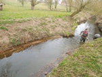
Fish habitat projects are spread across 6 locations including hazel faggot woody debris as deflectors to flush silts from the gravel; reprofiling sections of the dredged banks, to increase bank diversity to the over deepened channel; and the creation of additional braids of channel with deeper resting pools, shallow fringes and online pools.
Monitoring surveys and results
A newly formed relationship with the University of Worcester has created mutual benefits for both parties. A Sonde collects data and the university use this within their courses and final year projects, which we receive a copy of.
Lessons learnt
Image gallery
|
Catchment and subcatchmentSelect a catchment/subcatchment
Catchment
Subcatchment
Site
Project background
Cost for project phases
Reasons for river restoration
Measures
MonitoringHydromorphological quality elements
Biological quality elements
Physico-chemical quality elements
Any other monitoring, e.g. social, economic
Monitoring documents
Additional documents and videos
Additional links and references
Supplementary InformationEdit Supplementary Information
| ||||||||||||||||||||||||||||||||||||||||||||||||||||||||||||||||||||||||||||||||||||||||||||||||||||||||||||||||||||||||||||||||||||||||||||||||||||||||||||||||||||||||||||||||||||||||||||||||||


