Case study:Kentchurch Weir Removal: Difference between revisions
Mattleeson (talk | contribs) No edit summary |
No edit summary |
||
| (19 intermediate revisions by 5 users not shown) | |||
| Line 1: | Line 1: | ||
{{Case study status | {{Case study status | ||
|Approval status= | |Approval status=Approved | ||
}} | }} | ||
{{Location | {{Location | ||
| Line 8: | Line 8: | ||
|Status=Complete | |Status=Complete | ||
|Themes=Habitat and biodiversity | |Themes=Habitat and biodiversity | ||
|Country=England | |Country=England, Wales | ||
|Main contact forename= | |Main contact forename=Peter | ||
|Main contact surname= | |Main contact surname=Gough | ||
|Contact organisation=Natural Resources Wales | |||
|Contact organisation= | |Partner organisations=Atkins, | ||
|Partner organisations= | |||
|Multi-site=No | |Multi-site=No | ||
|Project picture=KENTCHURCHWEIR1.jpg | |Project picture=KENTCHURCHWEIR1.jpg | ||
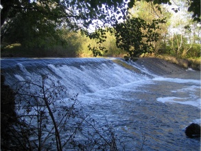
|Picture description=The 2 metre high Kentchurch Weir, prior to removal. Courtesy of Atkins. | |Picture description=The 2 metre high Kentchurch Weir, prior to removal. Courtesy of Atkins. | ||
|Project summary=In 2008, EA Wales and Atkins completed a project to install a fish pass at Osbaston, downstream of Kentchurch Weir - to improve fish passage upstream. However, the 2 metre high Kentchurch Weir posed as a significant and impassable barrier to fish passage further upstream. A £100,000, 18 month-long project was undertaken, beginning in 2008, to remove this structure and open up the upper reaches of the Monnow. | |||
}} | }} | ||
{{Image gallery}} | |||
{{Case study image | |||
|File name=KENTCHURCH PRE.jpg | |||
}} | |||
{{Case study image | |||
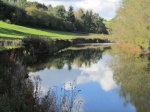
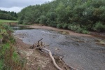
|File name=KENTCHURCH POST.jpg | |||
}} | |||
{{Image gallery end}} | |||
{{Toggle button}} | |||
{{Toggle content start}} | |||
{{Case study subcatchment | {{Case study subcatchment | ||
|Subcatchment=Monnow | |Subcatchment=R Monnow - conf Afon Honddu to conf R Wye | ||
}} | }} | ||
{{Site | {{Site | ||
| Line 26: | Line 37: | ||
|WFD (national) typology=Mid, Medium, Calcareous | |WFD (national) typology=Mid, Medium, Calcareous | ||
|WFD water body name=R Monnow - conf Afon Honddu to conf R Wye | |WFD water body name=R Monnow - conf Afon Honddu to conf R Wye | ||
|Pre-project morphology=High width:depth. Significant backwater upstream of impoundment. | |||
|Heavily modified water body=No | |Heavily modified water body=No | ||
|Protected species present=No | |Protected species present=No | ||
|Invasive species present=No | |Invasive species present=No | ||
}} | }} | ||
{{Project background}} | {{Project background | ||
{{Motivations}} | |Works started=2011/08/01 | ||
{{Measures}} | |Works completed=2012/08/15 | ||
|Total cost category=100 - 500 k€ | |||
|Total1 cost=120 | |||
|Funding sources=UK European Fisheries Fund Operational Programme | |||
}} | |||
{{Motivations | |||
|Biological quality elements=Good ecological status, but weir removal to improve fish passage to upper reaches. Also, to improve habitat for macrophytes and macroinvertebrates. | |||
}} | |||
{{Measures | |||
|Bank and bed modifications measure=Weir removal, Weir modification, | |||
|Floodplain / River corridor=Improving fish migration, | |||
}} | |||
{{Hydromorphological quality elements header}} | {{Hydromorphological quality elements header}} | ||
{{End table}} | {{End table}} | ||
| Line 40: | Line 63: | ||
{{End table}} | {{End table}} | ||
{{Other responses header}} | {{Other responses header}} | ||
{{Other response table row | |||
|Element=Bathymetric Survey | |||
|Monitored before=Yes | |||
|Monitored after=No | |||
|Qualitative monitoring=No | |||
|Quantitative monitoring=Yes | |||
|Control site used=No | |||
}} | |||
{{Other response table row | |||
|Element=Sediment Contamination Assessment | |||
|Monitored before=Yes | |||
|Monitored after=No | |||
|Qualitative monitoring=No | |||
|Quantitative monitoring=Yes | |||
|Control site used=No | |||
}} | |||
{{End table}} | {{End table}} | ||
{{Monitoring documents}} | {{Monitoring documents}} | ||
{{Monitoring documents end}} | {{Monitoring documents end}} | ||
{{Additional Documents}} | {{Additional Documents}} | ||
{{Additional Documents end}} | {{Additional Documents end}} | ||
{{Additional links and references header}} | {{Additional links and references header}} | ||
{{Additional links and references footer}} | {{Additional links and references footer}} | ||
{{Supplementary Information}} | {{Supplementary Information | ||
|Information=Considered to be the largest ever weir removal undertaken in Wales. Removal has allowed 160km of the Monnow catchment to be restored to its natural condition of flow and connectivity. | |||
}} | |||
{{Toggle content end}} | |||
Latest revision as of 14:54, 2 January 2019
Project overview
| Status | Complete |
|---|---|
| Project web site | |
| Themes | Habitat and biodiversity |
| Country | England, Wales |
| Main contact forename | Peter |
| Main contact surname | Gough |
| Main contact user ID | |
| Contact organisation | Natural Resources Wales |
| Contact organisation web site | |
| Partner organisations | Atkins |
| Parent multi-site project | |
| This is a parent project encompassing the following projects |
No |
Project summary
In 2008, EA Wales and Atkins completed a project to install a fish pass at Osbaston, downstream of Kentchurch Weir - to improve fish passage upstream. However, the 2 metre high Kentchurch Weir posed as a significant and impassable barrier to fish passage further upstream. A £100,000, 18 month-long project was undertaken, beginning in 2008, to remove this structure and open up the upper reaches of the Monnow.
Monitoring surveys and results
Lessons learnt
Image gallery
|
Catchment and subcatchmentSelect a catchment/subcatchment
Catchment
Subcatchment
Other case studies in this subcatchment: River Monnow (Going Native)
Site
Project background
Cost for project phases
Reasons for river restoration
Measures
MonitoringHydromorphological quality elements
Biological quality elements
Physico-chemical quality elements
Any other monitoring, e.g. social, economic
Monitoring documents
Additional documents and videos
Additional links and references
Supplementary InformationEdit Supplementary Information Considered to be the largest ever weir removal undertaken in Wales. Removal has allowed 160km of the Monnow catchment to be restored to its natural condition of flow and connectivity.
| ||||||||||||||||||||||||||||||||||||||||||||||||||||||||||||||||||||||||||||||||||||||||||||||||||||||||||||||||||||||||||||||||||||||||||||||||||||||||||||||||||||||||||||||||||||||||||||||||||||||||||||


