Case study:Meades water garden regeneration project: Difference between revisions
No edit summary |
No edit summary |
||
| (10 intermediate revisions by 4 users not shown) | |||
| Line 1: | Line 1: | ||
{{ | {{Case study status | ||
|Approval status= | |Approval status=Approved | ||
}} | }} | ||
{{Location | {{Location | ||
| Line 17: | Line 12: | ||
|Themes=Habitat and biodiversity, Monitoring, Water quality | |Themes=Habitat and biodiversity, Monitoring, Water quality | ||
|Country=England | |Country=England | ||
|Main contact forename= | |Main contact forename=Allen | ||
|Main contact surname= | |Main contact surname=Beechey | ||
|Contact organisation=Chilterns Conservation Board | |||
|Contact organisation= | |Contact organisation url=http://www.chilternsaonb.org/conservation-board.html | ||
|Contact organisation url=www. | |||
|Partner organisations=Chiltern Chalk Streams Project, | |Partner organisations=Chiltern Chalk Streams Project, | ||
|Multi-site=No | |Multi-site=No | ||
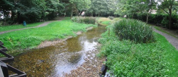
|Project picture=From bridge to upstream.jpg | |Project picture=From bridge to upstream.jpg | ||
|Picture description=Looking upstream at the restored river | |Picture description=Looking upstream at the restored river | ||
|Project summary= | |Project summary=Two weirs were removed and the site allowed to drain. A temporary dam was built at the top of the site and river flow was piped around the working area. Working from the upstream end, a new channel was dug through the accumulated silt following the line of preferential flow. Nicospan was installed to provide support to the new channel sides and to ensure separation of the silt from the gravel infill, which was imported to form the new river bed. It was important to allow at least 500mm of gravel to provide the depth that chalkstream invertebrates require for their life stage. Excavated silt was distributed around the site within the boundary of old ponds. The new channel was tied into the original course of the river which flowed around the back of the island in the lower pond. A low-lying bund was installed in place of the weir to create a wetland feature. Following completion of the river restoration work, new paths were laid in the gardens and an interpretation board installed. | ||
}} | |||
{{Image gallery}} | |||
{{Case study image | |||
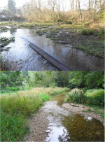
|File name=CS pictDS.png | |||
|Caption=Downstream of the bridge during construction (top) and post-restoration (below) | |||
}} | |||
{{Case study image | |||
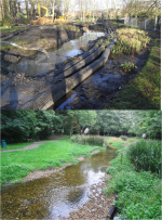
|File name=CS pictUS.png | |||
|Caption=Upstream of the bridge, during construction (top) and post-restoration (below) | |||
}} | |||
{{Case study image | |||
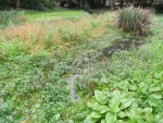
|File name=RIMG3386.JPG | |||
|Caption=Established wildlife upstream | |||
}} | |||
{{Case study image | |||
|File name=2007 03 28 (10).JPG | |||
|Caption=Downstream of the bridge prior to project | |||
}} | |||
{{Case study image | |||
|File name=2007 03 28 (17).JPG | |||
|Caption=Upstream of bridge prior to project | |||
}} | }} | ||
{{Image_gallery_end}} | |||
{{Toggle button}} | |||
{{Toggle content start}} | |||
{{Case_study_subcatchment | {{Case_study_subcatchment | ||
|Subcatchment= | |Subcatchment= | ||
| Line 35: | Line 53: | ||
}} | }} | ||
{{Site | {{Site | ||
|Name= | |Name=Meades Water Garden | ||
|WFD water body code=GB106039029870 | |||
|WFD water body name=Chess | |||
|Pre-project morphology=Single channel, Straight, High width:depth | |||
|WFD water body code= | |Reference morphology=Single channel, Sinuous, Step-pool, Pool-riffle | ||
|Heavily modified water body=Yes | |||
|Site designation=UK - Areas of Outstanding Natural Beauty | |||
|Protected species present=No | |||
|WFD water body name= | |Invasive species present=No | ||
|Dominant hydrology=Groundwater | |||
|Pre-project morphology= | |Dominant substrate=Bedrock, Gravel, | ||
|River corridor land use=Urban | |||
|Reference morphology= | |Average bankfull channel width category=5 - 10 m | ||
|Average bankfull channel depth category=0.5 - 2 m | |||
|Heavily modified water body= | |||
|Site designation= | |||
|Protected species present= | |||
|Invasive species present= | |||
|Dominant hydrology= | |||
|Dominant substrate= | |||
|River corridor land use= | |||
|Average bankfull channel width category= | |||
|Average bankfull channel depth category= | |||
}} | }} | ||
{{ | {{Project background | ||
|Reach length directly affected= | |Reach length directly affected=120 m | ||
|Project started=2007/01/01 | |||
|Works completed=2008/01/01 | |||
|Total cost category=50 - 100 k€ | |||
|Project started= | |Total1 cost=78 k€ | ||
|Works completed= | |||
|Total cost category= | |||
|Total1 cost= | |||
}} | }} | ||
{{Motivations | {{Motivations | ||
| Line 171: | Line 90: | ||
}} | }} | ||
{{Measures | {{Measures | ||
|Bank and bed modifications measure=Planting, Introduction of gravel, | |Bank and bed modifications measure=Planting, Introduction of gravel, Weir removal, | ||
|Floodplain / River corridor= | |Floodplain / River corridor=Creation of wetland, Vegetation removal | ||
|Wider stakeholder / citizen engagement=Public consultation, Information provision, | |Wider stakeholder / citizen engagement=Public consultation, Information provision, | ||
}} | }} | ||
| Line 224: | Line 143: | ||
{{Monitoring_documents}} | {{Monitoring_documents}} | ||
{{Monitoring_documents_end}} | {{Monitoring_documents_end}} | ||
{{Additional_Documents}} | {{Additional_Documents}} | ||
{{Additional_Documents_end}} | {{Additional_Documents_end}} | ||
| Line 274: | Line 171: | ||
}} | }} | ||
{{Case_study_upload}} | {{Case_study_upload}} | ||
{{Toggle content end}} | |||
Latest revision as of 09:27, 2 June 2017
Project overview
| Status | Complete |
|---|---|
| Project web site | |
| Themes | Habitat and biodiversity, Monitoring, Water quality |
| Country | England |
| Main contact forename | Allen |
| Main contact surname | Beechey |
| Main contact user ID | |
| Contact organisation | Chilterns Conservation Board |
| Contact organisation web site | http://http://www.chilternsaonb.org/conservation-board.html |
| Partner organisations | Chiltern Chalk Streams Project |
| Parent multi-site project | |
| This is a parent project encompassing the following projects |
No |
Project summary
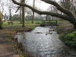
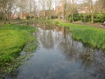
Two weirs were removed and the site allowed to drain. A temporary dam was built at the top of the site and river flow was piped around the working area. Working from the upstream end, a new channel was dug through the accumulated silt following the line of preferential flow. Nicospan was installed to provide support to the new channel sides and to ensure separation of the silt from the gravel infill, which was imported to form the new river bed. It was important to allow at least 500mm of gravel to provide the depth that chalkstream invertebrates require for their life stage. Excavated silt was distributed around the site within the boundary of old ponds. The new channel was tied into the original course of the river which flowed around the back of the island in the lower pond. A low-lying bund was installed in place of the weir to create a wetland feature. Following completion of the river restoration work, new paths were laid in the gardens and an interpretation board installed.
Monitoring surveys and results
Lessons learnt
Image gallery
|
Catchment and subcatchmentSelect a catchment/subcatchment
Catchment
Subcatchment
Site
Project background
Cost for project phases
Reasons for river restoration
Measures
MonitoringHydromorphological quality elements
Biological quality elements
Physico-chemical quality elements
Any other monitoring, e.g. social, economic
Monitoring documents
Additional documents and videos
Additional links and references
Supplementary InformationEdit Supplementary Information
| ||||||||||||||||||||||||||||||||||||||||||||||||||||||||||||||||||||||||||||||||||||||||||||||||||||||||||||||||||||||||||||||||||||||||||||||||||||||||||||||||||||||||||||||||||||||||||||||||||||||||||||||

