Case study:Babingley River at Hillington: Difference between revisions
No edit summary |
No edit summary |
||
| (14 intermediate revisions by 3 users not shown) | |||
| Line 1: | Line 1: | ||
{{Case study status | {{Case study status | ||
|Approval status= | |Approval status=Approved | ||
}} | }} | ||
{{Location | {{Location | ||
| Line 16: | Line 16: | ||
|Project picture=P9040007.JPG | |Project picture=P9040007.JPG | ||
|Picture description=Babingley River at Hillington | |Picture description=Babingley River at Hillington | ||
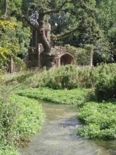
|Project summary=The Babingley River rises from chalk springs above the villages of Flitcham and Hillington in North West Norfolk. The Hillington site is located close to the source and includes an impounded online lake known as the ‘Broadwater’. The aim of the project was to revert 420m of lake back to river in order to improve the water quality, remove barriers to fish and eel passage and provide additional spawning habitat for wild brown trout (Salmo trutta). | |Project summary=The Babingley River rises from chalk springs above the villages of Flitcham and Hillington in North West Norfolk. The Hillington site is located close to the source and includes an impounded online lake known as the ‘Broadwater’. The aim of the project was to revert 420m of lake back to river in order to improve the water quality, remove barriers to fish and eel passage and provide additional spawning habitat for wild brown trout (Salmo trutta). Sluice boards (1.15m high) at the downstream extent of the site were removed resulting in the lowering of the water level. This concentrated the flow and enabled the river to cut a new channel that would be more sustainable in the long term. Deflectors were installed in the downstream extent of the reach (where gradient and flow velocities were less) to concentrate flow further and enable the river to continue cutting a channel into the newly exposed silt. Improvements in water quality as a result of the work created better habitat and spawning grounds and the removal of the sluice boards allowed free passage for fish to access these areas. However, lowering the water level created a barrier at the upstream weir, which had to be addressed using a pool and traverse fish easement created with rock rolls. | ||
}} | |||
{{Image gallery}} | |||
{{Case study image | |||
|File name=Babingley Aug2006pre.JPG | |||
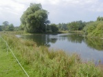
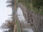
|Caption=Before Works - April 2006 | |||
}} | |||
{{Case study image | |||
|File name=Babingley August2007culvert.JPG | |||
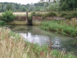
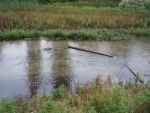
|Caption=Culvert and sluice boards - Aug 2007 | |||
}} | |||
{{Case study image | |||
|File name=Babingley Aug2007Rockrolls.JPG | |||
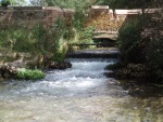
|Caption=Pool and traverse fish pass - Aug 2007 | |||
}} | |||
{{Case study image | |||
|File name=Babingley Feb2007Deflectors.JPG | |||
|Caption=Deflectors used to concentrate flow - Feb 2007 | |||
}} | |||
{{Case study image | |||
|File name=Babingley Aug2007Deflectors.JPG | |||
|Caption=Deflector boards after 6 months - Aug 2007 | |||
}} | |||
{{Case study image | |||
|File name=Babingley Feb2007trout.JPG | |||
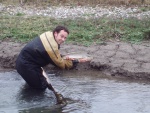
|Caption=Brown trout present - Feb 2007 | |||
}} | |||
{{Case study image | |||
|File name=Babingley Sept2007post.JPG | |||
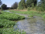
|Caption=Post Works - Sept 2007 | |||
}} | |||
{{Image gallery end}} | |||
{{Toggle button}} | |||
{{Toggle content start}} | |||
{{Case study subcatchment | |||
|Subcatchment=Babingley River | |||
}} | }} | ||
{{Site | {{Site | ||
|Name=Babingley River at Hillington | |Name=Babingley River at Hillington | ||
| Line 37: | Line 71: | ||
|Funding sources=Total cost: €695.00. Environment Agency and Hillington Fly Fishing Club | |Funding sources=Total cost: €695.00. Environment Agency and Hillington Fly Fishing Club | ||
}} | }} | ||
{{Motivations}} | {{Motivations | ||
{{Measures}} | |Specific mitigation=Barriers to fish migration, Impoundments (not hydropower), | ||
|Hydromorphological quality elements=Channel pattern/planform, | |||
|Biological quality elements=Fish, | |||
}} | |||
{{Measures | |||
|Bank and bed modifications measure=Creation of wooden deflectors, Habitat diversification, Cleaning of spawning gravels | |||
|Floodplain / River corridor=Riparian planting, | |||
|Planform / Channel pattern=Channel narrowing, Adding sinuosity, Removal of sluice gates, Creation of fish passes, Channel naturalisation, | |||
}} | |||
{{Hydromorphological quality elements header}} | {{Hydromorphological quality elements header}} | ||
{{End table}} | {{End table}} | ||
{{Biological quality elements header}} | {{Biological quality elements header}} | ||
{{Biological quality element table row | |||
|Element=Fish: Abundance | |||
|Monitored before=Yes | |||
|Monitored after=Yes | |||
|Qualitative monitoring=No | |||
|Quantitative monitoring=Yes | |||
|Control site used=No | |||
|Result=Improvement | |||
}} | |||
{{Biological quality element table row | |||
|Element=Invertebrates: Taxonomic composition | |||
|Monitored before=Yes | |||
|Monitored after=Yes | |||
|Qualitative monitoring=Yes | |||
|Quantitative monitoring=No | |||
|Control site used=No | |||
|Result=Improvement | |||
}} | |||
{{Biological quality element table row | |||
|Element=Macrophytes | |||
|Monitored before=No | |||
|Monitored after=Yes | |||
|Qualitative monitoring=No | |||
|Quantitative monitoring=Yes | |||
|Control site used=No | |||
|Result=Improvement | |||
}} | |||
{{End table}} | {{End table}} | ||
{{Physico-chemical quality elements header}} | {{Physico-chemical quality elements header}} | ||
| Line 49: | Line 118: | ||
{{Monitoring documents}} | {{Monitoring documents}} | ||
{{Monitoring documents end}} | {{Monitoring documents end}} | ||
{{Additional Documents}} | {{Additional Documents}} | ||
{{Additional Documents end}} | {{Additional Documents end}} | ||
{{Additional links and references header}} | {{Additional links and references header}} | ||
{{Additional links and references | |||
|Link=www.norfolkriverstrust.org/2012/04/reclaimed-river.html | |||
|Description=Norfolk Rivers Trust Article | |||
}} | |||
{{Additional links and references footer}} | {{Additional links and references footer}} | ||
{{Supplementary Information}} | {{Supplementary Information}} | ||
{{Toggle content end}} | |||
Latest revision as of 10:00, 5 June 2017
Project overview
| Status | Complete |
|---|---|
| Project web site | |
| Themes | Fisheries |
| Country | England |
| Main contact forename | Andy |
| Main contact surname | Sadler |
| Main contact user ID | |
| Contact organisation | Environment Agency |
| Contact organisation web site | http://http://www.environment-agency.gov.uk/ |
| Partner organisations | |
| Parent multi-site project | |
| This is a parent project encompassing the following projects |
No |
Project summary
The Babingley River rises from chalk springs above the villages of Flitcham and Hillington in North West Norfolk. The Hillington site is located close to the source and includes an impounded online lake known as the ‘Broadwater’. The aim of the project was to revert 420m of lake back to river in order to improve the water quality, remove barriers to fish and eel passage and provide additional spawning habitat for wild brown trout (Salmo trutta). Sluice boards (1.15m high) at the downstream extent of the site were removed resulting in the lowering of the water level. This concentrated the flow and enabled the river to cut a new channel that would be more sustainable in the long term. Deflectors were installed in the downstream extent of the reach (where gradient and flow velocities were less) to concentrate flow further and enable the river to continue cutting a channel into the newly exposed silt. Improvements in water quality as a result of the work created better habitat and spawning grounds and the removal of the sluice boards allowed free passage for fish to access these areas. However, lowering the water level created a barrier at the upstream weir, which had to be addressed using a pool and traverse fish easement created with rock rolls.
Monitoring surveys and results
Lessons learnt
Image gallery
|
Catchment and subcatchmentSelect a catchment/subcatchment
Catchment
Subcatchment
Other case studies in this subcatchment: Nine Chalk Rivers Project - Babingley Catchment
Site
Project background
Cost for project phases
Reasons for river restoration
Measures
MonitoringHydromorphological quality elements
Biological quality elements
Physico-chemical quality elements
Any other monitoring, e.g. social, economic
Monitoring documents
Additional documents and videos
Additional links and references
Supplementary InformationEdit Supplementary Information
| |||||||||||||||||||||||||||||||||||||||||||||||||||||||||||||||||||||||||||||||||||||||||||||||||||||||||||||||||||||||||||||||||||||||||||||||||||||||||||||||||||||||||||||||||||||||||||||||||||||||||||||||||||||||||||||||

