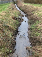
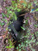
Case study:Pow Beck Water Quality Improvement Programme: Difference between revisions
Jump to navigation
Jump to search
(XML import) |
No edit summary |
||
| (One intermediate revision by one other user not shown) | |||
| Line 1: | Line 1: | ||
{{ | {{Case study status | ||
|Approval status= | |Approval status=Draft | ||
}} | }} | ||
{{Location | {{Location | ||
|Location= | |Location=54.496016,-3.5858192 | ||
}} | }} | ||
{{ | {{Project overview | ||
|Status= | |Status=Complete | ||
|Country=England | |||
|Main contact forename=Environment | |||
|Main contact surname=Agency | |||
|Contact organisation=Environment Agency | |||
|Multi-site=No | |||
|Project picture=Pow Beck 2.jpg | |||
|Country= | |||
|Main contact forename= | |||
|Main contact surname= | |||
|Contact organisation= | |||
|Multi-site= | |||
|Project picture= | |||
}} | }} | ||
{{ | {{Image gallery}} | ||
{{ | {{Case study image | ||
|File name=Pow Beck 2.jpg | |||
| | |||
}} | }} | ||
{{ | {{Case study image | ||
| | |File name=Pow Beck 1.jpg | ||
}} | }} | ||
{{ | {{Image gallery end}} | ||
{{Toggle button}} | |||
{{Toggle content start}} | |||
{{Case study subcatchment | |||
|Subcatchment=River Eden | |||
| | |||
}} | }} | ||
{{ | {{Site}} | ||
{{Project background}} | |||
{{Motivations}} | |||
{{Measures}} | |||
{{Hydromorphological quality elements header}} | |||
{{End table}} | |||
{{Biological quality elements header}} | |||
{{End table}} | |||
{{Physico-chemical quality elements header}} | |||
{{End table}} | |||
{{Other responses header}} | |||
{{End table}} | |||
{{Monitoring documents}} | |||
}} | {{Monitoring documents end}} | ||
{{Measures | {{Additional Documents}} | ||
{{Additional Documents end}} | |||
{{Additional links and references header}} | |||
{{Additional links and references footer}} | |||
{{Supplementary Information}} | |||
{{Toggle content end}} | |||
}} | |||
{{ | |||
{{ | |||
{{ | |||
{{ | |||
{{Physico- | |||
{{ | |||
{{ | |||
{{ | |||
{{ | |||
{{ | |||
{{ | |||
{{ | |||
{{ | |||
{{ | |||
{{ | |||
}} | |||
{{ | |||
{{Case_study_upload}} | {{Case_study_upload}} | ||
Latest revision as of 15:52, 1 September 2022
This case study is pending approval by a RiverWiki administrator.
Location: 54° 29' 45.66" N, 3° 35' 8.95" W
Left click to look around in the map, and use the wheel of your mouse to zoom in and out.
Project overview
| Status | Complete |
|---|---|
| Project web site | |
| Themes | |
| Country | England |
| Main contact forename | Environment |
| Main contact surname | Agency |
| Main contact user ID | |
| Contact organisation | Environment Agency |
| Contact organisation web site | |
| Partner organisations | |
| Parent multi-site project | |
| This is a parent project encompassing the following projects |
No |
Project summary
This case study hasn’t got any project summary, you can add some by editing the project overview.
Monitoring surveys and results
This case study hasn’t got any Monitoring survey and results, you can add some by editing the project overview.
Lessons learnt
This case study hasn’t got any lessons learnt, you can add some by editing the project overview.
Image gallery
|
Catchment and subcatchmentSelect a catchment/subcatchment
Catchment
Subcatchment
Other case studies in this subcatchment: Eden crayfish eDNA project, Farming with water - Ullswater Catchment, Scales Farm, The Lowther catchment water vole project
Site
Project background
Cost for project phases
Reasons for river restoration
Measures
MonitoringHydromorphological quality elements
Biological quality elements
Physico-chemical quality elements
Any other monitoring, e.g. social, economic
Monitoring documents
Additional documents and videos
Additional links and references
Supplementary InformationEdit Supplementary Information
| ||||||||||||||||||||||||||||||||||||||||||||||||||||||||||||||||||||||||||||||||||||||||||||||||||||||||||||||||||||||||||||||||||||||||||||||||||||||||||||||||||||||||||||||||||||||||||||||||||||||||


