Case study:River Keekle Restoration: Difference between revisions
No edit summary |
No edit summary |
||
| (5 intermediate revisions by 3 users not shown) | |||
| Line 1: | Line 1: | ||
{{Case study status | {{Case study status | ||
|Approval status= | |Approval status=Approved | ||
}} | |||
{{Location | |||
|Location=54.54628601630211, -3.5414885804057095 | |||
}} | }} | ||
{{Project overview | {{Project overview | ||
|Status=Complete | |Status=Complete | ||
| Line 15: | Line 17: | ||
|Partner organisations=Environment Agency, Natural England, AECOM, university of salford | |Partner organisations=Environment Agency, Natural England, AECOM, university of salford | ||
|Multi-site=No | |Multi-site=No | ||
| | |Project picture=20210318 121206.jpg | ||
|Project summary=The River Keekle is a tributary of the River Ehen located around 3 kilometres east of Whitehaven, in West Cumbria. The river was heavily modified until the 1990s due to nearby coal mining. After mine spoil was buried across the site the river was lined with an HDPE plastic liner. This liner was failing and heavily degraded, posing a flood risk and potential catastrophic contamination issue for the Keekle, as well as the River Ehen which is a Site of Special Scientific Interest and a Special Area of Conservation. Research by the University of Salford showed the liner had been shedding 500kg of plastic particles per year since its installation. | |Project summary=The River Keekle is a tributary of the River Ehen located around 3 kilometres east of Whitehaven, in West Cumbria. The river was heavily modified until the 1990s due to nearby coal mining. After mine spoil was buried across the site the river was lined with an HDPE plastic liner. This liner was failing and heavily degraded, posing a flood risk and potential catastrophic contamination issue for the Keekle, as well as the River Ehen which is a Site of Special Scientific Interest and a Special Area of Conservation. Research by the University of Salford showed the liner had been shedding 500kg of plastic particles per year since its installation. | ||
There was also concern that the river would vertically erode through the clay cap installed below the liner and expose ground water potentially mixed with mine waste that was buried in the 1990s, allowing heavy metals and chemicals to leach into the Keekle and further downstream. Whilst all of the EA’s sampling of water quality currently proved there was no contamination across the site, if nothing was done to stop erosion, there was a real possibility of the Keekle exposing mine waste in the future. | There was also concern that the river would vertically erode through the clay cap installed below the liner and expose ground water potentially mixed with mine waste that was buried in the 1990s, allowing heavy metals and chemicals to leach into the Keekle and further downstream. Whilst all of the EA’s sampling of water quality currently proved there was no contamination across the site, if nothing was done to stop erosion, there was a real possibility of the Keekle exposing mine waste in the future. | ||
The Upper Keekle was also failing under the Water Framework Directive classification as a habitat for fish due to mining-related modifications. The modifications include the liner, bed-check weirs that washed out during floods in the 1990s, erratic boulder locations and areas where the plastic has broken up, creating barriers to natural fish migration. | The Upper Keekle was also failing under the Water Framework Directive classification as a habitat for fish due to mining-related modifications. The modifications include the liner, bed-check weirs that washed out during floods in the 1990s, erratic boulder locations and areas where the plastic has broken up, creating barriers to natural fish migration. | ||
This project, over a two-year period (2019-2020) removed the entire extent of plastic lining, replacing with boulders, cobbles and gravels to naturalise the river. A total of 180 tonnes of plastic was eventually removed and recycled, whilst around 16,000 tonnes of stones were imported into the site and strategically placed throughout the 2.5km expanse of restored river. | This project, over a two-year period (2019-2020) removed the entire extent of plastic lining, replacing with boulders, cobbles and gravels to naturalise the river. A total of 180 tonnes of plastic was eventually removed and recycled, whilst around 16,000 tonnes of stones were imported into the site and strategically placed throughout the 2.5km expanse of restored river. | ||
| Line 106: | Line 111: | ||
|Average channel gradient category=0.001 - 0.01 | |Average channel gradient category=0.001 - 0.01 | ||
}} | }} | ||
{{Project background}} | {{Project background | ||
|Reach length directly affected=2520 | |||
|Project started=04/12/2017 | |||
|Works started=2019/05/13 | |||
|Works completed=2020/09/22 | |||
|Project completed=2021/09/03 | |||
|Total1 cost=1515000 | |||
|Funding sources=Water Environment Fund, Environment Agency, | |||
}} | |||
{{Motivations | {{Motivations | ||
|Specific mitigation=Barriers to fish migration, | |Specific mitigation=Barriers to fish migration, | ||
| Line 123: | Line 136: | ||
{{Monitoring documents end}} | {{Monitoring documents end}} | ||
{{Additional Documents}} | {{Additional Documents}} | ||
{{Case study documents | |||
|File name=RDPE Socio-Economic Schemes Case Study Booklet - WEG.pdf | |||
}} | |||
{{Additional Documents end}} | {{Additional Documents end}} | ||
{{Additional links and references header}} | {{Additional links and references header}} | ||
Latest revision as of 13:29, 4 August 2022
Project overview
| Status | Complete |
|---|---|
| Project web site | http://westcumbriariverstrust.org/projects/keekle |
| Themes | Environmental flows and water resources, Fisheries, Habitat and biodiversity, Hydromorphology, Monitoring, Social benefits, Water quality |
| Country | England |
| Main contact forename | Luke |
| Main contact surname | Bryant |
| Main contact user ID | User:WCRT |
| Contact organisation | West Cumbria Rivers Trust |
| Contact organisation web site | http://westcumbriariverstrust.org/ |
| Partner organisations | Environment Agency, Natural England, AECOM, university of salford |
| Parent multi-site project | |
| This is a parent project encompassing the following projects |
No |
Project summary
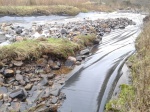
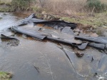
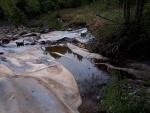
The River Keekle is a tributary of the River Ehen located around 3 kilometres east of Whitehaven, in West Cumbria. The river was heavily modified until the 1990s due to nearby coal mining. After mine spoil was buried across the site the river was lined with an HDPE plastic liner. This liner was failing and heavily degraded, posing a flood risk and potential catastrophic contamination issue for the Keekle, as well as the River Ehen which is a Site of Special Scientific Interest and a Special Area of Conservation. Research by the University of Salford showed the liner had been shedding 500kg of plastic particles per year since its installation.
There was also concern that the river would vertically erode through the clay cap installed below the liner and expose ground water potentially mixed with mine waste that was buried in the 1990s, allowing heavy metals and chemicals to leach into the Keekle and further downstream. Whilst all of the EA’s sampling of water quality currently proved there was no contamination across the site, if nothing was done to stop erosion, there was a real possibility of the Keekle exposing mine waste in the future.
The Upper Keekle was also failing under the Water Framework Directive classification as a habitat for fish due to mining-related modifications. The modifications include the liner, bed-check weirs that washed out during floods in the 1990s, erratic boulder locations and areas where the plastic has broken up, creating barriers to natural fish migration.
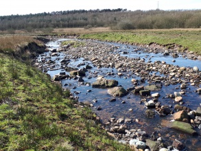
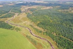
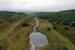
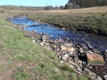
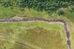
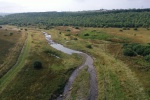
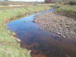
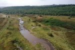
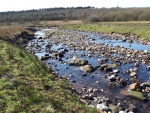
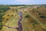
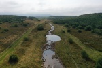
This project, over a two-year period (2019-2020) removed the entire extent of plastic lining, replacing with boulders, cobbles and gravels to naturalise the river. A total of 180 tonnes of plastic was eventually removed and recycled, whilst around 16,000 tonnes of stones were imported into the site and strategically placed throughout the 2.5km expanse of restored river.
Monitoring surveys and results
Lessons learnt
Image gallery
|
Catchment and subcatchmentSelect a catchment/subcatchment
Catchment
Subcatchment
Site
Project background
Cost for project phases
Reasons for river restoration
Measures
MonitoringHydromorphological quality elements
Biological quality elements
Physico-chemical quality elements
Any other monitoring, e.g. social, economic
Monitoring documents
Additional documents and videos
Additional links and references
Supplementary InformationEdit Supplementary Information
| ||||||||||||||||||||||||||||||||||||||||||||||||||||||||||||||||||||||||||||||||||||||||||||||||||||||||||||||||||||||||||||||||||||||||||||||||||||||||||||||||||||||||||||||||||||||||||||||||||||||||

