Case study:Albany Park: Difference between revisions
No edit summary |
No edit summary |
||
| Line 32: | Line 32: | ||
{{Image gallery}} | {{Image gallery}} | ||
{{Case study image | {{Case study image | ||
|File name=P03 Albany drone during construction | |File name=P03 Albany drone during construction.jpg | ||
|Caption=Drone Photograph during early phase of construction | |Caption=Drone Photograph during early phase of construction | ||
}} | }} | ||
{{Case study image | {{Case study image | ||
|File name=Albany downstream river breakthrough (looking upstream).JPG | |File name=P04 Albany downstream river breakthrough (looking upstream).JPG | ||
|Caption=Breaking back into Turkey Brook at the downstream end, looking upstream. | |||
}} | }} | ||
{{Case study image | {{Case study image | ||
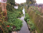
|File name=Pre-Restoration.jpeg | |File name=Pre-Restoration.jpeg | ||
|Caption=The confined concrete channel pre-restoration. | |||
}} | }} | ||
{{Case study image | {{Case study image | ||
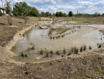
|File name=During construction.jpeg | |File name=During construction.jpeg | ||
|Caption=During construction. Note the extremely gravelly ground through which the channel was created. | |||
}} | }} | ||
{{Case study image | {{Case study image | ||
Revision as of 16:39, 27 July 2022
Project overview
| Status | Complete |
|---|---|
| Project web site | |
| Themes | Environmental flows and water resources, Fisheries, Flood risk management, Habitat and biodiversity, Hydromorphology, Social benefits, Spatial planning, Urban |
| Country | England |
| Main contact forename | Matilda |
| Main contact surname | Biddulph |
| Main contact user ID | User:mbiddulph |
| Contact organisation | Environment Agency |
| Contact organisation web site | http://www.gov.uk/government/organisations/environment-agency |
| Partner organisations | London Borough of Enfield |
| Parent multi-site project | |
| This is a parent project encompassing the following projects |
No |
Project summary
A partnership project between London Borough of Enfield (LBE) and the Environment Agency (EA; Biodiversity & Geomorphology team from Hertfordshire and North London Area). Funded by LBE, EA and the Greater London Authority (GLA). The environmental and flood risk benefits allowed for funding, and the project came to approximately £1.5million.
The Turkey Brook is a medium sized, clay-based catchment flowing initially through rural grassland into a dense urban area of London, before meeting the River Lee in Enfield. It is failing under the Water Framework Directive for: macrophytes and phytobenthos, phosphate, and drought/low flows, and hydromorphology. The river was confined in a steep sided concrete channel along the edge of the park, with very little biodiversity, habitat or connection with groundwater. The general public often did not even know it was there, or if they did they regarded it as an open sewer.
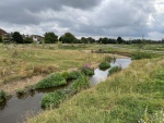
The Albany Park Restoration Project aimed to restore 400m of the Turkey Brook, by breaking it out of concrete and creating a natural, sinuous river through the park. The river now flows through a wide, shallow river corridor made up primarily of the Kempton Park Gravel Member, which allows the channel to reform and reshape itself during high flows until it reaches an equilibrium. The urban, flashy nature of the catchment means that intensive geomorphological work is achieved during each high flow event.
The river is now connected laterally with it's floodplain and riparian zone, and vertically with the groundwater and a hyporheic zone. The natural cross section and improved connectivity has improved the Turkey Brook's resilience to low flows, and its ability to store water and attenuate high flows. The constructed wetlands and SuDs features around the park has hopefully also improved water quality, but ongoing monitoring will determine the success of this.
The river is now a valuable public amenity in an otherwise heavily urban area, and provides an educational resource for local schools.
Monitoring surveys and results
As the project was completed in the Summer of 2021, monitoring is still on going. Invertebrates, macrophytes, fish and water quality will be monitored before and after for a number of years, alongside morph surveys with accompanying drone footages to show the change in channel shape over time.
Lessons learnt
The project was severely delayed due to a combination of Covid-19 and wet weather, there were also issues with securing planning permission due to the large number of stakeholders involved.
Image gallery
|
Catchment and subcatchmentSelect a catchment/subcatchment
Catchment
Subcatchment
Site
Project background
Cost for project phases
Reasons for river restoration
Measures
MonitoringHydromorphological quality elements
Biological quality elements
Physico-chemical quality elements
Any other monitoring, e.g. social, economic
Monitoring documents
Additional documents and videos
Additional links and references
Supplementary InformationEdit Supplementary Information
| ||||||||||||||||||||||||||||||||||||||||||||||||||||||||||||||||||||||||||||||||||||||||||||||||||||||||||||||||||||||||||||||||||||||||||||||||||||||||||||||||||||||||||||||||||||||||||||||||||||||||


