Case study:Farming For Water: Difference between revisions
SevernTrent (talk | contribs) No edit summary |
SevernTrent (talk | contribs) No edit summary |
||
| Line 61: | Line 61: | ||
{{Case study image | {{Case study image | ||
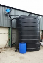
|File name=Rainwater harvesting.jpg | |File name=Rainwater harvesting.jpg | ||
}} | |||
{{Case study image | |||
|File name=Cover crop field 1 100918.jpg | |||
}} | }} | ||
{{Image gallery end}} | {{Image gallery end}} | ||
Latest revision as of 10:25, 14 February 2019
This case study is pending approval by a RiverWiki administrator.
Project overview
| Status | In progress |
|---|---|
| Project web site | http://www.stwater.co.uk/about-us/environment/catchment-management/farm-to-tap/ |
| Themes | Land use management - agriculture, Water quality |
| Country | England |
| Main contact forename | Jodie |
| Main contact surname | Rettino |
| Main contact user ID | User:SevernTrent |
| Contact organisation | Severn Trent Water |
| Contact organisation web site | http://www.stwater.co.uk/about-us/environment/catchment-management/farm-to-tap/ |
| Partner organisations | |
| Parent multi-site project | |
| This is a parent project encompassing the following projects |
No |
Project summary
Farming for Water (F4W) is designed to help reduce diffuse water pollution from agricultural practices, however our work has multiple benefits for the wider environment.
Farming for Water is built up of the following schemes:
• STEPS (Severn Trent Environmental Protection Scheme) • Farm to Tap • Pesticide Management - training, amnesty and machine calibration clinics • Specialised advice visits • Great Farm Challenge
The programme commenced in 2015 and forms part of a 25 year programme of work. We have a team of 7 internal Agricultural Advisors and 12 partnership Agricultural Advisors delivering F4W, across 27 catchments. The Agricultural Advisors engage with farmers through one to one visits, workshops, demonstrations, training, and specialised visits.
Our main schemes are STEPS and Farm to Tap. STEPS offers grants to farmers to undertake works which will help reduce diffuse pollution. There are a wide variety of grants and options available to choose from; which are designed to deliver reduced run off of pesticides, nutrients, and sediment to water courses. Many of the grant options require specialist visit and we are the first water company to partner with NE’s Farm Advice Framework contract. This allows us to offer tailored farm advice visits through an established framework of approved technical expert contractors.
STEPS pays a fixed rate grant per item up to a maximum of £5000 per year. The grant price represents an estimated 50% of the total cost of a capital or land management items. The grants window is open annually from January to March. The Farm to Tap scheme is available to arable farmers within our priority catchments. The scheme has run in its current form from 2016. It is run annually from September to December each year during the high risk pesticide run-off period. Farm to Tap rewards farmers for producing cleaner run off from their land and improving water quality downstream of their farm. Initially trialled from 2012 – 2015, it is one of the first water company payments for ecosystem services (PES) schemes with farmers providing us with an ecological service. This is in contrast to paying farmers to adopt specific mitigation methods on an individual farm basis. The approach acknowledges that co-ordinated action is needed across the catchment to see improvements in water quality, and that by stimulating outcomes rather than actions, land owners and farmers may take greater ownership of water quality issues.
Monitoring surveys and results
To evaluate the success of Farming for Water (F4W) we monitor/record:
• Number of farms engaged • Farmer feedback • Independent audits – 10% of engagement audited each year by independent consultants • Number of STEPS items taken up and their resulting pollution load reduction • Soil monitoring for nitrogen at 22 sites • In-catchment spot water quality monitoring – 96 sample locations, 12 samples taken per year • Monthly water treatment works (WTWs) abstraction points • Fortnightly metaldehyde monitoring (September – December) at 200 locations.
Enough data has been collected to evaluate the effectiveness of engagement with farmers, and the persuasiveness of incentives to change farming practice. Several WTWs have seen fewer pesticide exceedances since the start of F4W, but whether these improvements are due to the catchment schemes or natural variations is uncertain at this stage. Although the signs are encouraging, it is likely to take at least five more years of monitoring to be able to say with confidence whether F4W has been successful in consistently reducing peak pesticide concentrations.
Lessons learnt
1. Developing our schemes to enable us to cater for, and be flexible to, an extensive range of farms has been important for the success of F4W. Carrying out farmer feedback surveys and independent annual audits has allowed us to continually learn and adapt our schemes to meet farmer needs and expectations.
2. Catchment management is a long term solution in terms of water quality improvements, especially in groundwater catchments where travel times can be 10’s of years. We have needed to develop a way of monitoring the progress of the schemes to ensure we meet our long term water quality targets.
3. The success of our schemes and high interest from farmers meant that we needed to increase the number of Agricultural Advisors in our catchments. At the start of 2015 we had a ratio of 1 Advisor to 333 farmers. From January 2018 we recruited more partnership advisors which now gives us a ratio of 1 Advisor to 210 farmers.
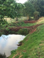
Image gallery
|
Catchment and subcatchmentSelect a catchment/subcatchment
Catchment
Subcatchment
Site
Project background
Cost for project phases
Reasons for river restoration
Measures
MonitoringHydromorphological quality elements
Biological quality elements
Physico-chemical quality elements
Any other monitoring, e.g. social, economic
Monitoring documents
Additional documents and videos
Additional links and references
Supplementary InformationEdit Supplementary Information
| ||||||||||||||||||||||||||||||||||||||||||||||||||||||||||||||||||||||||||||||||||||||||||||||||||||||||||||||||||||||||||||||||||||||||||||||||||||||||||||||||||||||||||||||||||||||||||||||||||||||||||||||


