Case study:River Little Ouse at Thetford: Difference between revisions
No edit summary |
No edit summary |
||
| (8 intermediate revisions by 5 users not shown) | |||
| Line 6: | Line 6: | ||
}} | }} | ||
{{Project overview | {{Project overview | ||
|Status= | |Status=Complete | ||
|Themes=Flood risk management, Habitat and biodiversity | |Themes=Flood risk management, Habitat and biodiversity | ||
|Country=England | |Country=England | ||
| Line 21: | Line 21: | ||
Further remediation works are planned for September 2013 and will consist of the creation of 'living revetments'. The approximate cost of this additional work is £6,000. | Further remediation works are planned for September 2013 and will consist of the creation of 'living revetments'. The approximate cost of this additional work is £6,000. | ||
}} | }} | ||
{{Case study subcatchment}} | {{Image gallery}} | ||
{{Case study image | |||
|File name=Meanders reopened Little Ouse.jpg | |||
|Caption=Reopening the meanders | |||
}} | |||
{{Case study image | |||
|File name=Breach 2002.jpg | |||
|Caption=Breach of meanders - 2002 | |||
}} | |||
{{Case study image | |||
|File name=Clay bank 2002.JPG | |||
|Caption=Bank reinforcement - Oct 2003 | |||
}} | |||
{{Case study image | |||
|File name=Clay bank breach 2004.JPG | |||
|Caption=Breach of reinforced bank - March 2004 | |||
}} | |||
{{Case study image | |||
|File name=Vegetated banks Dec 2005.jpg | |||
|Caption=Pre-seeded coir matting - Dec 2005 | |||
}} | |||
{{Case study image | |||
|File name=Bank erosion April 2008.JPG | |||
|Caption=Erosion of coir matting - April 2008 | |||
}} | |||
{{Image gallery end}} | |||
{{Toggle button}} | |||
{{Toggle content start}} | |||
{{Case study subcatchment | |||
|Subcatchment=Little Ouse River | |||
}} | |||
{{Site | {{Site | ||
|Name=River Little Ouse at Thetford | |Name=River Little Ouse at Thetford | ||
|WFD water body code=GB105033043090 | |WFD water body code=GB105033043090 | ||
|WFD water body name=Little Ouse | |||
|Pre-project morphology=Artificial channel, Straightened, trapezoidal | |Pre-project morphology=Artificial channel, Straightened, trapezoidal | ||
|Reference morphology=Sinuous meander | |Reference morphology=Sinuous meander | ||
| Line 31: | Line 63: | ||
|Invasive species present=No | |Invasive species present=No | ||
|Species=Wading birds (e.g. Lapwing) | |Species=Wading birds (e.g. Lapwing) | ||
|Dominant substrate=Gravel | |Dominant substrate=Gravel | ||
|River corridor land use=Agriculture (arable) | |River corridor land use=Agriculture (arable) | ||
}} | }} | ||
| Line 48: | Line 80: | ||
}} | }} | ||
{{Measures | {{Measures | ||
|Bank and bed modifications measure=Creation of pools and riffles, | |Bank and bed modifications measure=Creation of pools and riffles, | ||
|Floodplain / River corridor=Creation of | |Floodplain / River corridor=Creation of backwaters, Habitat creation, Habitat restoration, Creation of pond, | ||
|Planform / Channel pattern= | |Planform / Channel pattern=Reconnection of cutoff meander, | ||
}} | }} | ||
{{Hydromorphological quality elements header}} | {{Hydromorphological quality elements header}} | ||
| Line 88: | Line 120: | ||
{{Monitoring documents}} | {{Monitoring documents}} | ||
{{Monitoring documents end}} | {{Monitoring documents end}} | ||
{{Additional Documents}} | {{Additional Documents}} | ||
{{Additional Documents end}} | {{Additional Documents end}} | ||
| Line 123: | Line 130: | ||
{{Additional links and references footer}} | {{Additional links and references footer}} | ||
{{Supplementary Information}} | {{Supplementary Information}} | ||
{{Toggle content end}} | |||
Latest revision as of 16:52, 2 January 2019
Project overview
| Status | Complete |
|---|---|
| Project web site | |
| Themes | Flood risk management, Habitat and biodiversity |
| Country | England |
| Main contact forename | Chris |
| Main contact surname | Gregory |
| Main contact user ID | |
| Contact organisation | British Trust for Ornithology |
| Contact organisation web site | http://www.bto.org/ |
| Partner organisations | |
| Parent multi-site project | |
| This is a parent project encompassing the following projects |
No |
Project summary
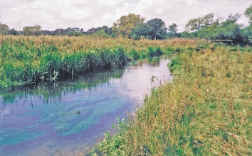
In 1991 the site and adjacent land were purchased by the BTO to create a wetland bird reserve. The Little Ouse had previously been straightened and flowed in a trapezoidal channel. In-stream habitat was poor, macrophytes were confined mainly to the shallow margins and the substrate was dominated by sand with some silt and gravel.
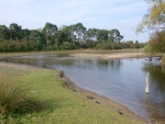
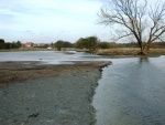
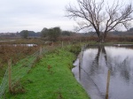
The Environment Agency were approached to assist with restoring flows to the original, meandering course which remained as a damp depression. By restoring flows to the old channel 900m of diverse river habitat with varied morphology and a connection to the floodplain was gained.
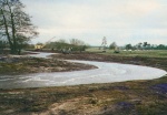
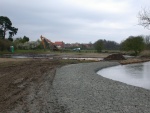
Problems have been experienced with the breaching of several banks at meanders and the development of permanently ponded areas (the original design was aimed at encouraging seasonal inundation to create suitable nesting habitats for waders such as lapwing). Several attempts have been made to repair these breaches with techniques such as blue clay banks and pre-seeded coir matting
Further remediation works are planned for September 2013 and will consist of the creation of 'living revetments'. The approximate cost of this additional work is £6,000.
Monitoring surveys and results
Lessons learnt
Image gallery
|
Catchment and subcatchmentSelect a catchment/subcatchment
Catchment
Subcatchment
Site
Project background
Cost for project phases
Reasons for river restoration
Measures
MonitoringHydromorphological quality elements
Biological quality elements
Physico-chemical quality elements
Any other monitoring, e.g. social, economic
Monitoring documents
Additional documents and videos
Additional links and references
Supplementary InformationEdit Supplementary Information
| |||||||||||||||||||||||||||||||||||||||||||||||||||||||||||||||||||||||||||||||||||||||||||||||||||||||||||||||||||||||||||||||||||||||||||||||||||||||||||||||||||||||||||||||||||||||||||||||||||||||||||||||||||||

