Case study:Harbertonford Flood Alleviation Scheme: Difference between revisions
Mattleeson (talk | contribs) No edit summary |
No edit summary |
||
| (18 intermediate revisions by 5 users not shown) | |||
| Line 1: | Line 1: | ||
{{Case study status | {{Case study status | ||
|Approval status= | |Approval status=Approved | ||
}} | }} | ||
{{Location | {{Location | ||
| Line 13: | Line 13: | ||
|Main contact id=NickRRC | |Main contact id=NickRRC | ||
|Contact organisation=River Restoration Centre | |Contact organisation=River Restoration Centre | ||
|Partner organisations=Environment Agency, | |Partner organisations=Environment Agency, Defra, South Hams District Council & Harbertonford Parish Council | ||
|Multi-site=No | |Multi-site=No | ||
|Project picture=Harbertonford Project Works.png | |||
|Picture description=Illustration of proposed works. Courtesy of Bradley et al.(Available at http://www.britishdams.org/2004conf/papers/bradley.PDF). | |||
|Project summary=The River Harbourne flows through the village of Harbertonford, which has been flooded on 21 separate occasions over the past 60 years - of which 6 flood events occurred between 1998 and 2000. The catchment is highly 'flashy', with little warning for residents prior to a flood. | |Project summary=The River Harbourne flows through the village of Harbertonford, which has been flooded on 21 separate occasions over the past 60 years - of which 6 flood events occurred between 1998 and 2000. The catchment is highly 'flashy', with little warning for residents prior to a flood. | ||
| Line 20: | Line 22: | ||
On 7th July 2012, a 1 in 40 year flood event occurred and Palmer's Dam was overtopped for the first time since its construction. This resulted in the flooding of some properties in Harbertonford, however flooding was limited to a few lowlying homes and the flood peak was significantly delayed, giving increased warning time. | On 7th July 2012, a 1 in 40 year flood event occurred and Palmer's Dam was overtopped for the first time since its construction. This resulted in the flooding of some properties in Harbertonford, however flooding was limited to a few lowlying homes and the flood peak was significantly delayed, giving increased warning time. | ||
As part of the bed-lowering technique, a series of pool-riffle sequences were constructed within the channel through Harbertonford - a best practice approach for habitat enhancement, proposed by the River Restoration Centre (www.therrc.co.uk). These would provide both improved spawning habitat and habitat for adult fish. | |||
Works included: | |||
*Channel lowered by 600mm through Harbertonford using pool-riffle sequences, to increase channel capacity, to withstand 28 cumec flow (1:10 year event). Also widened in areas to further increase capacity. Two weirs lowered to minimise backwater effect (Crowdy Mill and Mill Leat). | |||
*Zoned clay-core embankment dam constructed 2km US of Harbertonford, with 4.1 ha flood storage reservoir (150, 000 cu. metre capacity), capable of withstanding up to 1:40 year event. | |||
*Flood wall installed along a portion of the river, through Harbertonford. Replaced earth bank. Surface drainage systems improved. | |||
Community Involvement - Local primary school visited site during construction of dam and have continued to visit 'reservoir' site, to study ecological development. | |||
}} | |||
{{Image gallery}} | |||
{{Case study image | |||
|File name=CNV00014.JPG | |||
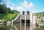
|Caption=View look upstream towards outlet of flood storage reservoir, with flow control structure. Courtesy of the River Restoration Centre. | |||
}} | }} | ||
{{Case study image | |||
|File name=CNV00020.JPG | |||
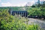
|Caption=View looking downstream towards dam and outlet. Courtesy of the River Restoration Centre. | |||
}} | |||
{{Case study image | |||
|File name=CNV00007.JPG | |||
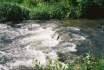
|Caption=One of a number of pool-riffle sequences installed on the advice of the River Restoration Centre. Courtesy of the River Restoration Centre. | |||
}} | |||
{{Case study image | |||
|File name=CNV00004.JPG | |||
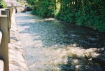
|Caption=View from newly constructed flood wall in Harbertonford - looking downstream. Courtesy of the River Restoration Centre. | |||
}} | |||
{{Image gallery end}} | |||
{{Toggle button}} | |||
{{Toggle content start}} | |||
{{Case study subcatchment | {{Case study subcatchment | ||
|Subcatchment= | |Subcatchment=HARBOURNE RIVER | ||
}} | }} | ||
{{Site | {{Site | ||
| Line 30: | Line 61: | ||
|WFD water body name=Harbourne River | |WFD water body name=Harbourne River | ||
|Heavily modified water body=No | |Heavily modified water body=No | ||
|Protected species present= | |Protected species present=Yes | ||
|Invasive species present=No | |Invasive species present=No | ||
|Species=Otter and common dormouse (protected); Atlantic salmon, bullhead, sea trout, brown trout. | |||
|Dominant substrate=Slate/shale, overlain by alluvium. | |Dominant substrate=Slate/shale, overlain by alluvium. | ||
|River corridor land use=Agriculture. | |River corridor land use=Agriculture. | ||
| Line 40: | Line 72: | ||
|Total cost category=more than 10000 k€ | |Total cost category=more than 10000 k€ | ||
|Total1 cost=3500000 | |Total1 cost=3500000 | ||
|Funding sources= | |Funding sources=Defra, South Hams District Council, Harbertonford Parish Council | ||
}} | }} | ||
{{Motivations | {{Motivations | ||
| Line 46: | Line 78: | ||
}} | }} | ||
{{Measures | {{Measures | ||
|Bank and bed modifications measure= | |Bank and bed modifications measure=Bed lowering, Creation of pools and riffles, Weir modification, | ||
|Floodplain / River corridor= | |Floodplain / River corridor=Containment bund to prevent flooding, Construction of flood wall, | ||
|Planform / Channel pattern=Channel widening, | |||
|Other technical measure=Surface drainage systems improved, SUDS, | |||
|Social measures=Engagement with schools, Community Education, | |||
}} | }} | ||
{{Hydromorphological quality elements header}} | {{Hydromorphological quality elements header}} | ||
| Line 59: | Line 94: | ||
{{Monitoring documents}} | {{Monitoring documents}} | ||
{{Monitoring documents end}} | {{Monitoring documents end}} | ||
{{Additional Documents}} | {{Additional Documents}} | ||
{{Additional Documents end}} | {{Additional Documents end}} | ||
| Line 78: | Line 111: | ||
{{Additional links and references footer}} | {{Additional links and references footer}} | ||
{{Supplementary Information}} | {{Supplementary Information}} | ||
{{Toggle content end}} | |||
Latest revision as of 15:11, 2 January 2019
Project overview
| Status | Complete |
|---|---|
| Project web site | |
| Themes | Flood risk management, Social benefits |
| Country | England |
| Main contact forename | Nick |
| Main contact surname | Elbourne |
| Main contact user ID | User:NickRRC |
| Contact organisation | River Restoration Centre |
| Contact organisation web site | |
| Partner organisations | Environment Agency, Defra, South Hams District Council & Harbertonford Parish Council |
| Parent multi-site project | |
| This is a parent project encompassing the following projects |
No |

Project summary
The River Harbourne flows through the village of Harbertonford, which has been flooded on 21 separate occasions over the past 60 years - of which 6 flood events occurred between 1998 and 2000. The catchment is highly 'flashy', with little warning for residents prior to a flood.
The Harbertonford Flood Alleviation Scheme was a joint project funded by DEFRA, the Environment Agency, South Hams District Council and Harbertonford Parish Council, costing £2.6 million. Its aim was to reduce the risk of flooding through the implementation of engineered flood alleviation solutions. A zoned clay-core embankment dam ('Palmer's Dam') with a 4.1 ha (150,000 cu m) reservoir storage area was constructed 2km upstream of Harbertonford, in conjunction with 600mm of bed level lowering and channel widening through Harbertonford to increase channel capacity (to accommodate flows up to 28 cumecs - 10 year flood. A flow control system was installed at the reservoir outlet to permit normal river flow, with automated flood control gates to throttle flows during a flood event. In addition, a flood defence wall was installed and surface drainage systems improved. Together, these measures were built to prevent flooding in Harbertonford up to a 1 in 40 year flood event.
On 7th July 2012, a 1 in 40 year flood event occurred and Palmer's Dam was overtopped for the first time since its construction. This resulted in the flooding of some properties in Harbertonford, however flooding was limited to a few lowlying homes and the flood peak was significantly delayed, giving increased warning time.
As part of the bed-lowering technique, a series of pool-riffle sequences were constructed within the channel through Harbertonford - a best practice approach for habitat enhancement, proposed by the River Restoration Centre (www.therrc.co.uk). These would provide both improved spawning habitat and habitat for adult fish.
Works included:
- Channel lowered by 600mm through Harbertonford using pool-riffle sequences, to increase channel capacity, to withstand 28 cumec flow (1:10 year event). Also widened in areas to further increase capacity. Two weirs lowered to minimise backwater effect (Crowdy Mill and Mill Leat).
- Zoned clay-core embankment dam constructed 2km US of Harbertonford, with 4.1 ha flood storage reservoir (150, 000 cu. metre capacity), capable of withstanding up to 1:40 year event.
- Flood wall installed along a portion of the river, through Harbertonford. Replaced earth bank. Surface drainage systems improved.
Community Involvement - Local primary school visited site during construction of dam and have continued to visit 'reservoir' site, to study ecological development.
Monitoring surveys and results
Lessons learnt
Image gallery
|
Catchment and subcatchmentSelect a catchment/subcatchment
Catchment
Subcatchment
Site
Project background
Cost for project phases
Reasons for river restoration
Measures
MonitoringHydromorphological quality elements
Biological quality elements
Physico-chemical quality elements
Any other monitoring, e.g. social, economic
Monitoring documents
Additional documents and videos
Additional links and references
Supplementary InformationEdit Supplementary Information
| ||||||||||||||||||||||||||||||||||||||||||||||||||||||||||||||||||||||||||||||||||||||||||||||||||||||||||||||||||||||||||||||||||||||||||||||||||||||||||||||||||||||||||||||||||||||||||||||||||||||||||||||


