Case study:Langford Lakes project: Difference between revisions
Mattleeson (talk | contribs) No edit summary |
No edit summary |
||
| (21 intermediate revisions by 5 users not shown) | |||
| Line 1: | Line 1: | ||
{{ | {{Case study status | ||
|Approval status= | |Approval status=Approved | ||
}} | }} | ||
{{Location | {{Location | ||
| Line 15: | Line 10: | ||
{{Project overview | {{Project overview | ||
|Status=Complete | |Status=Complete | ||
|Themes=Economic aspects, Flood risk management, Land use management - agriculture, Social benefits, Spatial planning | |Themes=Economic aspects, Flood risk management, Land use management - agriculture, Social benefits, Spatial planning | ||
|Country=England | |Country=England | ||
|Main contact forename= | |Main contact forename=Alasdair | ||
|Main contact surname= | |Main contact surname=Maxwell | ||
| | |Contact organisation=Environment Agency | ||
|Partner organisations=Wiltshire Wildlife Trust, | |Contact organisation url=www.environment-agency.gov.uk | ||
|Partner organisations=Wiltshire Wildlife Trust, Natural England, Wild Trout Trust | |||
|Multi-site=No | |Multi-site=No | ||
|Project summary=This area comprises a series of large lakes with the River Wylye, a chalk stream, flowing through the centre of them. Langford lakes and the River Wylye are renowned for their popularity for angling but fish populations have declined over recent years. | |Project picture=P8150209.JPG | ||
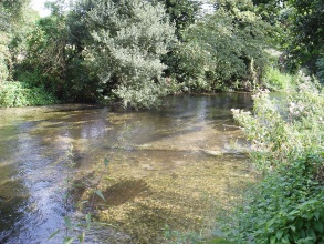
|Picture description=River Wylye, Langford Lakes restoration | |||
|Project summary=This area comprises a series of large lakes with the River Wylye, a chalk stream, flowing through the centre of them. Langford lakes and the River Wylye are renowned for their popularity for angling but fish populations have declined over recent years. In an attempt to trap sediment and diversify flow, a number of natural materials have been introduced to the stream. Creation of a V weir. | |||
}} | }} | ||
{{ | {{Image gallery}} | ||
| | {{Case study image | ||
|File name=P8150201.JPG | |||
}} | |||
{{Case study image | |||
|File name=P8150204.JPG | |||
}} | |||
{{Case study image | |||
|File name=P8150206.JPG | |||
}} | |||
{{Image_gallery_end}} | |||
{{Toggle button}} | |||
{{Toggle content start}} | |||
{{Case study subcatchment | |||
|Subcatchment=Wylye (Middle) | |||
}} | }} | ||
{{Site | {{Site | ||
| Line 49: | Line 56: | ||
|Mn discharge=0.3 | |Mn discharge=0.3 | ||
}} | }} | ||
{{ | {{Project background | ||
|Reach length directly affected= | |Reach length directly affected=1000 m | ||
|Project started=2002/10/01 | |||
|Works completed=2002/10/01 | |||
|Total1 cost=Unknown | |||
|Project started= | |Funding sources=Wiltshire wildlife trust,Natural England,Environment Agency | ||
|Works completed= | |||
|Total1 cost= | |||
|Funding sources= | |||
}} | }} | ||
{{Motivations | {{Motivations | ||
| Line 136: | Line 78: | ||
}} | }} | ||
{{Measures | {{Measures | ||
|Bank and bed modifications measure= | |Bank and bed modifications measure=Planting, Sediment trap building, Morphological diversification, Diversification of in-channel features, Weir construction, | ||
}} | }} | ||
{{Hydromorphological_quality_elements_header}} | {{Hydromorphological_quality_elements_header}} | ||
| Line 163: | Line 90: | ||
{{Monitoring_documents}} | {{Monitoring_documents}} | ||
{{Monitoring_documents_end}} | {{Monitoring_documents_end}} | ||
{{Additional_Documents}} | {{Additional_Documents}} | ||
{{Additional_Documents_end}} | {{Additional_Documents_end}} | ||
{{ | {{Additional links and references header}} | ||
{{Additional links and references | |||
|Link=publications.environment-agency.gov.uk/pdf/GESW0910BSTR-E-E.pdf | |||
|Description=WFD Status for Wylye - See P. 1355. | |||
}} | |||
{{Additional links and references | |||
|Link=www.therrc.co.uk/rrc_case_studies1.php?csid=30 | |||
|Description=River Restoration Centre Case Study | |||
}} | |||
{{Additional_links_and_references_footer}} | {{Additional_links_and_references_footer}} | ||
{{ | {{Supplementary Information | ||
|Information= | |Information=RRC Visit Notes (2002): | ||
Most of the examples of techniques in this river have only just been put into place (the official opening of the site was 28th September 2002). It is therefore, too early to establish which are likely to provide answers in terms of best practice and whether the increase in channel diversity will have a long term benefit for fisheries objectives. | |||
Some concerns were raised during the site visit about the use of the v weir in this particular situation and it remains to be seen how successful/sustainable this will be compared to the more ‘natural’ diversity initiatives using on site materials over the longer term. | |||
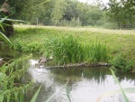
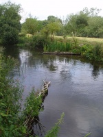
The faggots and pegs appear already to have trapped some sediment behind them. They are, however, very experimental and their height, in this case (approx 40-50cm), may ultimately be most critical to their long term success. Nevertheless they may provide a possible alternative to places where toe boarding or similar structural support has been used along other rivers. | |||
This is an excellent site for viewing and discussing a range of techniques, and evaluating their effectiveness and suitability along chalk streams and elsewhere. | |||
}} | }} | ||
{{Case_study_upload}} | {{Case_study_upload}} | ||
{{Toggle content end}} | |||
Latest revision as of 14:48, 2 January 2019
Project overview
| Status | Complete |
|---|---|
| Project web site | |
| Themes | Economic aspects, Flood risk management, Land use management - agriculture, Social benefits, Spatial planning |
| Country | England |
| Main contact forename | Alasdair |
| Main contact surname | Maxwell |
| Main contact user ID | |
| Contact organisation | Environment Agency |
| Contact organisation web site | http://www.environment-agency.gov.uk |
| Partner organisations | Wiltshire Wildlife Trust, Natural England, Wild Trout Trust |
| Parent multi-site project | |
| This is a parent project encompassing the following projects |
No |
Project summary
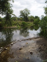
This area comprises a series of large lakes with the River Wylye, a chalk stream, flowing through the centre of them. Langford lakes and the River Wylye are renowned for their popularity for angling but fish populations have declined over recent years. In an attempt to trap sediment and diversify flow, a number of natural materials have been introduced to the stream. Creation of a V weir.
Monitoring surveys and results
Lessons learnt
Image gallery
|
Catchment and subcatchmentSelect a catchment/subcatchment
Catchment
Subcatchment
Other case studies in this subcatchment: Wild Wylye Phase 1
Site
Project background
Cost for project phases
Reasons for river restoration
Measures
MonitoringHydromorphological quality elements
Biological quality elements
Physico-chemical quality elements
Any other monitoring, e.g. social, economic
Monitoring documents
Additional documents and videos
Additional links and references
Supplementary InformationEdit Supplementary Information RRC Visit Notes (2002): Most of the examples of techniques in this river have only just been put into place (the official opening of the site was 28th September 2002). It is therefore, too early to establish which are likely to provide answers in terms of best practice and whether the increase in channel diversity will have a long term benefit for fisheries objectives. Some concerns were raised during the site visit about the use of the v weir in this particular situation and it remains to be seen how successful/sustainable this will be compared to the more ‘natural’ diversity initiatives using on site materials over the longer term. The faggots and pegs appear already to have trapped some sediment behind them. They are, however, very experimental and their height, in this case (approx 40-50cm), may ultimately be most critical to their long term success. Nevertheless they may provide a possible alternative to places where toe boarding or similar structural support has been used along other rivers. This is an excellent site for viewing and discussing a range of techniques, and evaluating their effectiveness and suitability along chalk streams and elsewhere.
| ||||||||||||||||||||||||||||||||||||||||||||||||||||||||||||||||||||||||||||||||||||||||||||||||||||||||||||||||||||||||||||||||||||||||||||||||||||||||||||||||||||||||||||||||||||||||||||||||||


