Case study:Guisborough Flood Alleviation Scheme: Difference between revisions
No edit summary |
No edit summary |
||
| Line 1: | Line 1: | ||
{{Case study status | {{Case study status | ||
|Approval status= | |Approval status=Approved | ||
}} | }} | ||
{{Location | {{Location | ||
Latest revision as of 13:16, 5 November 2018
Project overview
| Status | In progress |
|---|---|
| Project web site | http://www.therrc.co.uk/sites/default/files/projects/22_guisborough.pdf |
| Themes | Flood risk management, Habitat and biodiversity, Hydromorphology, Land use management - agriculture, Land use management - forestry |
| Country | England |
| Main contact forename | Ted |
| Main contact surname | Thomas |
| Main contact user ID | |
| Contact organisation | Environment Agency |
| Contact organisation web site | http://www.gov.uk/government/organisations/environment-agency |
| Partner organisations | Forestry Commission, Redcar and Cleveland Borough Council |
| Parent multi-site project | |
| This is a parent project encompassing the following projects |
No |
Project summary
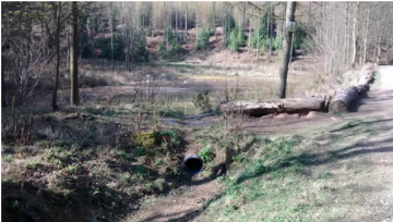
The Chapel Beck (main river) flows through Guisborough (Map 1) and is fed by a number of small tributaries (ordinary watercourses). There is significant modelled flood risk from the chapel beck but few instances of actual flooding, although the tributaries have caused flooding in the past. The project has so far determined that the reason for the lack of flooding from the beck is likely to be a large number of unaccounted for natural and unintentionally created attenuations upstream of the town. The project is seeking to formalise and improve these existing attenuations and to create further attenuations to reduce future flood risk, while creating 5ha of water dependent habitat.
Installing 15,000m3 of flood water storage in the catchment could reduce the 100-year peak flow by 10.9% (2m3s-1).
The published flood map cannot take account of the man-made attenuations present in the catchment because there is no guarantee that these will perform this inadvertent flood water storage function in perpetuity. Only if the features are formalised as flood risk assets and maintained can they be considered when estimating the actual flood risk to homes in Guisborough.
Monitoring surveys and results
Lessons learnt
Image gallery
|
Catchment and subcatchment
Site
Project background
Cost for project phases
Reasons for river restoration
Measures
MonitoringHydromorphological quality elements
Biological quality elements
Physico-chemical quality elements
Any other monitoring, e.g. social, economic
Monitoring documents
Additional documents and videos
Additional links and references
Supplementary InformationEdit Supplementary Information
| ||||||||||||||||||||||||||||||||||||||||||||||||||||||||||||||||||||||||||||||||||||||||||||||||||||||||||||||||||||||||||||||||||||||||||||||||||||||||||||||||||||||||||||||||||

