Case study:Wild Wylye Phase 1: Difference between revisions
No edit summary |
No edit summary |
||
| (18 intermediate revisions by 4 users not shown) | |||
| Line 1: | Line 1: | ||
{{Case study status | {{Case study status | ||
|Approval status= | |Approval status=Approved | ||
}} | }} | ||
{{Location | {{Location | ||
| Line 22: | Line 22: | ||
A very important driver of this project was to bring together different stakeholders and interest groups on the river to make this project into a synergistically resounding success. Funding for the project come from the riparian owners, the Environment Agency and the Wylye Fly Fishing Club (WFFC). There was a contribution in time, free of charge, from WFFC and the Wessex Chalk Streams Partnership (hosted by Wiltshire Wildlife Trust, supported by the Environment Agency, Natural England, Wessex Water and the Wiltshire Fisheries Association). These two core partners have also provided and supported volunteer labour during the delivery process. Additional funding for specific parts of the work came from the Woodland Trust. The involvement and engagement of such a diverse group of organisations, people and professions ensured that we did not focus on just one specific outcome, but took all points of view into account. Furthermore, volunteers physically working on river enhancement projects took pride in their work (see the image gallery) and developed a feeling of ‘ownership’. | A very important driver of this project was to bring together different stakeholders and interest groups on the river to make this project into a synergistically resounding success. Funding for the project come from the riparian owners, the Environment Agency and the Wylye Fly Fishing Club (WFFC). There was a contribution in time, free of charge, from WFFC and the Wessex Chalk Streams Partnership (hosted by Wiltshire Wildlife Trust, supported by the Environment Agency, Natural England, Wessex Water and the Wiltshire Fisheries Association). These two core partners have also provided and supported volunteer labour during the delivery process. Additional funding for specific parts of the work came from the Woodland Trust. The involvement and engagement of such a diverse group of organisations, people and professions ensured that we did not focus on just one specific outcome, but took all points of view into account. Furthermore, volunteers physically working on river enhancement projects took pride in their work (see the image gallery) and developed a feeling of ‘ownership’. | ||
At the end of the project we had installed more than 60 ‘soft-engineering’ structures, ranging from simple log deflectors to large brushwood mattresses. Furthermore, we re-build riffles (by introducing fresh gravels) and we re-aligned the channel at two occasions. | At the end of the project we had installed more than 60 ‘soft-engineering’ structures, ranging from simple log deflectors to large brushwood mattresses. Furthermore, we re-build riffles (by introducing fresh gravels) and we re-aligned the channel at two occasions. Also, involved Well-Being group with delivery. | ||
|Monitoring surveys and results=Whilst empirical evidence relating to the success of the project is not yet available – the project was only finished by the end of 2014, certain indications were noticed within weeks of project completion and these suggest that we have achieved many of the goals set for the project. | |Monitoring surveys and results=Whilst empirical evidence relating to the success of the project is not yet available – the project was only finished by the end of 2014, certain indications were noticed within weeks of project completion and these suggest that we have achieved many of the goals set for the project. | ||
| Line 36: | Line 36: | ||
The long running Environment Agency programme for Atlantic salmon redd counting on the river will be continued. This will enable a pre- and post-project comparison of redd location and abundance telling us whether we have improved spawning conditions. | The long running Environment Agency programme for Atlantic salmon redd counting on the river will be continued. This will enable a pre- and post-project comparison of redd location and abundance telling us whether we have improved spawning conditions. | ||
Repeated Fixed Point Photography ( | Repeated Fixed Point Photography (FPP) is being used to assess the establishment and development of river enhancement structures – such as hinged willows. Photos are taken at least twice a year. Although in itself very valuable, FPP cannot be used to evaluate the actual success in terms of reaching SAC, WFD targets. Data from biological monitoring are essential for that. Ultimately WFD and SSSI monitoring carried out on larger spatial and time scales will answer whether this project has contributed to the water body meeting these objectives. | ||
|Lessons learn=We did not encounter any major issues. Yes there were small hiccups during the delivery side of things (wrong gravel delivered, last-minute change of contractor), but not something that truly endangered the project. | |Lessons learn=We did not encounter any major issues. Yes there were small hiccups during the delivery side of things (wrong gravel delivered, last-minute change of contractor), but not something that truly endangered the project. | ||
The approach we took - project delivery mainly by volunteers - was so successful that we will endeavour to make that an important part from all future projects. | The approach we took - project delivery mainly by volunteers - was so successful that we will endeavour to make that an important part from all future projects. | ||
}} | }} | ||
{{Image gallery}} | {{Image gallery}} | ||
{{Case study image | |||
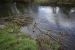
|File name=WildWylye01.JPG | |||
|Caption=Large Woody Debris Secured on the inner bend propagates sedimentation, eventually leading to channel narrowing. | |||
}} | |||
{{Case study image | |||
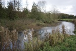
|File name=WildWylye02.JPG | |||
|Caption=Large scale ‘hinging’ of willows to provide additional in stream habitat. | |||
}} | |||
{{Case study image | |||
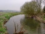
|File name=WildWylye03.jpg | |||
|Caption=Looking upstream before the work… | |||
}} | |||
{{Case study image | |||
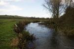
|File name=WildWylye04.JPG | |||
|Caption=... same view after the work. | |||
}} | |||
{{Case study image | |||
|File name=WildWylye05.JPG | |||
|Caption=Re-opening of a back-channel provides shelter for juvenile fish. | |||
}} | |||
{{Case study image | |||
|File name=WildWylye06.jpg | |||
|Caption=Small in-stream structures can have significant effect on low-discharge flow patterns | |||
}} | |||
{{Case study image | |||
|File name=WildWylye07.jpg | |||
|Caption=Securing a log deflector to the riverbed. | |||
}} | |||
{{Case study image | |||
|File name=WildWylye08.jpg | |||
|Caption=During the process: narrowing at one side of the channel has already been undertaken (by installing a brushwood mattress), now waiting for the digger driver to finish the job by… | |||
}} | |||
{{Case study image | |||
|File name=WildWylye09.jpg | |||
|Caption=… bank regrading to finish small scale channel re-alignment. | |||
}} | |||
{{Case study image | |||
|File name=WildWylye10.jpg | |||
|Caption=Bed raising by introducing new gravels (from a local quarry). | |||
}} | |||
{{Case study image | |||
|File name=WildWylye11.JPG | |||
|Caption=Volunteers and tools ready for a day’s work on the river. | |||
}} | |||
{{Case study image | |||
|File name=WildWylye12.JPG | |||
|Caption=Volunteers building a natural revetment out of hazel screens to narrow the river and in the process remove rubbish (radiators) used as river bank protection. | |||
}} | |||
{{Image gallery end}} | {{Image gallery end}} | ||
{{Toggle button}} | {{Toggle button}} | ||
| Line 50: | Line 96: | ||
|Subcatchment=Wylye (Middle) | |Subcatchment=Wylye (Middle) | ||
}} | }} | ||
{{Site}} | {{Site | ||
|WFD water body code=GB108043022550 | |||
|WFD water body name=Wylye (Middle) | |||
|Heavily modified water body=No | |||
|Protected species present=No | |||
|Invasive species present=No | |||
}} | |||
{{Project background | {{Project background | ||
|Reach length directly affected=2000 | |Reach length directly affected=2000 | ||
| Line 58: | Line 110: | ||
|Project completed=2015/03/01 | |Project completed=2015/03/01 | ||
|Total cost category=50 - 100 k€ | |Total cost category=50 - 100 k€ | ||
|Total1 cost= | |Total1 cost=81 | ||
|Funding sources=Environment Agency, | |Funding sources=Environment Agency, Landowner, | ||
|Investigation and design cost category=1 - 10 k€ | |Investigation and design cost category=1 - 10 k€ | ||
|Investigation and design Lead organisation=Wiltshire Wildlife Trust | |Investigation and design Lead organisation=Wiltshire Wildlife Trust | ||
| Line 84: | Line 136: | ||
The total value of volunteer labour was conservatively estimated at £9250 (appr. 12500 EUR) | The total value of volunteer labour was conservatively estimated at £9250 (appr. 12500 EUR) | ||
}} | }} | ||
{{Motivations}} | {{Motivations | ||
{{Measures}} | |Hydromorphological quality elements= Quantity & dynamics of flow, Width & depth variation, Continuity of sediment transport, | ||
|Biological quality elements=Fish | |||
|Physico-chemical quality elements=Nutrient concentrations | |||
}} | |||
{{Measures | |||
|Bank and bed modifications measure=Bed raising, Riffle creation, | |||
|Floodplain / River corridor=Lowering of floodbanks | |||
|Planform / Channel pattern=Channel realignment, Introducing large woody debris, Flow deflectors, Re-meandering, | |||
|Management interventions=Influence management by fisheries manager | |||
|Social measures=Community involvement, | |||
}} | |||
{{Hydromorphological quality elements header}} | {{Hydromorphological quality elements header}} | ||
{{Hydromorphological quality element table row | |||
|Element=Channel pattern/planform | |||
|Monitored before=Yes | |||
|Monitored after=Yes | |||
|Qualitative monitoring=No | |||
|Quantitative monitoring=Yes | |||
|Control site used=No | |||
|Result=Awaiting results | |||
}} | |||
{{Hydromorphological quality element table row | |||
|Element=Width & depth variation | |||
|Monitored before=Yes | |||
|Monitored after=Yes | |||
|Qualitative monitoring=No | |||
|Quantitative monitoring=Yes | |||
|Control site used=No | |||
|Result=Awaiting results | |||
}} | |||
{{End table}} | {{End table}} | ||
{{Biological quality elements header}} | {{Biological quality elements header}} | ||
{{Biological quality element table row | |||
|Element=Fish | |||
|Monitored before=Yes | |||
|Monitored after=Yes | |||
|Qualitative monitoring=No | |||
|Quantitative monitoring=Yes | |||
|Control site used=Yes | |||
|Result=Awaiting results | |||
}} | |||
{{End table}} | {{End table}} | ||
{{Physico-chemical quality elements header}} | {{Physico-chemical quality elements header}} | ||
| Line 97: | Line 186: | ||
{{Monitoring documents end}} | {{Monitoring documents end}} | ||
{{Additional Documents}} | {{Additional Documents}} | ||
{{Case study documents | |||
|File name=Design maps.pdf | |||
|Description=Maps with the final designs | |||
}} | |||
{{Case study documents | |||
|File name=Social media.pdf | |||
|Description=A selection of social media interactions during the project | |||
}} | |||
{{Additional Documents end}} | {{Additional Documents end}} | ||
{{Additional links and references header}} | {{Additional links and references header}} | ||
Latest revision as of 14:19, 1 November 2018
Project overview
| Status | Complete |
|---|---|
| Project web site | |
| Themes | Environmental flows and water resources, Fisheries, Habitat and biodiversity, Monitoring, Social benefits |
| Country | England |
| Main contact forename | Martijn |
| Main contact surname | Antheunisse |
| Main contact user ID | User:Martijnantheunisse |
| Contact organisation | Wiltshire Wildlife Trust |
| Contact organisation web site | http://www.wiltshirewildlifetrust.org |
| Partner organisations | Environment Agency, Wylye Fly Fishing Club, Natural England |
| Parent multi-site project | |
| This is a parent project encompassing the following projects |
No |
Project summary
The overarching goal of this project was to enhance the river habitat quality of the Wylye over a length of 2000m. Within five years from project completion, once the effects of structures and planting have maximised, the river will provide a complete configuration of high quality habitats for key-species (i.e. Atlantic salmon, ‘wild’ Brown trout and River water-crowfoot), in all their lifecycle stages, but also incorporating the needs of a whole raft of supporting species. In addition, the river will provide a better, more challenging ‘wild’ fishing experience, the Wylye valley will be perceived as a more natural, aesthetic river landscape by river-owners and users and the whole system will be more resilient to short term incidents (droughts, floods) and long term changes (rising temperatures due to climate change).
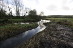
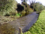
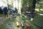
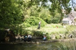
A very important driver of this project was to bring together different stakeholders and interest groups on the river to make this project into a synergistically resounding success. Funding for the project come from the riparian owners, the Environment Agency and the Wylye Fly Fishing Club (WFFC). There was a contribution in time, free of charge, from WFFC and the Wessex Chalk Streams Partnership (hosted by Wiltshire Wildlife Trust, supported by the Environment Agency, Natural England, Wessex Water and the Wiltshire Fisheries Association). These two core partners have also provided and supported volunteer labour during the delivery process. Additional funding for specific parts of the work came from the Woodland Trust. The involvement and engagement of such a diverse group of organisations, people and professions ensured that we did not focus on just one specific outcome, but took all points of view into account. Furthermore, volunteers physically working on river enhancement projects took pride in their work (see the image gallery) and developed a feeling of ‘ownership’.
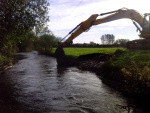
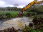
At the end of the project we had installed more than 60 ‘soft-engineering’ structures, ranging from simple log deflectors to large brushwood mattresses. Furthermore, we re-build riffles (by introducing fresh gravels) and we re-aligned the channel at two occasions. Also, involved Well-Being group with delivery.
Monitoring surveys and results
Whilst empirical evidence relating to the success of the project is not yet available – the project was only finished by the end of 2014, certain indications were noticed within weeks of project completion and these suggest that we have achieved many of the goals set for the project.
For example, in more than 10 areas where structures have been installed to increase bed dynamics and re-energize erosion-deposition equilibriums, the evidence of scour, cleaning and sorting of gravels by the river is already clearly visible.
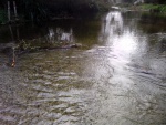
We cannot yet prove that this has led to an increase in fish spawning, but we can show that the gravels are now suitable for that purpose, whereas before they were concreted. Similarly, the dozen of brushwood structures installed to trap sediments and narrow the channel are clearly doing so. There is a higher flow velocity around the structures and the accretion of silt within them, is clearly visible. This has created in-channel sinuosity with the structures (woody debris and brushwood mattresses) deflecting flow from bank to bank from what was a uniform flow.
Further indication that the river restoration has already had a positive impact has been provided by chance meetings with fishermen on the river bank. Feedback has taught us that the fishing has become much more varied in the months after the work was delivered: a greater number of productive fish lies and much more variation in habitat and higher numbers of Grayling caught.
A more thorough evaluation of the project can (and will) be undertaken in the next year(s), when results from several monitoring efforts will become available. Prior to the project a topographical survey of the river bed and banks was undertaken. This survey will provide a baseline comparison when we repeat this survey in two and five years’ time. That will tell us whether we have indeed increased variation in channel morphology.
The long running Environment Agency programme for Atlantic salmon redd counting on the river will be continued. This will enable a pre- and post-project comparison of redd location and abundance telling us whether we have improved spawning conditions.
Repeated Fixed Point Photography (FPP) is being used to assess the establishment and development of river enhancement structures – such as hinged willows. Photos are taken at least twice a year. Although in itself very valuable, FPP cannot be used to evaluate the actual success in terms of reaching SAC, WFD targets. Data from biological monitoring are essential for that. Ultimately WFD and SSSI monitoring carried out on larger spatial and time scales will answer whether this project has contributed to the water body meeting these objectives.
Lessons learnt
We did not encounter any major issues. Yes there were small hiccups during the delivery side of things (wrong gravel delivered, last-minute change of contractor), but not something that truly endangered the project.
The approach we took - project delivery mainly by volunteers - was so successful that we will endeavour to make that an important part from all future projects.
Image gallery
|
Catchment and subcatchmentSelect a catchment/subcatchment
Catchment
Subcatchment
Other case studies in this subcatchment: Langford Lakes project
Site
Project background
Cost for project phases
Supplementary funding informationThe capital costs (and part of staff time) was funded by the Environment Agency and the landowners. The two main project partners (Wylye Fly Fishing Club and Wessex Chalk Streams Project - hosted by Wiltshire Wildlife Trust) provided staff time in-kind. The total value of volunteer labour was conservatively estimated at £9250 (appr. 12500 EUR)
Reasons for river restoration
Measures
MonitoringHydromorphological quality elements
Biological quality elements
Physico-chemical quality elements
Any other monitoring, e.g. social, economic
Monitoring documents
Additional documents and videos
Additional links and references
Supplementary InformationEdit Supplementary Information
| |||||||||||||||||||||||||||||||||||||||||||||||||||||||||||||||||||||||||||||||||||||||||||||||||||||||||||||||||||||||||||||||||||||||||||||||||||||||||||||||||||||||||||||||||||||||||||||||||||||||||||||||||||


