Case study:River Glaven, North Norfolk: Difference between revisions
No edit summary |
No edit summary |
||
| (7 intermediate revisions by the same user not shown) | |||
| Line 1: | Line 1: | ||
{{Case study status | {{Case study status | ||
|Approval status= | |Approval status=Approved | ||
}} | }} | ||
{{Location | {{Location | ||
| Line 7: | Line 7: | ||
{{Project overview | {{Project overview | ||
|Status=Complete | |Status=Complete | ||
|Project web site url= | |Project web site url=www.therrc.co.uk/sites/default/files/projects/5_glaven.pdf | ||
|Themes=Flood risk management, Habitat and biodiversity, Hydromorphology, Land use management - agriculture, Monitoring | |Themes=Flood risk management, Habitat and biodiversity, Hydromorphology, Land use management - agriculture, Monitoring | ||
|Country=England | |Country=England | ||
| Line 13: | Line 13: | ||
|Main contact surname=Wilkinson | |Main contact surname=Wilkinson | ||
|Contact organisation=James Hutton Institute | |Contact organisation=James Hutton Institute | ||
|Contact organisation url= | |Contact organisation url=www.hutton.ac.uk/ | ||
|Partner organisations=River Glaven Conservation Group, Wild Trout Trust, University College London, Queen Mary University of London, Environment Agency, Richard Hey, local farmers and landowners, Natural England, Norfolk Wildlife Trust | |Partner organisations=River Glaven Conservation Group, Wild Trout Trust, University College London, Queen Mary University of London, Environment Agency, Richard Hey, local farmers and landowners, Natural England, Norfolk Wildlife Trust | ||
|Multi-site=No | |Multi-site=No | ||
| Line 25: | Line 25: | ||
{{Toggle content start}} | {{Toggle content start}} | ||
{{Case study subcatchment}} | {{Case study subcatchment}} | ||
{{Site}} | {{Site | ||
{{Project background}} | |Name=Glaven | ||
{{Motivations}} | |Heavily modified water body=No | ||
{{Measures}} | |Protected species present=No | ||
|Invasive species present=No | |||
}} | |||
{{Project background | |||
|Project started=2009 | |||
|Total1 cost=£50k | |||
|Funding sources=Environment Agency, RGCG | |||
}} | |||
{{Motivations | |||
|Specific mitigation=Flood risk management | |||
}} | |||
{{Measures | |||
|Floodplain / River corridor=Floodplain reconnection | |||
|Planform / Channel pattern=Habitat restoration | |||
}} | |||
{{Hydromorphological quality elements header}} | {{Hydromorphological quality elements header}} | ||
{{End table}} | {{End table}} | ||
Latest revision as of 13:54, 1 November 2018
Project overview
| Status | Complete |
|---|---|
| Project web site | http://www.therrc.co.uk/sites/default/files/projects/5_glaven.pdf |
| Themes | Flood risk management, Habitat and biodiversity, Hydromorphology, Land use management - agriculture, Monitoring |
| Country | England |
| Main contact forename | Mark |
| Main contact surname | Wilkinson |
| Main contact user ID | |
| Contact organisation | James Hutton Institute |
| Contact organisation web site | http://www.hutton.ac.uk/ |
| Partner organisations | River Glaven Conservation Group, Wild Trout Trust, University College London, Queen Mary University of London, Environment Agency, Richard Hey, local farmers and landowners, Natural England, Norfolk Wildlife Trust |
| Parent multi-site project | |
| This is a parent project encompassing the following projects |
No |
Project summary
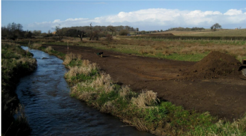
The River Glaven in north Norfolk has been historically modified, for example, through the creation of water mills. Coupled with this, widespread dredging has occurred and flood embankments have been created to protect agricultural land. The project's objectives were to improve the river corridor habitat by restoring river processes and reconnect the river and its floodplain and to develop an experience base that would serve the River Glaven Conservation Group (RGCG) well on other projects. The project provides a unique opportunity to monitor and model river and floodplain interactions. A MIKE SHE/MIKE 11 coupled hydrological/hydraulic model was employed to assess the impact of floodplain reconnection. Using data from 2007 to 2010, the study found that the removal of the embankment permitted widespread inundation of the floodplain at high flows (>1.7m3s-1) as well as enhancing flooding of the immediate riparian area during lower magnitude events. Removal of embankments has found to have reduced the channel capacity by approximately 60%, suggesting that overbank flooding was the most dramatic hydrological effect following the restoration project (Clilverd et al. 2013).
Monitoring surveys and results
Lessons learnt
Image gallery
|
Catchment and subcatchment
Site
Project background
Cost for project phases
Reasons for river restoration
Measures
MonitoringHydromorphological quality elements
Biological quality elements
Physico-chemical quality elements
Any other monitoring, e.g. social, economic
Monitoring documents
Additional documents and videos
Additional links and references
Supplementary InformationEdit Supplementary Information
| ||||||||||||||||||||||||||||||||||||||||||||||||||||||||||||||||||||||||||||||||||||||||||||||||||||||||||||||||||||||||||||||||||||||||||||||||||||||||||||||||||||||||||||||||||

