Case study:Prologis Midpoint Park river restoration scheme: Difference between revisions
No edit summary |
No edit summary |
||
| (13 intermediate revisions by 5 users not shown) | |||
| Line 1: | Line 1: | ||
{{Case study status | {{Case study status | ||
|Approval status= | |Approval status=Approved | ||
}} | }} | ||
{{Location | {{Location | ||
| Line 20: | Line 20: | ||
|Project summary=This river restoration scheme was designed to mitigate three major impacts from the redevelopment of part of Minworth Sewage Treatment Works for development of a business park, ProLogis Park Midpoint. It is an example of how an innovative approach can be taken to multiple problem-solving in development. | |Project summary=This river restoration scheme was designed to mitigate three major impacts from the redevelopment of part of Minworth Sewage Treatment Works for development of a business park, ProLogis Park Midpoint. It is an example of how an innovative approach can be taken to multiple problem-solving in development. | ||
The site comprised abandoned sludge lagoons that provided habitat for over-wintering birds. It was directly adjacent to the River Tame and was almost entirely within its floodplain. There was thus a need to provide ecological mitigation; to pull back the development area to respect Birmingham City Council’s requirement for a 50m riparian buffer strip; and to provide flood compensation. A river restoration scheme was designed, in close consultation with the Environment Agency, to form a back channel and islands along the Tame (which was canalised and lacked ecological interest in that reach), with an attenuation pond to control runoff. With Birmingham City Council’s approval, this was located within the buffer area, and was sized to provide the required flood storage volume to compensate for that lost to the development. The scheme thus met all the mitigation requirements through a holistic and innovative approach, while minimising the loss of developable land. | The site comprised abandoned sludge lagoons that provided habitat for over-wintering birds. It was directly adjacent to the River Tame and was almost entirely within its floodplain. There was thus a need to provide ecological mitigation; to pull back the development area to respect Birmingham City Council’s requirement for a 50m riparian buffer strip; and to provide flood compensation. A river restoration scheme was designed, in close consultation with the Environment Agency, to form a back channel and islands along the Tame (which was canalised and lacked ecological interest in that reach), with an attenuation pond to control runoff. With Birmingham City Council’s approval, this was located within the buffer area, and was sized to provide the required flood storage volume to compensate for that lost to the development. The scheme thus met all the mitigation requirements through a holistic and innovative approach, while minimising the loss of developable land. | ||
|Monitoring surveys and results=The river has adopted a more naturalised channel, with braiding, gravel shoals, small islands and back waters forming over time. This increases the potential biodiversity of this reach, which was previously canalised and fast flowing, with vertical banks. The backwater channel and islands provide suitable habitat for riparian mammals, while the slower shallow waters of the new channel offer a refuge for spawning and juvenile fish. The original bankside willow and poplar trees were retained on the three islands to provide undisturbed habitat, and | |||
Works include: | |||
*Provision of riparian buffer area to support Local Authority aspiration for riverside walkway | |||
*Retention of trees on islands and creation of deadwood piles for small mammals/invertebrates | |||
*Erection of bird and bat boxes | |||
*Wildflower seeding of back channel banks | |||
|Monitoring surveys and results=The river has adopted a more naturalised channel, with braiding, gravel shoals, small islands and back waters forming over time. This increases the potential biodiversity of this reach, which was previously canalised and fast flowing, with vertical banks. The backwater channel and islands provide suitable habitat for riparian mammals, while the slower shallow waters of the new channel offer a refuge for spawning and juvenile fish. The original bankside willow and poplar trees were retained on the three islands to provide undisturbed habitat, and deadwood piles were created on the islands from other trees and scrub that were felled around the sludge lagoons to provide habitat for invertebrates and small mammals. | |||
In accordance with the ongoing Wildlife Management Plan for the site, prepared by Cascade, the developer undertakes a regular maintenance schedule, mainly involving removing debris (particularly tyres) dumped upstream and which end up in the back channel. No formal monitoring and evaluation is undertaken although the site is inspected visually to check that the islands remain stable. | In accordance with the ongoing Wildlife Management Plan for the site, prepared by Cascade, the developer undertakes a regular maintenance schedule, mainly involving removing debris (particularly tyres) dumped upstream and which end up in the back channel. No formal monitoring and evaluation is undertaken although the site is inspected visually to check that the islands remain stable. | ||
|Lessons learn=This has demonstrated that river restoration can be achieved by private developers as a cost-effective mitigation measure. The construction cost of the scheme, mostly earthworks, was approximately 5% of the total. | |Lessons learn=This has demonstrated that river restoration can be achieved by private developers as a cost-effective mitigation measure. The construction cost of the scheme, mostly earthworks, was approximately 5% of the total. | ||
It is important to show that these types of schemes can be delivered effectively by private developers, in close consultation with other stakeholders. This complements other river restoration work being undertaken by the public sector. | |||
Finally, in the process of facilitating development (which assists in economic regeneration) these types of restoration schemes can contribute a range of ecosystem services including supporting services (habitat creation; biodiversity); regulating services (flood control) and cultural services (potential recreation and amenity through riverside walkway; tranquillity; and educational services through being used as a demonstration project). | Finally, in the process of facilitating development (which assists in economic regeneration) these types of restoration schemes can contribute a range of ecosystem services including supporting services (habitat creation; biodiversity); regulating services (flood control) and cultural services (potential recreation and amenity through riverside walkway; tranquillity; and educational services through being used as a demonstration project). | ||
| Line 91: | Line 97: | ||
|Subcatchment=River Tame from R Blythe to River Anker | |Subcatchment=River Tame from R Blythe to River Anker | ||
}} | }} | ||
{{Site}} | {{Site | ||
|WFD water body code=GB104028046440 | |||
|WFD water body name=River Tame from R Blythe to River Anker | |||
|Heavily modified water body=No | |||
|Protected species present=No | |||
|Invasive species present=No | |||
}} | |||
{{Project background | {{Project background | ||
|Reach length directly affected=400 | |||
|Works started=2008/01/01 | |Works started=2008/01/01 | ||
|Works completed=2008/12/01 | |Works completed=2008/12/01 | ||
|Funding sources=Private developer | |Funding sources=Private developer | ||
|Investigation and design Lead organisation=Cascade Consulting | |||
|Investigation and design Other contact forename=Thomasine | |||
|Investigation and design Other contact surname=Rudd | |||
|Stakeholder engagement Lead organisation=Cascade Consulting | |||
|Stakeholder engagement Other contact forename=Thomasine | |||
|Stakeholder engagement Other contact surname=Rudd | |||
|Works and supervision Lead organisation=Prologis | |||
|Works and supervision Other contact forename=David | |||
|Works and supervision Other contact surname=Storer | |||
|Post-project management and maintenance Lead organisation=Prologis | |||
|Post-project management and maintenance Other contact forename=David | |||
|Post-project management and maintenance Other contact surname=Storer | |||
}} | |||
{{Motivations | |||
|Other motivation=As an integrated mitigation to facilitate development adjacent to the river | |||
}} | |||
{{Measures | |||
|Bank and bed modifications measure=formation of back channel with three islands | |||
|Floodplain / River corridor=Creation of a flood expansion area, Creation of pond, Buffer strips, | |||
|Planform / Channel pattern=Creation of braided channel, | |||
|Management interventions=regular maintenance in line with Wildlifel Management Plan to remove rubbish fly-tipped upstream | |||
|Social measures=has been used as an example of good practice by Environment Agency | |||
}} | }} | ||
{{Hydromorphological quality elements header}} | {{Hydromorphological quality elements header}} | ||
{{End table}} | {{End table}} | ||
Latest revision as of 10:20, 5 June 2017
Project overview
| Status | Complete |
|---|---|
| Project web site | |
| Themes | Flood risk management, Habitat and biodiversity, Social benefits, Urban |
| Country | England |
| Main contact forename | Thomasine |
| Main contact surname | Rudd |
| Main contact user ID | User:T Rudd |
| Contact organisation | Cascade Consulting |
| Contact organisation web site | http://www.cascadeconsulting.co.uk |
| Partner organisations | Prologis |
| Parent multi-site project | |
| This is a parent project encompassing the following projects |
No |
Project summary
This river restoration scheme was designed to mitigate three major impacts from the redevelopment of part of Minworth Sewage Treatment Works for development of a business park, ProLogis Park Midpoint. It is an example of how an innovative approach can be taken to multiple problem-solving in development.
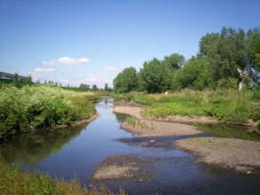
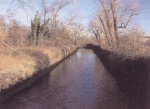
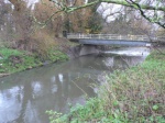
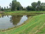
The site comprised abandoned sludge lagoons that provided habitat for over-wintering birds. It was directly adjacent to the River Tame and was almost entirely within its floodplain. There was thus a need to provide ecological mitigation; to pull back the development area to respect Birmingham City Council’s requirement for a 50m riparian buffer strip; and to provide flood compensation. A river restoration scheme was designed, in close consultation with the Environment Agency, to form a back channel and islands along the Tame (which was canalised and lacked ecological interest in that reach), with an attenuation pond to control runoff. With Birmingham City Council’s approval, this was located within the buffer area, and was sized to provide the required flood storage volume to compensate for that lost to the development. The scheme thus met all the mitigation requirements through a holistic and innovative approach, while minimising the loss of developable land.
Works include:
- Provision of riparian buffer area to support Local Authority aspiration for riverside walkway
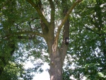
- Retention of trees on islands and creation of deadwood piles for small mammals/invertebrates
- Erection of bird and bat boxes
- Wildflower seeding of back channel banks
Monitoring surveys and results
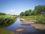
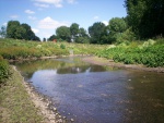
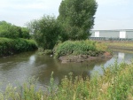
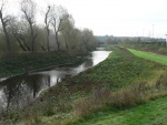
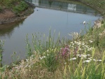
The river has adopted a more naturalised channel, with braiding, gravel shoals, small islands and back waters forming over time. This increases the potential biodiversity of this reach, which was previously canalised and fast flowing, with vertical banks. The backwater channel and islands provide suitable habitat for riparian mammals, while the slower shallow waters of the new channel offer a refuge for spawning and juvenile fish. The original bankside willow and poplar trees were retained on the three islands to provide undisturbed habitat, and deadwood piles were created on the islands from other trees and scrub that were felled around the sludge lagoons to provide habitat for invertebrates and small mammals.
In accordance with the ongoing Wildlife Management Plan for the site, prepared by Cascade, the developer undertakes a regular maintenance schedule, mainly involving removing debris (particularly tyres) dumped upstream and which end up in the back channel. No formal monitoring and evaluation is undertaken although the site is inspected visually to check that the islands remain stable.
Lessons learnt
This has demonstrated that river restoration can be achieved by private developers as a cost-effective mitigation measure. The construction cost of the scheme, mostly earthworks, was approximately 5% of the total.
It is important to show that these types of schemes can be delivered effectively by private developers, in close consultation with other stakeholders. This complements other river restoration work being undertaken by the public sector.
Finally, in the process of facilitating development (which assists in economic regeneration) these types of restoration schemes can contribute a range of ecosystem services including supporting services (habitat creation; biodiversity); regulating services (flood control) and cultural services (potential recreation and amenity through riverside walkway; tranquillity; and educational services through being used as a demonstration project).
Image gallery
|
Catchment and subcatchmentSelect a catchment/subcatchment
Catchment
Subcatchment
Other case studies in this subcatchment: Taming the Tame
Site
Project background
Cost for project phases
Reasons for river restoration
Measures
MonitoringHydromorphological quality elements
Biological quality elements
Physico-chemical quality elements
Any other monitoring, e.g. social, economic
Monitoring documents
Additional documents and videos
Additional links and references
Supplementary InformationEdit Supplementary Information
| ||||||||||||||||||||||||||||||||||||||||||||||||||||||||||||||||||||||||||||||||||||||||||||||||||||||||||||||||||||||||||||||||||||||||||||||||||||||||||||||||||||||||||||||||||||||||||||||||||||||||

