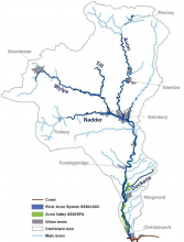
Case study:Salisbury Avon Restoration Project: Difference between revisions
No edit summary |
No edit summary |
||
| (9 intermediate revisions by 8 users not shown) | |||
| Line 1: | Line 1: | ||
{{Case study status | {{Case study status | ||
|Approval status= | |Approval status=Approved | ||
}} | }} | ||
{{Location | {{Location | ||
| Line 14: | Line 14: | ||
|Contact organisation url=www.wiltshirewildlife.org | |Contact organisation url=www.wiltshirewildlife.org | ||
|Partner organisations=Environment Agency, Natural England, Wessex Water, Wiltshire Fishery Association | |Partner organisations=Environment Agency, Natural England, Wessex Water, Wiltshire Fishery Association | ||
|Multi-site=Yes | |Multi-site=Yes | ||
|Project picture=Avon salisbury.png | |||
|Project summary=The Hampshire Avon has historically been dredged, over-widened and impounded in many places due to past river management. This has led to a reduction in the river’s geomorphological processes, which has, in turn, led to a decline in the habitat quality and quantity throughout the reach. This decline, despite recent sympathetic management, has continued due to the lack of variation in channel form and flows, as well as riparian land use. | |Project summary=The Hampshire Avon has historically been dredged, over-widened and impounded in many places due to past river management. This has led to a reduction in the river’s geomorphological processes, which has, in turn, led to a decline in the habitat quality and quantity throughout the reach. This decline, despite recent sympathetic management, has continued due to the lack of variation in channel form and flows, as well as riparian land use. | ||
| Line 30: | Line 30: | ||
Restoring natural functions to the river system will also increase the potential of the river to adapt to a changing climate in the future as part of a living landscape. | Restoring natural functions to the river system will also increase the potential of the river to adapt to a changing climate in the future as part of a living landscape. | ||
}} | }} | ||
{{Image gallery}} | |||
{{Case study image | |||
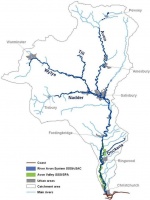
|File name=Map with the area.JPG | |||
|Caption=Map with the area | |||
}} | |||
{{Image gallery end}} | |||
{{Toggle button}} | |||
{{Toggle content start}} | |||
{{Case study subcatchment | {{Case study subcatchment | ||
|Subcatchment=Avon | |Subcatchment=Hampshire Avon (Lower) | ||
}} | }} | ||
{{Site | {{Site | ||
|Name=Hampshire Avon | |Name=Hampshire Avon | ||
|Reference morphology=Actively meandering, | |WFD water body code=GB108043015840 | ||
|WFD water body name=Hampshire Avon (Lower) | |||
|Reference morphology=Actively meandering, | |||
|Heavily modified water body=No | |Heavily modified water body=No | ||
|Protected species present=No | |Protected species present=No | ||
| Line 49: | Line 60: | ||
}} | }} | ||
{{Measures | {{Measures | ||
|Bank and bed modifications measure=Creation of | |Bank and bed modifications measure=Introduction of spawning gravels, Riffle creation, Introducing large woody debris, Creation of berms, | ||
|Floodplain / River corridor=Tree planting | |Floodplain / River corridor=Tree planting | ||
|Planform / Channel pattern=Re-meandering | |Planform / Channel pattern=Re-meandering, Channel narrowing, | ||
}} | }} | ||
{{Hydromorphological quality elements header}} | {{Hydromorphological quality elements header}} | ||
| Line 62: | Line 73: | ||
{{End table}} | {{End table}} | ||
{{Monitoring documents}} | {{Monitoring documents}} | ||
{{Case study monitoring documents | |||
|Monitoring document=SW008 monitoring framework table.docx | |||
|Description=RRC Monitoring table - Avon | |||
}} | |||
{{Monitoring documents end}} | {{Monitoring documents end}} | ||
{{Additional Documents}} | {{Additional Documents}} | ||
{{Case study documents | {{Case study documents | ||
| Line 78: | Line 88: | ||
{{Additional links and references footer}} | {{Additional links and references footer}} | ||
{{Supplementary Information}} | {{Supplementary Information}} | ||
{{Toggle content end}} | |||
Latest revision as of 13:43, 1 June 2017
Project overview
| Status | In progress |
|---|---|
| Project web site | |
| Themes | Habitat and biodiversity, Hydromorphology |
| Country | England |
| Main contact forename | John |
| Main contact surname | Rattray |
| Main contact user ID | |
| Contact organisation | Wiltshire Wildlife Trust |
| Contact organisation web site | http://www.wiltshirewildlife.org |
| Partner organisations | Environment Agency, Natural England, Wessex Water, Wiltshire Fishery Association |
| This is a parent project encompassing the following projects |
Project summary
The Hampshire Avon has historically been dredged, over-widened and impounded in many places due to past river management. This has led to a reduction in the river’s geomorphological processes, which has, in turn, led to a decline in the habitat quality and quantity throughout the reach. This decline, despite recent sympathetic management, has continued due to the lack of variation in channel form and flows, as well as riparian land use.
Description of Works This project focuses on two 750m reaches of the Hampshire Avon at Figheldean and West Amesbury, identified in the Strategic Framework for the Restoration of the River Avon (SFfRRA) as being in need of restoration for habitat quality. The restoration aims to return a more natural flow regime at the two sites, in order to promote natural bed scouring and increase riparian habitat for a variety of organisms. This will be achieved through:
- the narrowing of over-widened channels to promote bed scouring and increase Ranunculus growth;
- re-meandering of channelized sections, through the creation of berms and the use of woody debris, to restore natural deposition/erosion processes;
- introduction of woody debris to aid channel narrowing and create in-channel habitat for fish and invertebrates;
- creation of gravel riffles to create fish spawning habitat and flow variation;
- tree planting for channel shading and to provide future woody debris;
- riparian habitat creation/enhancement, such as scrape creation for invertebrate and bird life and bank re-profiling to reconnect the river to the floodplain (re-wetting wet woodland/pasture).
Each restoration project completed will act as an example to future projects in the area. Through appropriate publi-cation and engagement this project will help to raise awareness of river restoration techniques and implementation on the River Avon catchment. Restoring natural functions to the river system will also increase the potential of the river to adapt to a changing climate in the future as part of a living landscape.
Monitoring surveys and results
Lessons learnt
Image gallery
|
Catchment and subcatchmentSelect a catchment/subcatchment
Catchment
Subcatchment
Other case studies in this subcatchment: River Avon Stream project, Salmonid, coarse fish and wetland bird habitat and flood plain linkage project, Hampshire Avon, Strategic Framework for Restoration of the River Avon (SFfRRA)
Site
Project background
Cost for project phases
Reasons for river restoration
Measures
MonitoringHydromorphological quality elements
Biological quality elements
Physico-chemical quality elements
Any other monitoring, e.g. social, economic
Monitoring documents
Additional documents and videos
Additional links and references
Supplementary InformationEdit Supplementary Information
| ||||||||||||||||||||||||||||||||||||||||||||||||||||||||||||||||||||||||||||||||||||||||||||||||||||||||||||||||||||||||||||||||||||||||||||||||||||||||||||||||||||||||||||||||||||||||||||||


