Case study:Test and Itchen River Restoration Strategy: Difference between revisions
No edit summary |
No edit summary |
||
| (39 intermediate revisions by 2 users not shown) | |||
| Line 1: | Line 1: | ||
{{Case study status | {{Case study status | ||
|Approval status= | |Approval status=Approved | ||
}} | |||
{{Location | |||
|Location=50.882188959129, -1.3936328887939453 | |||
}} | }} | ||
{{Project overview | {{Project overview | ||
|Status=In progress | |Status=In progress | ||
| Line 10: | Line 12: | ||
|Main contact surname=Leman | |Main contact surname=Leman | ||
|Contact organisation=Environment Agency | |Contact organisation=Environment Agency | ||
|Contact organisation url=www.gov.uk/government/organisations/environment-agency | |||
|Partner organisations=Natural England, local fisheries and riparian owners | |Partner organisations=Natural England, local fisheries and riparian owners | ||
|Multi-site=Yes | |Multi-site=Yes | ||
|Project summary=The Test and Itchen River Restoration Strategy is a collaborative project between the Environment Agency, Natural England, local fisheries and riparian owners. Presently the SSSI status of the Test and Itchen is in unfavourable condition. This is due to historic dredging, the number of structures, industry and historic management. | |Project picture=2014-06-17 10.24.48.jpg | ||
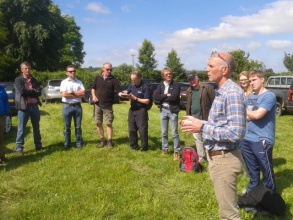
|Picture description=A River Restoration Centre Members site visit (June 2014) where Test and Itchen Project Officer, Heb Leman (Environment Agency), explained the aims of the restoration strategy. Photo © RRC | |||
|Project summary=The Test and Itchen River Restoration Strategy is a collaborative project between the Environment Agency, Natural England, local fisheries and riparian owners. | |||
Presently the SSSI status of the Test and Itchen is in unfavourable condition. This is due to historic dredging, the number of structures, industry and historic management. The aim of the Strategy is to collaboratively work with landowners to restore both rivers so that they reach favourable condition in the future. | |||
Up to June 2014, approximately 2km has been improved by bed raising, narrowing and encouraging a change in management. Five restoration projects were completed in 2013 and a further six are planned for 2014. | |||
<i>Project 1: Old Station Beat restoration, River Test at Bossington (completed 2013)</i><br> | |||
At the Bossington Estate, the Environment Agency and Natural England have worked with Cain Bio-engineering to narrow the channel considerably (up to 40-60% in some sections) to restore a more natural river which has already led to significant improvement in the variety of river bed heterogeneity and in-channel habitats observed. The Estate have supported the project as they would like to attract anglers who prefer fly fishing in a more ‘challenging’ environment, than on other sections of the middle River Test, to offer this in the Test Valley. The total cost of the scheme was approximately £40,000 for 450m of restoration. | |||
<i>Project 2: River Test, Houghton Estate, close to Stockbridge (completed 2013)</i><br> | |||
The Houghton Club, one of the first fisheries to establish in England if not the world, has been open-minded. They agreed to modify historic bank management practices to enhance the channel and side channel scrapes have been created to reconnect the river to its floodplain in strategic areas. Selective channel narrowing has also taken place. Flooding in winter 2013/4 immediately showed the benefits of reconnecting the river with the surrounding land (which is designated SSSI). From a flood risk management perspective, holding water on this land prior to the river reaching Stockbridge was noted to have had a positive influence on flood risk reduction in the village. The project was jointly funded by the Environment Agency and the Houghton Estate. | |||
|Monitoring surveys and results=Students at the University of Southampton are monitoring the Bossington Estate project, and are working with the Environment Agency on other sites too. | |||
|Lessons learn=The sections of river that have been restored demonstrate the contrasting approaches of contractors working on different sites (see Image Gallery). The extent of channel narrowing and restoration works take into account varying views of the landowners, the aspirations of the fishery and the requirement to improve the SSSI. | |||
}} | }} | ||
{{Image gallery}} | {{Image gallery}} | ||
{{Case study image | |||
|File name=2014-06-17 11.00.23.jpg | |||
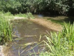
|Caption=Backwater/ fish refuge on the Park Stream, Bossington Estate (tributary of the River Test) ©RRC June 2014 | |||
}} | |||
{{Case study image | |||
|File name=2014-06-17 11.03.51.jpg | |||
|Caption=Channel narrowing and bed raising on the Park Stream, Bossington Estate (tributary of the River Test) ©RRC June 2014 | |||
}} | |||
{{Case study image | |||
|File name=2014-06-17 11.14.28.jpg | |||
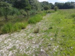
|Caption=Gravel infill shows the width of channel narrowing (40-60% of pre-restored channel) on the Park Stream, Bossington Estate (tributary of the River Test) ©RRC June 2014 | |||
}} | |||
{{Case study image | |||
|File name=2014-06-17 11.17.44.jpg | |||
|Caption=Clean gravels and excellent spawning habitat after channel narrowing on the Park Stream, Bossington Estate (tributary of the River Test) ©RRC June 2014 | |||
}} | |||
{{Case study image | |||
|File name=2014-06-17 12.16.00.jpg | |||
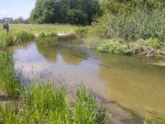
|Caption=Post channel narrowing (looking upstream) on the River Test, Houghton Club estate ©RRC June 2014 | |||
}} | |||
{{Case study image | |||
|File name=2014-06-17 12.22.46.jpg | |||
|Caption=Post channel narrowing (looking downstream) on the River Test, Houghton Club estate ©RRC June 2014 | |||
}} | |||
{{Image gallery end}} | {{Image gallery end}} | ||
{{Toggle button}} | {{Toggle button}} | ||
| Line 22: | Line 61: | ||
{{Case study subcatchment}} | {{Case study subcatchment}} | ||
{{Site}} | {{Site}} | ||
{{Project background}} | {{Project background | ||
{{Motivations}} | |Project completed=2015/03/31 | ||
{{Measures}} | |Investigation and design Lead organisation=Environment Agency/ Geodata/ Atkins | ||
|Stakeholder engagement Lead organisation=Environment Agency | |||
|Monitoring Lead organisation=Southampton University | |||
}} | |||
{{Motivations | |||
|Specific mitigation=Barriers to fish migration, Flood risk management, Impoundments (not hydropower), Land drainage, Riparian development, | |||
|Hydromorphological quality elements=Channel pattern/planform, Continuity for organisms, Continuity of sediment transport, Freshwater flow regime, Quantity & dynamics of flow, Width & depth variation, | |||
|Biological quality elements=Fish, Invertebrates, Macrophytes, | |||
}} | |||
{{Measures | |||
|Bank and bed modifications measure=Bed raising, | |||
|Floodplain / River corridor=Floodplain reconnection, | |||
|Planform / Channel pattern=Channel narrowing, | |||
|Other technical measure=Fish habitat restoration, | |||
|Management interventions=More sensitive channel maintenance, | |||
}} | |||
{{Hydromorphological quality elements header}} | {{Hydromorphological quality elements header}} | ||
{{End table}} | {{End table}} | ||
| Line 38: | Line 92: | ||
{{Additional Documents end}} | {{Additional Documents end}} | ||
{{Additional links and references header}} | {{Additional links and references header}} | ||
{{Additional links and references footer}} | {{Additional links and references footer}} | ||
{{Supplementary Information}} | {{Supplementary Information}} | ||
{{Toggle content end}} | {{Toggle content end}} | ||
Latest revision as of 11:01, 1 June 2017
Project overview
| Status | In progress |
|---|---|
| Project web site | |
| Themes | Environmental flows and water resources, Fisheries, Flood risk management, Habitat and biodiversity, Hydromorphology, Monitoring |
| Country | England |
| Main contact forename | Heb |
| Main contact surname | Leman |
| Main contact user ID | |
| Contact organisation | Environment Agency |
| Contact organisation web site | http://www.gov.uk/government/organisations/environment-agency |
| Partner organisations | Natural England, local fisheries and riparian owners |
| This is a parent project encompassing the following projects |
Old Station Beat restoration, River Test at Bossington, Test and Itchen River Restoration Strategy 2 |
Project summary
The Test and Itchen River Restoration Strategy is a collaborative project between the Environment Agency, Natural England, local fisheries and riparian owners.
Presently the SSSI status of the Test and Itchen is in unfavourable condition. This is due to historic dredging, the number of structures, industry and historic management. The aim of the Strategy is to collaboratively work with landowners to restore both rivers so that they reach favourable condition in the future.
Up to June 2014, approximately 2km has been improved by bed raising, narrowing and encouraging a change in management. Five restoration projects were completed in 2013 and a further six are planned for 2014.
Project 1: Old Station Beat restoration, River Test at Bossington (completed 2013)
At the Bossington Estate, the Environment Agency and Natural England have worked with Cain Bio-engineering to narrow the channel considerably (up to 40-60% in some sections) to restore a more natural river which has already led to significant improvement in the variety of river bed heterogeneity and in-channel habitats observed. The Estate have supported the project as they would like to attract anglers who prefer fly fishing in a more ‘challenging’ environment, than on other sections of the middle River Test, to offer this in the Test Valley. The total cost of the scheme was approximately £40,000 for 450m of restoration.
Project 2: River Test, Houghton Estate, close to Stockbridge (completed 2013)
The Houghton Club, one of the first fisheries to establish in England if not the world, has been open-minded. They agreed to modify historic bank management practices to enhance the channel and side channel scrapes have been created to reconnect the river to its floodplain in strategic areas. Selective channel narrowing has also taken place. Flooding in winter 2013/4 immediately showed the benefits of reconnecting the river with the surrounding land (which is designated SSSI). From a flood risk management perspective, holding water on this land prior to the river reaching Stockbridge was noted to have had a positive influence on flood risk reduction in the village. The project was jointly funded by the Environment Agency and the Houghton Estate.
Monitoring surveys and results
Students at the University of Southampton are monitoring the Bossington Estate project, and are working with the Environment Agency on other sites too.
Lessons learnt
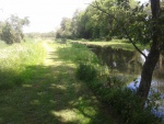
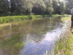
The sections of river that have been restored demonstrate the contrasting approaches of contractors working on different sites (see Image Gallery). The extent of channel narrowing and restoration works take into account varying views of the landowners, the aspirations of the fishery and the requirement to improve the SSSI.
Image gallery
|
Catchment and subcatchment
Site
Project background
Cost for project phases
Reasons for river restoration
Measures
MonitoringHydromorphological quality elements
Biological quality elements
Physico-chemical quality elements
Any other monitoring, e.g. social, economic
Monitoring documents
Additional documents and videos
Additional links and references
Supplementary InformationEdit Supplementary Information
| ||||||||||||||||||||||||||||||||||||||||||||||||||||||||||||||||||||||||||||||||||||||||||||||||||||||||||||||||||||||||||||||||||||||||||||||||||||||||||||||||||||||||

