Case study:Guphill Brook Riverine Enhancement: Difference between revisions
T.PRECIOUS (talk | contribs) No edit summary |
TimPrecious (talk | contribs) No edit summary |
||
| Line 64: | Line 64: | ||
{{Case study image | {{Case study image | ||
|File name=G0031110.JPG | |File name=G0031110.JPG | ||
}} | |||
{{Case study image | |||
|File name=20160405 124802.jpg | |||
}} | }} | ||
{{Image gallery end}} | {{Image gallery end}} | ||
Revision as of 17:47, 17 January 2017
Project overview
| Status | In progress |
|---|---|
| Project web site | |
| Themes | Fisheries, Flood risk management, Habitat and biodiversity, Hydromorphology, Social benefits, Water quality, Urban |
| Country | England |
| Main contact forename | Tim |
| Main contact surname | Precious |
| Main contact user ID | User:TimPrecious |
| Contact organisation | Warwickshire Wildlife Trust |
| Contact organisation web site | http://www.warwickshirewildlifetrust.org.uk/ |
| Partner organisations | |
| Parent multi-site project | |
| This is a parent project encompassing the following projects |
No |
Project summary
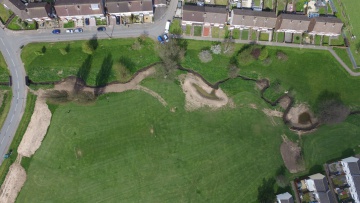
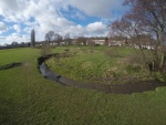
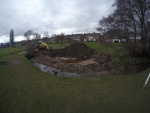
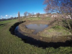
This river enhancement project is working to reconnect the river once more with its floodplain and to create associated wetland features that have been removed or lost from the River Sherbourne.
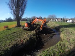
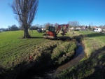
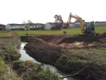
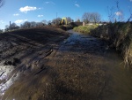
The project has created multiple online backwater refuge pools to provide fish and water vole with areas of slack water and cover in times of high flow. Regrading of 4 inside meander banks has been undertaken to improve the hydromorphology of this over deepened and channelised river by increasing gravel deposition, light levels and ultimately macrophytic growth. These outcomes will provide: increased spawning area for fish, increased habitat for invertebrates e.g mayfly, increased cover for fish from predation and cover and food for water vole.
The pools aid in improving water quality by assisting in the drop out of pollutants which are washed from the busy A45 road in times of heavy rainfall.
The online pools provide some additional flood risk reduction downstream by holding back water in times of above average flows.
Lowland meadow will be created on excavated soil bunds and a 200m wetland meadow buffer strip is establishing alongside the brook after being stripped of topsoil and sown with a seed mix in Spring 2016.
Woody debris installed at multiple points with Wild Trout Trust during volunteer days. These deflectors will assist in creating deeper pools for fish to hold up in during average and below average flows. They also provide riffles downstream of deeper pools increasing spawning area for fish.
Monitoring surveys and results
Fixed point photography.
Invertebrate samples at bank regrading points and woody debris installations before works and 2 years after works.
Botanical survey of site before works and 2 years after works.
Short film documenting enhancement techniques and volunteer involvement.
Lessons learnt
Start a monitoring plan with help from River Restoration Centre early on in project planning. Set aside sufficient funds to carry on monitoring such as invertebrate sampling and flora surveys for several years.
Agree with Council several months before scheduled works if path closure is necessary as this can be very costly.
Forming partnerships with Council and EA greatly assists in smooth running of project and maximises gains.
Completing excavation works in early spring (February/March) allows for quick regeneration of vegetation after disturbance and an ideal time to plant any plug plants/trees or sow seed mixture.
Image gallery
|
Catchment and subcatchmentSelect a catchment/subcatchment
Catchment
Subcatchment
Site
Project background
Cost for project phases
Reasons for river restoration
Measures
MonitoringHydromorphological quality elements
Biological quality elements
Physico-chemical quality elements
Any other monitoring, e.g. social, economic
Monitoring documents
Additional documents and videos
Additional links and references
Supplementary InformationEdit Supplementary Information
| ||||||||||||||||||||||||||||||||||||||||||||||||||||||||||||||||||||||||||||||||||||||||||||||||||||||||||||||||||||||||||||||||||||||||||||||||||||||||||||||||||||||||||||||||||||||||||||||||

