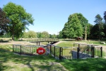
Case study:Restoration of Wandle Park: Difference between revisions
No edit summary |
Hazel Wilson (talk | contribs) No edit summary |
||
| (16 intermediate revisions by 4 users not shown) | |||
| Line 1: | Line 1: | ||
{{Case study status | {{Case study status | ||
|Approval status= | |Approval status=Approved | ||
}} | }} | ||
{{Location | {{Location | ||
| Line 7: | Line 7: | ||
{{Project overview | {{Project overview | ||
|Status=Complete | |Status=Complete | ||
|Themes=Habitat and biodiversity | |Themes=Flood risk management, Habitat and biodiversity, Social benefits, Water quality | ||
|Country=England | |Country=England | ||
|Main contact forename=Tom | |Main contact forename=Tom | ||
|Main contact surname=Sweeney | |Main contact surname=Sweeney | ||
|Contact organisation=Croydon Council | |||
|Contact organisation url=www.croydon.gov.uk/ | |||
|Partner organisations=Royal HaskoningDHV, | |||
|Multi-site=No | |Multi-site=No | ||
|Project picture=WANDLE 1.jpg | |Project picture=WANDLE 1.jpg | ||
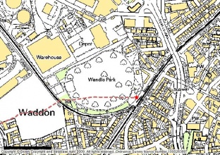
|Picture description=Site Location Plan | |Picture description=Site Location Plan | ||
|Project summary=The River Wandle is located in the southeast of England. It is approximately 14km long with two sources, one at Waddon Ponds (Croydon) and the other at Carshalton Ponds (Sutton). It flowsnorth-eastthrough Croydon, Sutton, Lambeth, Merton and Wandsworth to then join the Tidal Thames. | |||
The River Wandle runs under the Wandle Park, in the London Borough of Croydon, for approximately 350mand is only evident by the presence of two man-hole access chambers located within the park’s playing fields. The parkis located at OSgrid reference TQ31681,65563 and covers anarea of 8.5 hectares. | |||
Wandle Park is owned and managed by Croydon Council. It is surrounded byamultitude of land-use types including residential, industrial and commercial. | |||
The London Borough of Croydon in partnership with the Environment Agency is developing a scheme to restore the River Wandle at Wandle Park, Croydon. The London Borough of Croydon believes that the park is presently an underused asset and wishes to restore the park to reflect is original Victorian lay out. | |||
The main objectives of the project are as follows: Restore the river corridor through Wandle Park improving the habitat for local wildlife; Provide flood risk benefit for properties downstream to approximately 1 in 50 return period; Providethe local community with an opportunity to enjoy a high-quality environment and encourage people to care for, use, appreciate and enjoy the environment; Improve the water quality in the channel in support of the Water Framework Directive, helping to meet Good Ecological Potential (GEP) in the catchmentand; Provideflood storagethat will contribute to the London Rivers Action Plan. | |||
Update (July 2015) | |||
The London Borough of Croydon worked in partnership with Royal HaskoningDHV and LDA Design to oversee the design and implementation of an ambitious scheme to regenerate Wandle Park, improving an important green space into an asset for the local community and contributing towards the delivery of WFD objectives. At the heart of this ambitious £2 million scheme was the restoration of over 250m of the River Wandle, previously culverted below ground, into an open, naturally functioning meandering channel. This project was Highly Commended at the 2015 Landscape Institute Awards. | |||
|Lessons learn=This project had a range of key challenges that were overcome through the design process, including: | |||
• The restoration of natural hydromorphological processes whilst minimising the potential for large scale channel migration. This was resolved through the design of a multi-stage channel which allows the low flow channel to adjust within a more permanent high flow bank line. Seeded gravels were also allowed to rework naturally to create a wide range of in-channel habitat niches. The two stage channel safely accommodates both the low dry weather flows and the high flood flows. | |||
• Ensuring that the river could be re-meandered through contaminated land at the site without increasing remobilisation of in situ contaminated sediments and leachate. An uncontaminated capping layer using uncontaminated soils was used to protect the environment and park users from contaminated materials. | |||
• Minimising the need for expensive off-site disposal of contaminated materials and the need to import uncontaminated soils for capping. Soils on the site were categorized as contaminated and less contaminated (i.e. with contaminant concentrations below hazardous levels), and the former were used as a base layer for landscape features within the park. These were capped with less contaminated soils from the site to prevent exposure to the wider environment. | |||
}} | }} | ||
{{Image gallery}} | {{Image gallery}} | ||
{{Case study image | |||
|File name=During works.jpg | |||
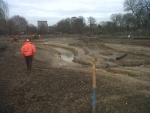
|Caption=During works | |||
}} | |||
{{Case study image | |||
|File name=3665 140416 009.JPG | |||
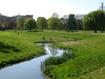
|Caption=Post restoration, April 2014 © Royal HaskoningDHV | |||
}} | |||
{{Case study image | |||
|File name=DSC 0144.JPG | |||
|Caption=Post restoration, June 2013 © Royal HaskoningDHV | |||
}} | |||
{{Case study image | |||
|File name=2996 130605 River Pano (2).jpg | |||
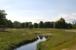
|Caption=Post restoration panoramic, June 2013 © Royal HaskoningDHV | |||
}} | |||
{{Case study image | |||
|File name=DSC 0090.JPG | |||
|Caption=New river crossing, June 2013 June 2013 © Royal HaskoningDHV | |||
}} | |||
{{Image gallery end}} | {{Image gallery end}} | ||
{{Toggle button}} | {{Toggle button}} | ||
{{Toggle content start}} | {{Toggle content start}} | ||
{{Case study subcatchment}} | {{Case study subcatchment | ||
{{Site}} | |Subcatchment=Wandle (Croydon to Wandsworth) and the R. Gravney | ||
{{Project background}} | }} | ||
{{Site | |||
|Name=Wandle Park | |||
|WFD water body code=GB106039023460 | |||
|WFD water body name=Wandle (Croydon to Wandsworth) and the R. Gravney | |||
|Heavily modified water body=No | |||
|Site designation=Site of Local Importance for Nature Conservation | |||
|Protected species present=No | |||
|Invasive species present=No | |||
}} | |||
{{Project background | |||
|Project started=2009/01/01 | |||
|Project completed=2013/12/31 | |||
}} | |||
{{Motivations}} | {{Motivations}} | ||
{{Measures}} | {{Measures}} | ||
| Line 37: | Line 85: | ||
{{Additional Documents end}} | {{Additional Documents end}} | ||
{{Additional links and references header}} | {{Additional links and references header}} | ||
{{Additional links and references | |||
|Link=www.therrc.co.uk/sites/default/files/files/Conference/2015/Outputs/presentations/6.1.3_ian_dennis.pdf | |||
|Description=Restoring Wandle Park - RRC Conference 2015 Presentation | |||
}} | |||
{{Additional links and references footer}} | {{Additional links and references footer}} | ||
{{Supplementary Information}} | {{Supplementary Information}} | ||
{{Toggle content end}} | {{Toggle content end}} | ||
Latest revision as of 09:12, 27 October 2015
Project overview
| Status | Complete |
|---|---|
| Project web site | |
| Themes | Flood risk management, Habitat and biodiversity, Social benefits, Water quality |
| Country | England |
| Main contact forename | Tom |
| Main contact surname | Sweeney |
| Main contact user ID | |
| Contact organisation | Croydon Council |
| Contact organisation web site | http://www.croydon.gov.uk/ |
| Partner organisations | Royal HaskoningDHV |
| Parent multi-site project | |
| This is a parent project encompassing the following projects |
No |
Project summary
The River Wandle is located in the southeast of England. It is approximately 14km long with two sources, one at Waddon Ponds (Croydon) and the other at Carshalton Ponds (Sutton). It flowsnorth-eastthrough Croydon, Sutton, Lambeth, Merton and Wandsworth to then join the Tidal Thames.
The River Wandle runs under the Wandle Park, in the London Borough of Croydon, for approximately 350mand is only evident by the presence of two man-hole access chambers located within the park’s playing fields. The parkis located at OSgrid reference TQ31681,65563 and covers anarea of 8.5 hectares.
Wandle Park is owned and managed by Croydon Council. It is surrounded byamultitude of land-use types including residential, industrial and commercial.
The London Borough of Croydon in partnership with the Environment Agency is developing a scheme to restore the River Wandle at Wandle Park, Croydon. The London Borough of Croydon believes that the park is presently an underused asset and wishes to restore the park to reflect is original Victorian lay out.
The main objectives of the project are as follows: Restore the river corridor through Wandle Park improving the habitat for local wildlife; Provide flood risk benefit for properties downstream to approximately 1 in 50 return period; Providethe local community with an opportunity to enjoy a high-quality environment and encourage people to care for, use, appreciate and enjoy the environment; Improve the water quality in the channel in support of the Water Framework Directive, helping to meet Good Ecological Potential (GEP) in the catchmentand; Provideflood storagethat will contribute to the London Rivers Action Plan.
Update (July 2015) The London Borough of Croydon worked in partnership with Royal HaskoningDHV and LDA Design to oversee the design and implementation of an ambitious scheme to regenerate Wandle Park, improving an important green space into an asset for the local community and contributing towards the delivery of WFD objectives. At the heart of this ambitious £2 million scheme was the restoration of over 250m of the River Wandle, previously culverted below ground, into an open, naturally functioning meandering channel. This project was Highly Commended at the 2015 Landscape Institute Awards.
Monitoring surveys and results
Lessons learnt
This project had a range of key challenges that were overcome through the design process, including:
• The restoration of natural hydromorphological processes whilst minimising the potential for large scale channel migration. This was resolved through the design of a multi-stage channel which allows the low flow channel to adjust within a more permanent high flow bank line. Seeded gravels were also allowed to rework naturally to create a wide range of in-channel habitat niches. The two stage channel safely accommodates both the low dry weather flows and the high flood flows.
• Ensuring that the river could be re-meandered through contaminated land at the site without increasing remobilisation of in situ contaminated sediments and leachate. An uncontaminated capping layer using uncontaminated soils was used to protect the environment and park users from contaminated materials.
• Minimising the need for expensive off-site disposal of contaminated materials and the need to import uncontaminated soils for capping. Soils on the site were categorized as contaminated and less contaminated (i.e. with contaminant concentrations below hazardous levels), and the former were used as a base layer for landscape features within the park. These were capped with less contaminated soils from the site to prevent exposure to the wider environment.
Image gallery
|
Catchment and subcatchmentSelect a catchment/subcatchment
Catchment
Subcatchment
Other case studies in this subcatchment: Beddington Park, Beddington Park Enhancements, Boulder Pool and Plough Lane, Durand Close, EDF Weir removal, Eel Pass over tilting weir at Ravensbury Park, Garratt Park, Hackbridge Restoration, Hackbridge weir notch, King Georges Park... further results
Site
Project background
Cost for project phases
Reasons for river restoration
Measures
MonitoringHydromorphological quality elements
Biological quality elements
Physico-chemical quality elements
Any other monitoring, e.g. social, economic
Monitoring documents
Additional documents and videos
Additional links and references
Supplementary InformationEdit Supplementary Information
| ||||||||||||||||||||||||||||||||||||||||||||||||||||||||||||||||||||||||||||||||||||||||||||||||||||||||||||||||||||||||||||||||||||||||||||||||||||||||||||||||||||||||||||||||||||||||||||||||||||||||||

