Case study:Quaggy channel improvements: Difference between revisions
No edit summary |
No edit summary |
||
| (9 intermediate revisions by 4 users not shown) | |||
| Line 1: | Line 1: | ||
{{Case study status | {{Case study status | ||
|Approval status= | |Approval status=Approved | ||
}} | }} | ||
{{Location | {{Location | ||
| Line 14: | Line 14: | ||
|Contact organisation=Environment Agency | |Contact organisation=Environment Agency | ||
|Contact organisation url=www.environment-agency.gov.uk | |Contact organisation url=www.environment-agency.gov.uk | ||
|Partner organisations=Quaggy Waterways Action Group | |||
|Name of parent multi-site project=Case_study:Quaggy Flood Alleviation Scheme | |Name of parent multi-site project=Case_study:Quaggy Flood Alleviation Scheme | ||
|Multi-site=No | |Multi-site=No | ||
|Project picture=Manor Park4.JPG | |||
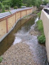
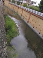
|Picture description=gravel introduced into the channel and new wall | |||
|Project summary=Along the stretch of river between Weigall Road and the centre of Lewisham, the Quaggy runs through rear gardens, beneath roads and along open urban spaces. | |Project summary=Along the stretch of river between Weigall Road and the centre of Lewisham, the Quaggy runs through rear gardens, beneath roads and along open urban spaces. | ||
| Line 22: | Line 25: | ||
The riverbed has also been altered to create a more natural river with meanders and areas of deep and shallow water. Faster and slower flowing areas improve habitat for wildlife. Specialist bird boxes have been built into brick walls to provide nesting sites for grey wagtail and wrens. | The riverbed has also been altered to create a more natural river with meanders and areas of deep and shallow water. Faster and slower flowing areas improve habitat for wildlife. Specialist bird boxes have been built into brick walls to provide nesting sites for grey wagtail and wrens. | ||
}} | }} | ||
{{Case study subcatchment}} | {{Image gallery}} | ||
{{Case study image | |||
|File name=Manor Park3.JPG | |||
}} | |||
{{Case study image | |||
|File name=Manor Park7.JPG | |||
}} | |||
{{Case study image | |||
|File name=Manor Park8.JPG | |||
}} | |||
{{Case study image | |||
|File name=Manor Park6.JPG | |||
}} | |||
{{Image gallery end}} | |||
{{Toggle button}} | |||
{{Toggle content start}} | |||
{{Case study subcatchment | |||
|Subcatchment=Quaggy | |||
}} | |||
{{Site | {{Site | ||
|Name=Weigall Road to Lewisham | |Name=Weigall Road to Lewisham | ||
|WFD water body code=GB106039023290, | |WFD water body code=GB106039023290, | ||
|WFD (national) typology=Calcareous, | |WFD (national) typology=Calcareous, | ||
|WFD water body name=Quaggy | |WFD water body name=Quaggy | ||
|Heavily modified water body=Yes | |Heavily modified water body=Yes | ||
|Protected species present=No | |Protected species present=No | ||
|Invasive species present=Yes | |Invasive species present=Yes | ||
|River corridor land use=Urban, | |Species=Japanese Knotweed, | ||
|River corridor land use=Urban, | |||
}} | }} | ||
{{Project background}} | {{Project background}} | ||
| Line 46: | Line 68: | ||
{{Monitoring documents}} | {{Monitoring documents}} | ||
{{Monitoring documents end}} | {{Monitoring documents end}} | ||
{{Additional Documents}} | {{Additional Documents}} | ||
{{Case study documents | {{Case study documents | ||
|File name=A River Reborn - Quaggy.pdf | |File name=A River Reborn - Quaggy.pdf | ||
|Description=leaflet | |||
}} | |||
{{Case study documents | |||
|File name=Quaggy FAS General Information, 28 May 08.pdf | |||
|Description=general information | |||
}} | }} | ||
{{Additional Documents end}} | {{Additional Documents end}} | ||
| Line 56: | Line 81: | ||
{{Additional links and references footer}} | {{Additional links and references footer}} | ||
{{Supplementary Information}} | {{Supplementary Information}} | ||
{{Toggle content end}} | |||
Latest revision as of 17:10, 6 September 2013
Project overview
| Status | Complete |
|---|---|
| Project web site | |
| Themes | Flood risk management |
| Country | England |
| Main contact forename | Toni |
| Main contact surname | Scarr |
| Main contact user ID | User:Ascarr |
| Contact organisation | Environment Agency |
| Contact organisation web site | http://www.environment-agency.gov.uk |
| Partner organisations | Quaggy Waterways Action Group |
| Parent multi-site project | |
| This is a parent project encompassing the following projects |
No |
Project summary
Along the stretch of river between Weigall Road and the centre of Lewisham, the Quaggy runs through rear gardens, beneath roads and along open urban spaces.
Some of the houses close to the river, mostly terraced homes, were at high risk of flooding. Our innovative approach allowed us to integrate flood defences sensitively within people’s gardens. These are now set back from the river, recovering land that can be used as part of the flood plain.
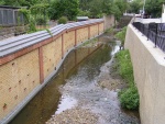
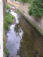
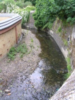
The riverbed has also been altered to create a more natural river with meanders and areas of deep and shallow water. Faster and slower flowing areas improve habitat for wildlife. Specialist bird boxes have been built into brick walls to provide nesting sites for grey wagtail and wrens.
Monitoring surveys and results
Lessons learnt
Image gallery
|
Catchment and subcatchmentSelect a catchment/subcatchment
Catchment
Subcatchment
Other case studies in this subcatchment: Colfes School, Lidl, Manor House Gardens, Manor House Gardens Gauging Station, Manor Park, Mottingham Farm, Quaggy Flood Alleviation Scheme, River Quaggy- Chinbrook meadows, Sutcliffe Park, Sydenham Cottages Nature Reserve
Site
Project background
Cost for project phases
Reasons for river restoration
Measures
MonitoringHydromorphological quality elements
Biological quality elements
Physico-chemical quality elements
Any other monitoring, e.g. social, economic
Monitoring documents
Additional documents and videos
Additional links and references
Supplementary InformationEdit Supplementary Information
| ||||||||||||||||||||||||||||||||||||||||||||||||||||||||||||||||||||||||||||||||||||||||||||||||||||||||||||||||||||||||||||||||||||||||||||||||||||||||||||||||||||||||||||||||||||||||||||||||||||||||

