Case study:The restoration of the Sotovo lake: Volga-Akhtuba floodplain
Project overview
| Status | In progress |
|---|---|
| Project web site | |
| Themes | Habitat and biodiversity, Monitoring, Social benefits |
| Country | Russia |
| Main contact forename | Dmitry |
| Main contact surname | Zolotarev |
| Main contact user ID | User:Dzolotaryov |
| Contact organisation | UNDP |
| Contact organisation web site | |
| Partner organisations | Coca-Cola, Volzhsky Institute of Humanities, Volgograd State Socio-Pedagogical University, Nature Park "Volga-Akhtuba Floodplain" |
| Parent multi-site project | |
| This is a parent project encompassing the following projects |
No |
Project summary
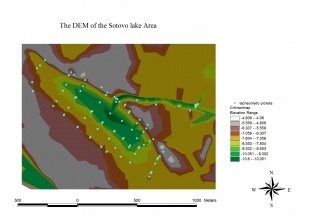
Volga-Akhtuba floodplain is one of the biggest floodplains in Europe. The lower part of the Volga basin (downstream Volgograd and Volzhskaya hydro-electric power station) remains more or less in its natural conditions while the rest of the Volga river represents the cascade of the dams and reservoirs for electric power production. During the hydrological monitoring which our group (Filippov O.V.) has started at 2001 it has been found out that some territories of the floodplain (some local ecosystems) have been very depressed. The reasons for such a situation are: 1. construction of the Volzhskaya HPP in 1958 which has been regulating the discharge of the water in the following way: the amount of the water hasn’t been changed but the distribution has been violated (winter discharges became larger; summer – less); 2. Local population during decades has used the territory for agriculture – plant growing and local dikes and dams were needed; 3. One of such places – the lake Sotovo – was surrounded with dikes to prevent flooding to come to the neighboring territories which were used for gardening. In 2006 the UNDP project named “Conservation of Wetlands Biodiversity in the Lower Volga Region” started. The group of scientists with the specialists of the project discussed some places for restoration in the floodplain and the Sotovo Lake was chosen. The lake was completely dried out because as we found out later it was surrounded with dikes and the paths for water from the river which should feed the lake from upper flow were closed. The main aim was to re-install the natural flooding regime at the Sotovo lake. To reach the aim it was decided to remove some parts of the earthen dike and to construct an installation (dam) for water level regulation.
Monitoring surveys and results
Lessons learnt
Image gallery
|
Catchment and subcatchment
Site
Project background
Cost for project phases
Reasons for river restoration
Measures
MonitoringHydromorphological quality elements
Biological quality elements
Physico-chemical quality elements
Any other monitoring, e.g. social, economic
Monitoring documents
Additional documents and videos
Additional links and references
Supplementary InformationEdit Supplementary Information
| ||||||||||||||||||||||||||||||||||||||||||||||||||||||||||||||||||||||||||||||||||||||||||||||||||||||||||||||||||||||||||||||||||||||||||||||||||||||||||||||||||||||||||||||||||

