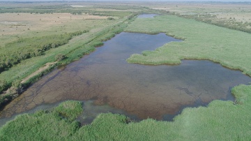
Case study:The Verdier marshes
This case study is pending approval by a RiverWiki administrator.
Project overview
| Status | In progress |
|---|---|
| Project web site | http://www.lesmaraisduverdier.fr |
| Themes | Habitat and biodiversity, Social benefits |
| Country | France |
| Main contact forename | Virginie |
| Main contact surname | Mauclert |
| Main contact user ID | |
| Contact organisation | TOUR DU VALAT |
| Contact organisation web site | http://tourduvalat.org |
| Partner organisations | |
| Parent multi-site project | |
| This is a parent project encompassing the following projects |
No |
Project summary
Community-based conservation empowers local people in the management process through partnerships in planning and implementation of conservation projects in the hopes of creating accountability and ownership of conservation objectives. We have taken this concept a step further, using the principles of community-based conservation in the planning, implementation and monitoring of a wetland restoration project in Camargue (southern France). The Tour du Valat (scientists and landowner), with active collaboration from a local community, has recovered 120 ha of natural wetlands that had been converted into fish farming. The conservation objective was to recover the principle habitats traditional to the Camargue with a move from artificial marsh exploitation with high, continual water levels to a more “natural management” with seasonal fluctuations in water levels. The results of the participatory monitoring have shown a return of traditional flora and fauna, with the recovery of permanent and temporary marshes, reed beds stands, pastoral vegetation and bush lands. The project evaluation showed that stakeholders appreciated their involvement in a co-learning process where habitat management, plant ecology, local uses of plants and game birds were discussed in depth with scientists and villagers. The recovered land now hosts a variety of multi-use activities for the villagers including grazing, hunting, fishing, hiking, bird watching and educational visits. Now, six years after the initiation of the project, we have shifted from a community based restoration project to a joint community managed project.
Monitoring surveys and results
Lessons learnt
Image gallery
|
Catchment and subcatchmentSelect a catchment/subcatchment
Catchment
Subcatchment
Other case studies in this subcatchment: INTERREG MED WETNET - Membership card of the Verdier Marshes-Rhone Delta Wetland Contract, MediCyn, Restoration of the Cassaire wetland (Rhôle delta)
Site
Project background
Cost for project phases
Reasons for river restoration
Measures
MonitoringHydromorphological quality elements
Biological quality elements
Physico-chemical quality elements
Any other monitoring, e.g. social, economic
Monitoring documents
Additional documents and videos
Additional links and references
Supplementary InformationEdit Supplementary Information
| ||||||||||||||||||||||||||||||||||||||||||||||||||||||||||||||||||||||||||||||||||||||||||||||||||||||||||||||||||||||||||||||||||||||||||||||||||||||||||||||||||||||||||||||||||||||||||||||||||||||||

