Case study:Stabilization of hydrological situation on the Neznaika River
This case study is pending approval by a RiverWiki administrator.
Project overview
| Status | Complete |
|---|---|
| Project web site | |
| Themes | Environmental flows and water resources, Flood risk management, Hydromorphology |
| Country | Russia |
| Main contact forename | Andrey |
| Main contact surname | Pyatov |
| Main contact user ID | |
| Contact organisation | CentrRegionVodHoz |
| Contact organisation web site | http://http://www.fgwu.ru/ |
| Partner organisations | |
| This is a parent project encompassing the following projects |
Project summary
The Neznaika river originates northeast village Aprelevka of Moscow Oblast and flows into the Desna river at the left bank on a distance of 30 km from the mouth. The river is 32 km long.
Water regime of the river is characterized by high spring floods, and little discharge in winter and summer/autumn low-water period, that is sometimes interrupted by rain floods.
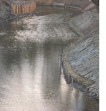
Due to the intensive overgrowing shrubs and weeds, littering and silting of the riverbed within the reach of the Serednevo Village there has been a marked tightness of the bed and erosion of the banks in recent years. All these adversely affect the run-off ability of the spring and rain floods and lead to an annual overflow the channel of the river to the surface (depth of flood - 0.8-1.0 m) and flooding private land (gardens), outbuildings (workhouses, cages for kettle) and houses for a relatively long period of time.
Currently, there has been a particularly dangerous situation in the area of low water bridge over the Neznaika river due to quick erosion of the right bank of the river.
Works included:
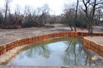
- Re-profiling of the river bed with a bottom width of 1.5 m and slopes 1:2.5 (in some places 1:2) facing the natural surface.
- Removal of sediment along the entire length of area restored by applying the multifunctional machine TRUXOR DM5000.
Monitoring surveys and results
Lessons learnt
Image gallery
|
Catchment and subcatchment
Site
Project background
Cost for project phases
Reasons for river restoration
Measures
MonitoringHydromorphological quality elements
Biological quality elements
Physico-chemical quality elements
Any other monitoring, e.g. social, economic
Monitoring documents
Additional documents and videos
Additional links and references
Supplementary InformationEdit Supplementary Information
| ||||||||||||||||||||||||||||||||||||||||||||||||||||||||||||||||||||||||||||||||||||||||||||||||||||||||||||||||||||||||||||||||||||||||||||||||||||||||||||||||||||||||||||||||||


